List of the highest major summits of the United States
The following sortable table comprises the 477 mountain peaks of the United States with at least 3,000 m (9,843 ft) of topographic elevation and at least 500 m (1,640 ft) of topographic prominence.[1]
The summit of a mountain or hill may be measured in three principal ways:
- The topographic elevation of a summit measures the height of the summit above a geodetic sea level.[2][3]
- The topographic prominence of a summit is a measure of how high the summit rises above its surroundings.[4][3]
- The topographic isolation (or radius of dominance) of a summit measures how far the summit lies from its nearest point of equal elevation.[5]
In the United States, only Denali exceeds 6000 meters (19,685 feet) elevation. Four major summits exceed 5000 meters (16,404 feet), nine exceed 4500 meters (14,764 feet), 104 exceed 4000 meters (13,123 feet), 246 exceed 3500 meters (11,483 feet), and the following 477 major summits exceed 3000 meters (9843 feet) elevation.
Major 3000-meter summits
A total of 477 mountain summits in the United States meet both criteria for the definition of "major summit" used here: at least 3,000 metres (9,843 ft) of topographic elevation and at least 500 metres (1,640 ft) of topographic prominence. Of these 477 summits, 117 are located in Colorado, 67 in Alaska, 51 in California, 43 in Wyoming, 42 in Montana, 40 in Utah, 38 in Nevada, 36 in Idaho, 26 in New Mexico, five in Arizona, five in Oregon, four in Washington, and three in Hawaiʻi. Five of these summits are located on the international border between Alaska and the Yukon, and three are located on the international border between Alaska and British Columbia. The ten highest major summits of the United States are all located in Alaska.
The northernmost summit with at least 3000 metres elevation and 500 metres prominence is Hess Mountain in central Alaska; the southernmost is Mauna Loa on the Island of Hawaii; the westernmost is Haleakalā on the Island of Maui; and the easternmost is East Spanish Peak in south-central Colorado. In the contiguous United States (i.e. excluding Alaska and Hawaii), the northernmost, southernmost, westernmost, and easternmost major summits are Kintla Peak in Montana, Mount Graham in Arizona, Mount Shasta in California, and East Spanish Peak in Colorado, respectively.
| Rank | Mountain Peak | State | Mountain Range | Elevation | Prominence | Isolation | Location |
|---|---|---|---|---|---|---|---|
| 1 | Denali[lower-alpha 1] (Mount McKinley) |
 Alaska |
Alaska Range | 20,310 ft 6190.5 m | 20,146 ft 6141 m | 4,629 mi 7,450 km |
63.0690°N 151.0063°W |
| 2 | Mount Saint Elias[lower-alpha 2] | Alaska Yukon |
Saint Elias Mountains | 18,009 ft 5489 m | 11,250 ft 3429 m | 25.6 mi 41.3 km |
60.2927°N 140.9307°W |
| 3 | Mount Foraker[lower-alpha 3] | Alaska |
Alaska Range | 17,400 ft 5304 m | 7,250 ft 2210 m | 14.27 mi 23 km |
62.9604°N 151.3998°W |
| 4 | Mount Bona[lower-alpha 4] | Alaska |
Saint Elias Mountains | 16,550 ft 5044 m | 6,900 ft 2103 m | 49.7 mi 80 km |
61.3856°N 141.7495°W |
| 5 | Mount Blackburn[6][lower-alpha 5] | Alaska |
Wrangell Mountains | 16,390 ft 4996 m | 11,640 ft 3548 m | 60.7 mi 97.6 km |
61.7305°N 143.4031°W |
| 6 | Mount Sanford | Alaska |
Wrangell Mountains | 16,237 ft 4949 m | 7,687 ft 2343 m | 40.3 mi 64.8 km |
62.2132°N 144.1292°W |
| 7 | Mount Fairweather[lower-alpha 6] (Fairweather Mountain) |
Alaska British Columbia |
Saint Elias Mountains | 15,325 ft 4671 m | 12,995 ft 3961 m | 124.4 mi 200 km |
58.9064°N 137.5265°W |
| 8 | Mount Hubbard | Alaska Yukon |
Saint Elias Mountains | 14,951 ft 4557 m | 8,061 ft 2457 m | 21.3 mi 34.4 km |
60.3194°N 139.0726°W |
| 9 | Mount Bear | Alaska |
Saint Elias Mountains | 14,831 ft 4520 m | 5,054 ft 1540 m | 20.1 mi 32.4 km |
61.2834°N 141.1433°W |
| 10 | Mount Hunter | Alaska |
Alaska Range | 14,573 ft 4442 m | 4,653 ft 1418 m | 6.88 mi 11.07 km |
62.9504°N 151.0915°W |
| 11 | Mount Whitney[7][lower-alpha 7][lower-alpha 8] |  California |
Sierra Nevada | 14,505 ft 4421 m | 10,080 ft 3072 m | 1,646 mi 2,649 km |
36.5786°N 118.2920°W |
| 12 | Mount Alverstone[8] (Boundary Point 180) |
Alaska Yukon |
Saint Elias Mountains | 14,500 ft 4420 m | 1,950 ft 594 m | 2.25 mi 3.62 km |
60.3518°N 139.0749°W |
| 13 | University Peak | Alaska |
Saint Elias Mountains | 14,470 ft 4410 m | 3,210 ft 978 m | 3.71 mi 5.97 km |
61.3272°N 141.7867°W |
| 14 | Mount Elbert[9][lower-alpha 9] |  Colorado |
Sawatch Range | 14,440 ft 4401.2 m | 9,093 ft 2772 m | 671 mi 1,079 km |
39.1178°N 106.4454°W |
| 15 | Mount Massive[10][lower-alpha 10][lower-alpha 11] | Colorado |
Sawatch Range | 14,428 ft 4398 m | 1,961 ft 598 m | 5.06 mi 8.14 km |
39.1875°N 106.4757°W |
| 16 | Mount Harvard[11][lower-alpha 12][lower-alpha 13] | Colorado |
Sawatch Range | 14,421 ft 4395.6 m | 2,360 ft 719 m | 14.92 mi 24 km |
38.9244°N 106.3207°W |
| 17 | Mount Rainier[lower-alpha 14][lower-alpha 15] |  Washington |
Cascade Range | 14,417 ft 4394 m | 13,210 ft 4026 m | 731 mi 1,177 km |
46.8529°N 121.7604°W |
| 18 | Mount Williamson[lower-alpha 16] | California |
Sierra Nevada | 14,379 ft 4383 m | 1,676 ft 511 m | 5.41 mi 8.7 km |
36.6559°N 118.3111°W |
| 19 | Blanca Peak[lower-alpha 17][lower-alpha 18][lower-alpha 19] | Colorado |
Sangre de Cristo Mountains | 14,351 ft 4374 m | 5,326 ft 1623 m | 103.4 mi 166.4 km |
37.5775°N 105.4856°W |
| 20 | La Plata Peak[lower-alpha 20] | Colorado |
Sawatch Range | 14,343 ft 4372 m | 1,836 ft 560 m | 6.28 mi 10.11 km |
39.0294°N 106.4729°W |
| 21 | Uncompahgre Peak[12][lower-alpha 21][lower-alpha 22] | Colorado |
San Juan Mountains | 14,321 ft 4365 m | 4,277 ft 1304 m | 85 mi 136.8 km |
38.0717°N 107.4621°W |
| 22 | Crestone Peak[lower-alpha 23][lower-alpha 24] | Colorado |
Sangre de Cristo Range | 14,300 ft 4359 m | 4,554 ft 1388 m | 27.4 mi 44 km |
37.9669°N 105.5855°W |
| 23 | Mount Lincoln[13][lower-alpha 25][lower-alpha 26] | Colorado |
Mosquito Range | 14,293 ft 4356.5 m | 3,862 ft 1177 m | 22.5 mi 36.2 km |
39.3515°N 106.1116°W |
| 24 | Castle Peak[14][lower-alpha 27] | Colorado |
Elk Mountains | 14,279 ft 4352.2 m | 2,365 ft 721 m | 20.9 mi 33.6 km |
39.0097°N 106.8614°W |
| 25 | Grays Peak[15][lower-alpha 28][lower-alpha 29] | Colorado |
Front Range | 14,278 ft 4352 m | 2,770 ft 844 m | 25 mi 40.2 km |
39.6339°N 105.8176°W |
| 26 | Mount Antero[16][lower-alpha 30] | Colorado |
Sawatch Range | 14,276 ft 4351.4 m | 2,503 ft 763 m | 17.67 mi 28.4 km |
38.6741°N 106.2462°W |
| 27 | Mount Blue Sky[17][lower-alpha 31] | Colorado |
Front Range | 14,271 ft 4350 m | 2,770 ft 844 m | 9.79 mi 15.76 km |
39.5883°N 105.6438°W |
| 28 | Longs Peak[18][lower-alpha 32][lower-alpha 33] | Colorado |
Front Range | 14,259 ft 4346 m | 2,940 ft 896 m | 43.6 mi 70.2 km |
40.2550°N 105.6151°W |
| 29 | Mount Wilson[lower-alpha 34][lower-alpha 35][lower-alpha 36] | Colorado |
San Miguel Mountains | 14,252 ft 4344 m | 4,024 ft 1227 m | 33 mi 53.1 km |
37.8391°N 107.9916°W |
| 30 | White Mountain Peak[19][lower-alpha 37] | California |
White Mountains | 14,252 ft 4344 m | 7,196 ft 2193 m | 67.4 mi 108.6 km |
37.6341°N 118.2557°W |
| 31 | North Palisade[20][lower-alpha 38][lower-alpha 39] | California |
Sierra Nevada | 14,248 ft 4343 m | 2,894 ft 882 m | 32.2 mi 51.8 km |
37.0943°N 118.5145°W |
| 32 | Mount Princeton[21] | Colorado |
Sawatch Range | 14,204 ft 4329.3 m | 2,177 ft 664 m | 5.19 mi 8.36 km |
38.7492°N 106.2424°W |
| 33 | Mount Yale[22] | Colorado |
Sawatch Range | 14,200 ft 4328.2 m | 1,896 ft 578 m | 5.55 mi 8.93 km |
38.8442°N 106.3138°W |
| 34 | Mount Shasta[23][lower-alpha 40] | California |
Cascade Range | 14,179 ft 4321.8 m | 9,772 ft 2979 m | 335 mi 539 km |
41.4092°N 122.1949°W |
| 35 | Maroon Peak[24] | Colorado |
Elk Mountains | 14,163 ft 4317 m | 2,336 ft 712 m | 8.06 mi 12.97 km |
39.0708°N 106.9890°W |
| 36 | Mount Wrangell | Alaska |
Wrangell Mountains | 14,163 ft 4317 m | 5,613 ft 1711 m | 14.79 mi 23.8 km |
62.0059°N 144.0187°W |
| 37 | Mount Sneffels[25][lower-alpha 41] | Colorado |
Sneffels Range | 14,158 ft 4315.4 m | 3,050 ft 930 m | 15.71 mi 25.3 km |
38.0038°N 107.7923°W |
| 38 | Capitol Peak[26][lower-alpha 42] | Colorado |
Elk Mountains | 14,137 ft 4309 m | 1,750 ft 533 m | 7.44 mi 11.98 km |
39.1503°N 107.0829°W |
| 39 | Pikes Peak[27][lower-alpha 43] | Colorado |
Front Range | 14,115 ft 4302.31 m | 5,530 ft 1686 m | 60.6 mi 97.6 km |
38.8405°N 105.0442°W |
| 40 | Windom Peak[lower-alpha 44][lower-alpha 45][lower-alpha 46] | Colorado |
Needle Mountains | 14,093 ft 4296 m | 2,187 ft 667 m | 26.3 mi 42.4 km |
37.6212°N 107.5919°W |
| 41 | Mount Augusta | Alaska Yukon |
Saint Elias Mountains | 14,070 ft 4289 m | 5,082 ft 1549 m | 14.41 mi 23.2 km |
60.3074°N 140.4584°W |
| 42 | Handies Peak[28] | Colorado |
San Juan Mountains | 14,058 ft 4284.8 m | 1,908 ft 582 m | 11.18 mi 18 km |
37.9130°N 107.5044°W |
| 43 | Culebra Peak[lower-alpha 47][lower-alpha 48][lower-alpha 49] | Colorado |
Culebra Range | 14,053 ft 4283 m | 4,827 ft 1471 m | 35.4 mi 56.9 km |
37.1224°N 105.1858°W |
| 44 | San Luis Peak[29] | Colorado |
San Juan Mountains | 14,022 ft 4273.8 m | 3,113 ft 949 m | 26.9 mi 43.4 km |
37.9868°N 106.9313°W |
| 45 | Mount of the Holy Cross[30][lower-alpha 50][lower-alpha 51] | Colorado |
Sawatch Range | 14,011 ft 4270.5 m | 2,113 ft 644 m | 18.41 mi 29.6 km |
39.4668°N 106.4817°W |
| 46 | Grizzly Peak[31] | Colorado |
Sawatch Range | 13,995 ft 4265.6 m | 1,928 ft 588 m | 6.77 mi 10.89 km |
39.0425°N 106.5976°W |
| 47 | Mount Humphreys[32][lower-alpha 52] | California |
Sierra Nevada | 13,992 ft 4265 m | 2,563 ft 781 m | 14.71 mi 23.7 km |
37.2705°N 118.6730°W |
| 48 | Mount Keith[33][lower-alpha 53] | California |
Sierra Nevada | 13,982 ft 4262 m | 1,936 ft 590 m | 3.09 mi 4.97 km |
36.7001°N 118.3436°W |
| 49 | Mount Ouray[34][lower-alpha 54] | Colorado |
Sawatch Range | 13,961 ft 4255.4 m | 2,659 ft 810 m | 13.58 mi 21.9 km |
38.4227°N 106.2247°W |
| 50 | Vermilion Peak[lower-alpha 55] | Colorado |
San Juan Mountains | 13,900 ft 4237 m | 2,105 ft 642 m | 9.07 mi 14.6 km |
37.7993°N 107.8285°W |
| 51 | Atna Peaks | Alaska |
Wrangell Mountains | 13,860 ft 4225 m | 2,210 ft 674 m | 3.64 mi 5.86 km |
61.7495°N 143.2414°W |
| 52 | Regal Mountain[35] | Alaska |
Wrangell Mountains | 13,845 ft 4220 m | 4,395 ft 1340 m | 12.25 mi 19.72 km |
61.7438°N 142.8675°W |
| 53 | Mount Darwin[36][lower-alpha 56] | California |
Sierra Nevada | 13,837 ft 4218 m | 1,891 ft 576 m | 7.13 mi 11.48 km |
37.1669°N 118.6721°W |
| 54 | Mount Hayes[lower-alpha 57][lower-alpha 58] | Alaska |
Alaska Range | 13,832 ft 4216 m | 11,507 ft 3507 m | 125.5 mi 202 km |
63.6203°N 146.7178°W |
| 55 | Mount Silverheels[37] | Colorado |
Front Range | 13,829 ft 4215 m | 2,283 ft 696 m | 5.48 mi 8.82 km |
39.3394°N 106.0054°W |
| 56 | Rio Grande Pyramid[38] | Colorado |
San Juan Mountains | 13,827 ft 4214.4 m | 1,881 ft 573 m | 10.76 mi 17.31 km |
37.6797°N 107.3924°W |
| 57 | Gannett Peak[39][lower-alpha 59][lower-alpha 60] |  Wyoming |
Wind River Range | 13,809 ft 4209.1 m | 7,076 ft 2157 m | 290 mi 467 km |
43.1842°N 109.6542°W |
| 58 | Mount Kaweah[lower-alpha 61][lower-alpha 62][lower-alpha 63] | California |
Sierra Nevada | 13,807 ft 4209 m | 2,027 ft 618 m | 10.73 mi 17.27 km |
36.5261°N 118.4785°W |
| 59 | Mauna Kea[40][lower-alpha 64][lower-alpha 65] |  Hawaii |
Island of Hawaiʻi | 13,803 ft 4207.3 m | 13,803 ft 4207 m | 2,453 mi 3,947 km |
19.8207°N 155.4681°W |
| 60 | Grand Teton[41][lower-alpha 66][lower-alpha 67] | Wyoming |
Teton Range | 13,775 ft 4198.7 m | 6,545 ft 1995 m | 69.4 mi 111.6 km |
43.7412°N 110.8024°W |
| 61 | Mount Cook | Alaska Yukon |
Saint Elias Mountains | 13,760 ft 4194 m | 7,710 ft 2350 m | 14.54 mi 23.4 km |
60.1816°N 139.9811°W |
| 62 | Mount Morgan[42] | California |
Sierra Nevada | 13,758 ft 4193.4 m | 2,648 ft 807 m | 9.86 mi 15.87 km |
37.4053°N 118.7329°W |
| 63 | Mount Gabb[lower-alpha 68] | California |
Sierra Nevada | 13,747 ft 4190 m | 2,601 ft 793 m | 4.28 mi 6.89 km |
37.3769°N 118.8025°W |
| 64 | Bald Mountain[lower-alpha 69] | Colorado |
Front Range | 13,690 ft 4173 m | 2,099 ft 640 m | 7.51 mi 12.09 km |
39.4448°N 105.9705°W |
| 65 | Mount Oso[lower-alpha 70] | Colorado |
San Juan Mountains | 13,690 ft 4173 m | 1,664 ft 507 m | 5.41 mi 8.71 km |
37.6070°N 107.4936°W |
| 66 | Mauna Loa[lower-alpha 71][lower-alpha 72] | Hawaii |
Island of Hawaiʻi | 13,679 ft 4169 m | 7,099 ft 2164 m | 25.4 mi 40.8 km |
19.4756°N 155.6054°W |
| 67 | Mount Jackson[43] | Colorado |
Sawatch Range | 13,676 ft 4168.5 m | 1,810 ft 552 m | 3.21 mi 5.16 km |
39.4853°N 106.5367°W |
| 68 | Mount Tom[44][lower-alpha 73] | California |
Sierra Nevada | 13,657 ft 4163 m | 1,992 ft 607 m | 4.77 mi 7.67 km |
37.3385°N 118.6570°W |
| 69 | Bard Peak[lower-alpha 74] | Colorado |
Front Range | 13,647 ft 4159 m | 1,701 ft 518 m | 5.43 mi 8.74 km |
39.7204°N 105.8044°W |
| 70 | West Spanish Peak[lower-alpha 75][lower-alpha 76] | Colorado |
Spanish Peaks | 13,631 ft 4155 m | 3,686 ft 1123 m | 19.87 mi 32 km |
37.3756°N 104.9934°W |
| 71 | Mount Powell[lower-alpha 77][lower-alpha 78] | Colorado |
Gore Range | 13,586 ft 4141 m | 3,000 ft 914 m | 21.5 mi 34.6 km |
39.7601°N 106.3407°W |
| 72 | Hagues Peak[45][lower-alpha 79] | Colorado |
Mummy Range | 13,573 ft 4137 m | 2,420 ft 738 m | 15.7 mi 25.3 km |
40.4845°N 105.6464°W |
| 73 | Mount Dubois[lower-alpha 80] | California |
White Mountains | 13,565 ft 4135 m | 2,339 ft 713 m | 9.63 mi 15.5 km |
37.7834°N 118.3432°W |
| 74 | Tower Mountain[lower-alpha 81] | Colorado |
San Juan Mountains | 13,558 ft 4132 m | 1,652 ft 504 m | 4.88 mi 7.86 km |
37.8573°N 107.6230°W |
| 75 | Treasure Mountain[lower-alpha 82] | Colorado |
Elk Mountains | 13,535 ft 4125 m | 2,828 ft 862 m | 6.92 mi 11.13 km |
39.0244°N 107.1228°W |
| 76 | Kings Peak[lower-alpha 83][lower-alpha 84] |  Utah |
Uinta Mountains | 13,534 ft 4125 m | 6,358 ft 1938 m | 166.6 mi 268 km |
40.7763°N 110.3729°W |
| 77 | North Arapaho Peak[46][lower-alpha 85][lower-alpha 86] | Colorado |
Front Range | 13,508 ft 4117 m | 1,665 ft 507 m | 15.38 mi 24.8 km |
40.0265°N 105.6504°W |
| 78 | Mount Pinchot[lower-alpha 87] | California |
Sierra Nevada | 13,500 ft 4115 m | 2,110 ft 643 m | 4.71 mi 7.58 km |
36.9473°N 118.4054°W |
| 79 | Mount Natazhat | Alaska |
Saint Elias Mountains | 13,435 ft 4095 m | 5,985 ft 1824 m | 15.49 mi 24.9 km |
61.5217°N 141.1030°W |
| 80 | Mount Jarvis | Alaska |
Wrangell Mountains | 13,421 ft 4091 m | 4,771 ft 1454 m | 11.15 mi 17.95 km |
62.0234°N 143.6198°W |
| 81 | Parry Peak[lower-alpha 88] | Colorado |
Front Range | 13,397 ft 4083 m | 1,720 ft 524 m | 9.46 mi 15.22 km |
39.8381°N 105.7132°W |
| 82 | Bill Williams Peak[lower-alpha 89][lower-alpha 90] | Colorado |
Williams Mountains | 13,389 ft 4081 m | 1,682 ft 513 m | 3.72 mi 5.98 km |
39.1806°N 106.6102°W |
| 83 | Sultan Mountain[lower-alpha 91] | Colorado |
San Juan Mountains | 13,373 ft 4076 m | 1,868 ft 569 m | 4.59 mi 7.39 km |
37.7859°N 107.7038°W |
| 84 | Mount Herard[lower-alpha 92] | Colorado |
Sangre de Cristo Mountains | 13,345 ft 4068 m | 2,040 ft 622 m | 4.63 mi 7.45 km |
37.8492°N 105.4949°W |
| 85 | West Buffalo Peak[47][lower-alpha 93] | Colorado |
Mosquito Range | 13,332 ft 4064 m | 1,986 ft 605 m | 9.61 mi 15.46 km |
38.9917°N 106.1249°W |
| 86 | Tressider Peak | Alaska |
Saint Elias Mountains | 13,315 ft 4058 m | 1,665 ft 507 m | 3.32 mi 5.34 km |
61.3590°N 141.6664°W |
| 87 | Summit Peak[48][lower-alpha 94] | Colorado |
San Juan Mountains | 13,308 ft 4056.2 m | 2,760 ft 841 m | 39.6 mi 63.7 km |
37.3506°N 106.6968°W |
| 88 | Middle Peak[lower-alpha 95][lower-alpha 96] | Colorado |
San Miguel Mountains | 13,306 ft 4056 m | 1,960 ft 597 m | 4.78 mi 7.69 km |
37.8536°N 108.1082°W |
| 89 | Antora Peak[lower-alpha 97] | Colorado |
Sawatch Range | 13,275 ft 4046 m | 2,409 ft 734 m | 6.75 mi 10.86 km |
38.3250°N 106.2180°W |
| 90 | Henry Mountain[lower-alpha 98] | Colorado |
Sawatch Range | 13,261 ft 4042 m | 1,674 ft 510 m | 10.94 mi 17.61 km |
38.6856°N 106.6211°W |
| 91 | Hesperus Mountain[lower-alpha 99][lower-alpha 100] | Colorado |
La Plata Mountains | 13,237 ft 4035 m | 2,852 ft 869 m | 24.5 mi 39.5 km |
37.4451°N 108.0890°W |
| 92 | Mount Silverthrone | Alaska |
Alaska Range | 13,220 ft 4029 m | 3,240 ft 988 m | 7.9 mi 12.72 km |
63.1157°N 150.6755°W |
| 93 | Jacque Peak[lower-alpha 101] | Colorado |
Gore Range | 13,211 ft 4027 m | 2,065 ft 629 m | 4.52 mi 7.28 km |
39.4549°N 106.1970°W |
| 94 | Bennett Peak[lower-alpha 102] | Colorado |
San Juan Mountains | 13,209 ft 4026 m | 1,743 ft 531 m | 17.08 mi 27.5 km |
37.4833°N 106.4343°W |
| 95 | Wind River Peak[49][lower-alpha 103] | Wyoming |
Wind River Range | 13,197 ft 4022.4 m | 2,572 ft 784 m | 35.1 mi 56.6 km |
42.7085°N 109.1284°W |
| 96 | Conejos Peak[50] | Colorado |
San Juan Mountains | 13,179 ft 4017 m | 1,912 ft 583 m | 8.15 mi 13.12 km |
37.2887°N 106.5709°W |
| 97 | Mount Marcus Baker[lower-alpha 104] | Alaska |
Chugach Mountains | 13,176 ft 4016 m | 10,751 ft 3277 m | 126.3 mi 203 km |
61.4374°N 147.7525°W |
| 98 | Cloud Peak[51][lower-alpha 105][lower-alpha 106] | Wyoming |
Bighorn Mountains | 13,167 ft 4013.3 m | 7,077 ft 2157 m | 145 mi 233 km |
44.3821°N 107.1739°W |
| Wheeler Peak[52][lower-alpha 107][lower-alpha 108] |  New Mexico |
Taos Mountains | 13,167 ft 4013.3 m | 3,409 ft 1039 m | 37 mi 59.6 km |
36.5569°N 105.4169°W | |
| 100 | Francs Peak[53][lower-alpha 109] | Wyoming |
Absaroka Range | 13,164 ft 4012.3 m | 4,056 ft 1236 m | 47.2 mi 76 km |
43.9613°N 109.3392°W |
| 101 | Twilight Peak[lower-alpha 110][lower-alpha 111] | Colorado |
Needle Mountains | 13,163 ft 4012 m | 2,338 ft 713 m | 4.88 mi 7.86 km |
37.6630°N 107.7270°W |
| 102 | South River Peak[54] | Colorado |
San Juan Mountains | 13,154 ft 4009.4 m | 2,448 ft 746 m | 21.1 mi 34 km |
37.5741°N 106.9815°W |
| 103 | Mount Ritter[lower-alpha 112][lower-alpha 113] | California |
Sierra Nevada | 13,149 ft 4008 m | 3,990 ft 1216 m | 22 mi 35.4 km |
37.6891°N 119.1996°W |
| 104 | Red Slate Mountain[55][lower-alpha 114] | California |
Sierra Nevada | 13,129 ft 4002 m | 1,736 ft 529 m | 8.31 mi 13.38 km |
37.5075°N 118.8693°W |
| 105 | Mount Lyell (California)[56] | California |
Sierra Nevada | 13,120 ft 3998.9 m | 1,926 ft 587 m | 5.26 mi 8.46 km |
37.7394°N 119.2716°W |
| 106 | Bushnell Peak[57] | Colorado |
Sangre de Cristo Mountains | 13,110 ft 3995.8 m | 2,405 ft 733 m | 11.07 mi 17.82 km |
38.3412°N 105.8892°W |
| 107 | Truchas Peak[58][lower-alpha 115][lower-alpha 116] | New Mexico |
Santa Fe Mountains | 13,108 ft 3995.2 m | 4,001 ft 1220 m | 42.3 mi 68.2 km |
35.9625°N 105.6450°W |
| 108 | Wheeler Peak[59][lower-alpha 117] |  Nevada |
Snake Range | 13,065 ft 3982.3 m | 7,568 ft 2307 m | 232 mi 373 km |
38.9858°N 114.3139°W |
| 109 | Mount Dana[60] | California |
Sierra Nevada | 13,063 ft 3981.5 m | 2,437 ft 743 m | 11.4 mi 18.35 km |
37.8999°N 119.2211°W |
| 110 | West Elk Peak[61][lower-alpha 118] | Colorado |
West Elk Mountains | 13,042 ft 3975.2 m | 3,095 ft 943 m | 13.78 mi 22.2 km |
38.7179°N 107.1994°W |
| 111 | Mount Moffit | Alaska |
Alaska Range | 13,020 ft 3969 m | 3,970 ft 1210 m | 10.2 mi 16.41 km |
63.5683°N 146.3982°W |
| 112 | Mount Centennial[lower-alpha 119] (Peak 13010) |
Colorado |
San Juan Mountains | 13,016 ft 3967 m | 1,790 ft 546 m | 2.86 mi 4.61 km |
37.6062°N 107.2446°W |
| 113 | Kuna Peak | California |
Sierra Nevada | 13,009 ft 3965 m | 1,923 ft 586 m | 6.03 mi 9.71 km |
37.8129°N 119.2083°W |
| 114 | Clark Peak[62][lower-alpha 120] | Colorado |
Medicine Bow Mountains | 12,954 ft 3948.4 m | 2,771 ft 845 m | 16.4 mi 26.4 km |
40.6068°N 105.9300°W |
| 115 | Mount Richthofen[lower-alpha 121][lower-alpha 122] | Colorado |
Never Summer Mountains | 12,945 ft 3946 m | 2,680 ft 817 m | 9.66 mi 15.54 km |
40.4695°N 105.8945°W |
| 116 | Mount Root | Alaska British Columbia |
Saint Elias Mountains | 12,887 ft 3928 m | 2,979 ft 908 m | 5.46 mi 8.79 km |
58.9854°N 137.5001°W |
| 117 | Lizard Head Peak[lower-alpha 123][lower-alpha 124] | Wyoming |
Wind River Range | 12,847 ft 3916 m | 1,902 ft 580 m | 6.46 mi 10.4 km |
42.7901°N 109.1978°W |
| 118 | Granite Peak[63][lower-alpha 125] |  Montana |
Beartooth Mountains | 12,807 ft 3903.5 m | 4,779 ft 1457 m | 86 mi 138.5 km |
45.1634°N 109.8075°W |
| 119 | Mount Crosson | Alaska |
Alaska Range | 12,800 ft 3901 m | 1,650 ft 503 m | 5.11 mi 8.22 km |
63.0081°N 151.2763°W |
| 120 | Venado Peak[lower-alpha 126] | New Mexico |
Taos Mountains | 12,739 ft 3883 m | 2,971 ft 906 m | 11.8 mi 18.99 km |
36.7917°N 105.4933°W |
| 121 | Chair Mountain[64] | Colorado |
Elk Mountains | 12,727 ft 3879.1 m | 2,461 ft 750 m | 8.89 mi 14.3 km |
39.0581°N 107.2822°W |
| 122 | Mount Peale[65][lower-alpha 127] | Utah |
La Sal Mountains | 12,726 ft 3879 m | 6,181 ft 1884 m | 72.8 mi 117.1 km |
38.4385°N 109.2292°W |
| Mount Crillon | Alaska |
Saint Elias Mountains | 12,726 ft 3879 m | 7,176 ft 2187 m | 19.52 mi 31.4 km |
58.6625°N 137.1712°W | |
| 124 | Mount Gunnison[66] | Colorado |
West Elk Mountains | 12,725 ft 3878.7 m | 3,539 ft 1079 m | 11.84 mi 19.05 km |
38.8121°N 107.3826°W |
| 125 | Gold Hill[67][68] | New Mexico |
Taos Mountains | 12,700 ft 3871 m | 1,715 ft 523 m | 6.06 mi 9.76 km |
36.6432°N 105.4560°W |
| 126 | East Spanish Peak[69][lower-alpha 128][lower-alpha 129] | Colorado |
Spanish Peaks | 12,688 ft 3867 m | 2,383 ft 726 m | 4.21 mi 6.78 km |
37.3934°N 104.9201°W |
| 127 | Borah Peak[70][lower-alpha 130] |  Idaho |
Lost River Range | 12,668 ft 3861.2 m | 6,002 ft 1829 m | 150.8 mi 243 km |
44.1374°N 113.7811°W |
| 128 | Mount Wood[lower-alpha 131][lower-alpha 132] | Montana |
Absaroka Range | 12,665 ft 3860 m | 2,880 ft 878 m | 7.48 mi 12.04 km |
45.2749°N 109.8078°W |
| 129 | Mount Gunnar Naslund | Alaska |
Saint Elias Mountains | 12,658 ft 3858 m | 2,108 ft 643 m | 6.86 mi 11.04 km |
61.2282°N 141.3140°W |
| 130 | Mount Conness[71] | California |
Sierra Nevada | 12,649 ft 3855.5 m | 2,650 ft 808 m | 7.18 mi 11.55 km |
37.9670°N 119.3213°W |
| 131 | Humphreys Peak[lower-alpha 133][lower-alpha 134] |  Arizona |
San Francisco Peaks | 12,637 ft 3852 m | 6,039 ft 1841 m | 246 mi 396 km |
35.3464°N 111.6780°W |
| 132 | Santa Fe Baldy[72][lower-alpha 135] | New Mexico |
Santa Fe Mountains | 12,632 ft 3850.1 m | 2,002 ft 610 m | 10.99 mi 17.69 km |
35.8322°N 105.7581°W |
| 133 | Gothic Mountain[lower-alpha 136] | Colorado |
Elk Mountains | 12,631 ft 3850 m | 1,645 ft 501 m | 2.73 mi 4.39 km |
38.9562°N 107.0107°W |
| 134 | Castle Mountain[73] | Montana |
Absaroka Range | 12,618 ft 3846.1 m | 2,672 ft 814 m | 9.74 mi 15.67 km |
45.0989°N 109.6305°W |
| Lone Cone[74] | Colorado |
San Miguel Mountains | 12,618 ft 3846.1 m | 2,273 ft 693 m | 8.4 mi 13.52 km |
37.8880°N 108.2556°W | |
| 136 | Mount Moran[75] | Wyoming |
Teton Range | 12,610 ft 3843.5 m | 2,645 ft 806 m | 6.18 mi 9.94 km |
43.8350°N 110.7765°W |
| 137 | Mount Tlingit | Alaska |
Saint Elias Mountains | 12,606 ft 3842 m | 2,006 ft 611 m | 2.26 mi 3.63 km |
58.8931°N 137.3938°W |
| 138 | Little Costilla Peak[76] | New Mexico |
Culebra Range | 12,588 ft 3836.8 m | 2,444 ft 745 m | 7.75 mi 12.48 km |
36.8335°N 105.2229°W |
| 139 | Mount Carpe | Alaska |
Alaska Range | 12,550 ft 3825 m | 1,800 ft 549 m | 4.1 mi 6.6 km |
63.1521°N 150.8616°W |
| 140 | Needham Mountain[lower-alpha 137] | California |
Sierra Nevada | 12,545 ft 3824 m | 1,840 ft 561 m | 5.93 mi 9.54 km |
36.4545°N 118.5373°W |
| 141 | Graham Peak[77] | Colorado |
San Juan Mountains | 12,536 ft 3821.1 m | 2,551 ft 778 m | 8.64 mi 13.9 km |
37.4972°N 107.3761°W |
| 142 | Whetstone Mountain[78] | Colorado |
West Elk Mountains | 12,527 ft 3818.1 m | 2,456 ft 749 m | 9.39 mi 15.11 km |
38.8223°N 106.9799°W |
| 143 | Kahiltna Dome | Alaska |
Alaska Range | 12,525 ft 3818 m | 2,175 ft 663 m | 3.45 mi 5.55 km |
63.0550°N 151.2394°W |
| 144 | Mount Thor | Alaska |
Chugach Mountains | 12,521 ft 3816 m | 3,271 ft 997 m | 20.4 mi 32.8 km |
61.4854°N 147.1460°W |
| 145 | Mount Watson | Alaska |
Saint Elias Mountains | 12,497 ft 3809 m | 1,932 ft 589 m | 2.52 mi 4.05 km |
59.0088°N 137.5541°W |
| 146 | Atlantic Peak[lower-alpha 138] | Wyoming |
Wind River Range | 12,495 ft 3808 m | 2,150 ft 655 m | 9.07 mi 14.6 km |
42.6165°N 109.0013°W |
| 147 | Specimen Mountain[lower-alpha 139] | Colorado |
Front Range | 12,494 ft 3808 m | 1,731 ft 528 m | 4.7 mi 7.56 km |
40.4449°N 105.8081°W |
| 148 | Baldy Mountain[79][lower-alpha 140] | New Mexico |
Cimarron Range | 12,445 ft 3793.3 m | 2,701 ft 823 m | 11.33 mi 18.24 km |
36.6299°N 105.2134°W |
| 149 | East Beckwith Mountain[80] | Colorado |
West Elk Mountains | 12,441 ft 3792.1 m | 2,492 ft 760 m | 6.24 mi 10.05 km |
38.8464°N 107.2233°W |
| 150 | Knobby Crest[lower-alpha 141][lower-alpha 142] | Colorado |
Kenosha Mountains | 12,434 ft 3790 m | 1,759 ft 536 m | 8.27 mi 13.31 km |
39.3681°N 105.6050°W |
| 151 | Bison Peak[81][lower-alpha 143] | Colorado |
Tarryall Mountains | 12,432 ft 3789.4 m | 2,451 ft 747 m | 18.23 mi 29.3 km |
39.2384°N 105.4978°W |
| 152 | Anthracite Range high point[82] | Colorado |
West Elk Mountains | 12,394 ft 3777.8 m | 2,125 ft 648 m | 4.77 mi 7.68 km |
38.8145°N 107.1445°W |
| 153 | Matchless Mountain[lower-alpha 144] | Colorado |
Elk Mountains | 12,389 ft 3776 m | 1,763 ft 537 m | 7.87 mi 12.67 km |
38.8340°N 106.6451°W |
| 154 | Flat Top Mountain[83][lower-alpha 145] | Colorado |
Flat Tops | 12,361 ft 3768 m | 4,054 ft 1236 m | 40.8 mi 65.6 km |
40.0147°N 107.0833°W |
| Mount Nystrom[84] | Wyoming |
Wind River Range | 12,361 ft 3768 m | 1,816 ft 554 m | 4.92 mi 7.92 km |
42.6418°N 109.0939°W | |
| 156 | Moby Dick | Alaska |
Alaska Range | 12,360 ft 3767 m | 2,910 ft 887 m | 4.78 mi 7.7 km |
63.5561°N 146.6026°W |
| 157 | Greenhorn Mountain[85][lower-alpha 146] | Colorado |
Wet Mountains | 12,352 ft 3765 m | 3,777 ft 1151 m | 25.2 mi 40.6 km |
37.8815°N 105.0133°W |
| 158 | Elliott Mountain[lower-alpha 147] | Colorado |
San Miguel Mountains | 12,346 ft 3763 m | 2,240 ft 683 m | 5.13 mi 8.26 km |
37.7344°N 108.0580°W |
| 159 | Mount Deborah[lower-alpha 148] | Alaska |
Alaska Range | 12,339 ft 3761 m | 5,189 ft 1582 m | 16.08 mi 25.9 km |
63.6377°N 147.2384°W |
| 160 | Mount Warren | California |
Sierra Nevada | 12,333 ft 3759 m | 2,005 ft 611 m | 5 mi 8.05 km |
37.9898°N 119.2235°W |
| 161 | Twin Peaks[lower-alpha 149] | California |
Sierra Nevada | 12,329 ft 3758 m | 2,143 ft 653 m | 4.78 mi 7.7 km |
38.0836°N 119.3588°W |
| 162 | Carter Mountain[86] | Wyoming |
Absaroka Range | 12,324 ft 3756.4 m | 1,699 ft 518 m | 16.68 mi 26.8 km |
44.1972°N 109.4112°W |
| 163 | Mount Waas[87][88] | Utah |
La Sal Mountains | 12,316 ft 3753.8 m | 1,793 ft 547 m | 5.24 mi 8.43 km |
38.5391°N 109.2278°W |
| 164 | Parkview Mountain[89][lower-alpha 150] | Colorado |
Rabbit Ears Range | 12,301 ft 3749.4 m | 2,676 ft 816 m | 9.36 mi 15.07 km |
40.3303°N 106.1363°W |
| 165 | Cornwall Mountain[lower-alpha 151] | Colorado |
San Juan Mountains | 12,291 ft 3746 m | 1,744 ft 532 m | 5.2 mi 8.37 km |
37.3811°N 106.4920°W |
| 166 | Mount Adams[90] | Washington |
Cascade Range | 12,281 ft 3743.4 m | 8,136 ft 2480 m | 45.8 mi 73.6 km |
46.2024°N 121.4909°W |
| 167 | Trout Peak[91][lower-alpha 152] | Wyoming |
Absaroka Range | 12,250 ft 3733.7 m | 3,704 ft 1129 m | 28.4 mi 45.7 km |
44.6012°N 109.5253°W |
| 168 | Mount Huntington | Alaska |
Alaska Range | 12,240 ft 3730.8 m | 2,890 ft 881 m | 3.88 mi 6.24 km |
62.9677°N 150.8996°W |
| 169 | Leatherman Peak[92][lower-alpha 153] | Idaho |
Lost River Range | 12,233 ft 3728.7 m | 1,688 ft 515 m | 4.51 mi 7.26 km |
44.0820°N 113.7330°W |
| 170 | Mount Huxley | Alaska |
Saint Elias Mountains | 12,216 ft 3723.4 m | 2,066 ft 630 m | 5.49 mi 8.84 km |
60.3279°N 141.1554°W |
| 171 | Diamond Peak[93][lower-alpha 154] | Idaho |
Lemhi Range | 12,202 ft 3719.3 m | 5,387 ft 1642 m | 31.8 mi 51.2 km |
44.1414°N 113.0827°W |
| 172 | Mount Jordan | Alaska |
Saint Elias Mountains | 12,190 ft 3716 m | 2,340 ft 713 m | 7.08 mi 11.4 km |
61.3987°N 141.4700°W |
| 173 | Mount Zirkel[lower-alpha 155][lower-alpha 156] | Colorado |
Park Range | 12,185 ft 3714 m | 3,470 ft 1058 m | 37.7 mi 60.6 km |
40.8313°N 106.6631°W |
| 174 | Delano Peak[94][lower-alpha 157] | Utah |
Tushar Mountains | 12,174 ft 3710.7 m | 4,709 ft 1435 m | 112.1 mi 180.5 km |
38.3692°N 112.3714°W |
| 175 | Wapiti Ridge | Wyoming |
Absaroka Range | 12,172 ft 3710 m | 2,487 ft 758 m | 12.63 mi 20.3 km |
44.3238°N 109.6063°W |
| 176 | Mount Salisbury | Alaska |
Saint Elias Mountains | 12,170 ft 3709 m | 4,020 ft 1225 m | 3.04 mi 4.9 km |
58.8505°N 137.3719°W |
| 177 | Crested Butte[lower-alpha 158] | Colorado |
Elk Mountains | 12,168 ft 3709 m | 2,582 ft 787 m | 4.65 mi 7.49 km |
38.8835°N 106.9436°W |
| 178 | Younts Peak[95] | Wyoming |
Absaroka Range | 12,166 ft 3708.3 m | 2,241 ft 683 m | 12.7 mi 20.4 km |
43.9820°N 109.8665°W |
| 179 | Sawtooth Mountain[96] | Colorado |
La Garita Mountains | 12,153 ft 3704.2 m | 1,927 ft 587 m | 16.73 mi 26.9 km |
38.2740°N 106.8670°W |
| 180 | Olancha Peak[97][lower-alpha 159] | California |
Sierra Nevada | 12,132 ft 3697.8 m | 3,103 ft 946 m | 14.84 mi 23.9 km |
36.2652°N 118.1182°W |
| 181 | Mount Mather | Alaska |
Alaska Range | 12,123 ft 3695 m | 2,873 ft 876 m | 9.27 mi 14.92 km |
63.1946°N 150.4362°W |
| 182 | Park Cone[lower-alpha 160] | Colorado |
Sawatch Range | 12,106 ft 3690 m | 2,040 ft 622 m | 3.44 mi 5.53 km |
38.7967°N 106.6028°W |
| 183 | Fortress Mountain[98] | Wyoming |
Absaroka Range | 12,096 ft 3687 m | 1,644 ft 501 m | 9.49 mi 15.28 km |
44.3370°N 109.7974°W |
| 184 | Ibapah Peak[lower-alpha 161][lower-alpha 162] | Utah |
Deep Creek Range | 12,092 ft 3685.6 m | 5,267 ft 1605 m | 61.2 mi 98.5 km |
39.8282°N 113.9200°W |
| 185 | Carbon Peak[99] | Colorado |
West Elk Mountains | 12,088 ft 3684.3 m | 2,179 ft 664 m | 3.92 mi 6.31 km |
38.7943°N 107.0431°W |
| 186 | Glover Peak[lower-alpha 163] | Wyoming |
Wind River Range | 12,072 ft 3680 m | 1,706 ft 520 m | 2.49 mi 4 km |
43.1589°N 109.7656°W |
| Mount Moriah[100] | Nevada |
Snake Range | 12,072 ft 3680 m | 4,909 ft 1496 m | 20.3 mi 32.7 km |
39.2732°N 114.1988°W | |
| 188 | Mount Guero[101] | Colorado |
West Elk Mountains | 12,058 ft 3675.4 m | 2,432 ft 741 m | 6.38 mi 10.27 km |
38.7196°N 107.3861°W |
| 189 | Siris Peak | Alaska |
Saint Elias Mountains | 12,050 ft 3673 m | 2,600 ft 792 m | 16.05 mi 25.8 km |
60.7340°N 141.0138°W |
| 190 | Red Table Mountain[102] | Colorado |
Sawatch Range | 12,043 ft 3670.7 m | 2,017 ft 615 m | 7.88 mi 12.68 km |
39.4181°N 106.7712°W |
| 191 | Chalk Benchmark[103] | Colorado |
San Juan Mountains | 12,038 ft 3669.3 m | 1,971 ft 601 m | 7.26 mi 11.68 km |
37.1418°N 106.7500°W |
| 192 | Medicine Bow Peak[104][lower-alpha 164] | Wyoming |
Medicine Bow Mountains | 12,016 ft 3662.4 m | 3,243 ft 988 m | 40.6 mi 65.4 km |
41.3603°N 106.3176°W |
| 193 | Hyndman Peak[105][106][lower-alpha 165] | Idaho |
Pioneer Mountains | 12,012 ft 3661 m | 4,829 ft 1472 m | 30.1 mi 48.5 km |
43.7494°N 114.1311°W |
| Mount Witherspoon | Alaska |
Chugach Mountains | 12,012 ft 3661 m | 2,162 ft 659 m | 5.98 mi 9.63 km |
61.3954°N 147.2010°W | |
| 195 | Mount Zwischen[lower-alpha 166] | Colorado |
Sangre de Cristo Mountains | 12,011 ft 3660.9 m | 2,266 ft 691 m | 4.44 mi 7.14 km |
37.7913°N 105.4554°W |
| 196 | Mount Drum | Alaska |
Wrangell Mountains | 12,010 ft 3660.7 m | 6,760 ft 2060 m | 17.73 mi 28.5 km |
62.1159°N 144.6394°W |
| 197 | Little Cone[107] | Colorado |
San Miguel Mountains | 11,988 ft 3654 m | 1,840 ft 561 m | 5.19 mi 8.35 km |
37.9275°N 108.0908°W |
| USGS Peak[108] | Idaho |
Lost River Range | 11,988 ft 3654 m | 1,802 ft 549 m | 4.14 mi 6.66 km |
44.0133°N 113.5818°W | |
| 199 | Sierra Blanca Peak[109][lower-alpha 167] | New Mexico |
Sacramento Mountains | 11,981 ft 3651.8 m | 5,553 ft 1693 m | 165.7 mi 267 km |
33.3743°N 105.8087°W |
| 200 | Mount Hope | Alaska |
Saint Elias Mountains | 11,950 ft 3642 m | 2,000 ft 610 m | 2.64 mi 4.25 km |
60.7039°N 141.0614°W |
| 201 | Bald Mountain[110][111][lower-alpha 168] | Utah |
Uinta Mountains | 11,948 ft 3642 m | 1,843 ft 562 m | 4.01 mi 6.45 km |
40.6989°N 110.9031°W |
| 202 | Mount Jefferson[lower-alpha 169][lower-alpha 170] | Nevada |
Toquima Range | 11,946 ft 3641 m | 5,871 ft 1789 m | 98.6 mi 158.7 km |
38.7519°N 116.9267°W |
| 203 | Hess Mountain[lower-alpha 171] | Alaska |
Alaska Range | 11,940 ft 3639 m | 2,490 ft 759 m | 2.78 mi 4.47 km |
63.6382°N 147.1482°W |
| Mount Brooks[112] | Alaska |
Alaska Range | 11,940 ft 3639 m | 1,790 ft 546 m | 5.03 mi 8.09 km |
63.1875°N 150.6479°W | |
| 205 | Cerro Vista[113][lower-alpha 172] | New Mexico |
Sangre de Cristo Mountains | 11,937 ft 3638.3 m | 2,519 ft 768 m | 14.19 mi 22.8 km |
36.2353°N 105.4108°W |
| 206 | Mount Nebo[lower-alpha 173][lower-alpha 174] | Utah |
Wasatch Range | 11,933 ft 3637 m | 5,508 ft 1679 m | 75.6 mi 121.6 km |
39.8219°N 111.7603°W |
| 207 | The Grand Parapet | Alaska |
Saint Elias Mountains | 11,930 ft 3636 m | 2,180 ft 664 m | 5.26 mi 8.47 km |
61.4103°N 142.0266°W |
| 208 | Lituya Mountain | Alaska |
Saint Elias Mountains | 11,924 ft 3634 m | 3,674 ft 1120 m | 3.9 mi 6.27 km |
58.8054°N 137.4367°W |
| Haydon Peak | Alaska |
Saint Elias Mountains | 11,924 ft 3634 m | 1,674 ft 510 m | 2.97 mi 4.78 km |
60.2606°N 140.9881°W | |
| 210 | Charleston Peak[114][lower-alpha 175] (Mount Charleston) |
Nevada |
Spring Mountains | 11,916 ft 3632 m | 8,258 ft 2517 m | 135.1 mi 218 km |
36.2716°N 115.6956°W |
| 211 | Mount Donna | Alaska |
Saint Elias Mountains | 11,915 ft 3631.7 m | 2,665 ft 812 m | 6.63 mi 10.67 km |
61.1341°N 141.3509°W |
| 212 | North Schell Peak[115][lower-alpha 176] | Nevada |
Schell Creek Range | 11,895 ft 3625.6 m | 5,413 ft 1650 m | 23.5 mi 37.9 km |
39.4132°N 114.5997°W |
| 213 | Huntsman Ridge[lower-alpha 177] (Dutch Peak) |
Colorado |
Elk Mountains | 11,858 ft 3614 m | 3,072 ft 936 m | 10.3 mi 16.58 km |
39.1920°N 107.3668°W |
| 214 | Eagle Peak | California |
Sierra Nevada | 11,854 ft 3613 m | 2,359 ft 719 m | 5.75 mi 9.26 km |
38.1799°N 119.4086°W |
| 215 | Sheep Mountain[116] | Colorado |
Rabbit Ears Range | 11,825 ft 3604.2 m | 1,792 ft 546 m | 7.16 mi 11.53 km |
40.3610°N 106.2658°W |
| 216 | South Mountain[117][lower-alpha 178] | Utah |
La Sal Mountains | 11,822 ft 3603.3 m | 1,679 ft 512 m | 2.65 mi 4.26 km |
38.4011°N 109.2615°W |
| 217 | Castle Peak[118][lower-alpha 179] | Idaho |
White Cloud Mountains | 11,812 ft 3600.4 m | 4,035 ft 1230 m | 27.3 mi 44 km |
44.0402°N 114.5887°W |
| 218 | Arc Dome[lower-alpha 180][lower-alpha 181] | Nevada |
Toiyabe Range | 11,778 ft 3590 m | 5,233 ft 1595 m | 23.1 mi 37.2 km |
38.8327°N 117.3531°W |
| 219 | Tower Peak | California |
Sierra Nevada | 11,762 ft 3585 m | 2,182 ft 665 m | 7.93 mi 12.76 km |
38.1445°N 119.5477°W |
| 220 | Mount Timpanogos[119][lower-alpha 182] | Utah |
Wasatch Range | 11,752 ft 3582 m | 5,279 ft 1609 m | 39.6 mi 63.8 km |
40.3908°N 111.6459°W |
| 221 | Doubletop Peak[120][lower-alpha 183][lower-alpha 184] | Wyoming |
Gros Ventre Range | 11,746 ft 3580 m | 3,000 ft 914 m | 24.8 mi 39.9 km |
43.3473°N 110.2864°W |
| 222 | Mount Phillips[121][122] | New Mexico |
Cimarron Range | 11,742 ft 3579 m | 2,921 ft 890 m | 7.51 mi 12.09 km |
36.4766°N 105.1595°W |
| 223 | Ryan Peak[123][124][lower-alpha 185] | Idaho |
Boulder Mountains | 11,720 ft 3572 m | 3,214 ft 980 m | 12.97 mi 20.9 km |
43.9024°N 114.4096°W |
| 224 | Waugh Mountain[lower-alpha 186][lower-alpha 187] | Colorado |
South Park Hills | 11,716 ft 3571 m | 2,330 ft 710 m | 18.86 mi 30.4 km |
38.6022°N 105.6955°W |
| 225 | Coal Mountain[lower-alpha 188] | Colorado |
West Elk Mountains | 11,710 ft 3569 m | 1,715 ft 523 m | 5.73 mi 9.22 km |
38.7870°N 107.4837°W |
| 226 | Pilot Peak | Wyoming |
Absaroka Range | 11,699 ft 3566 m | 2,500 ft 762 m | 10.69 mi 17.2 km |
44°58′36″N 109°52′56″W |
| 227 | Mount Patterson[lower-alpha 189][lower-alpha 190] | California |
Sweetwater Range | 11,679 ft 3560 m | 4,173 ft 1272 m | 18.5 mi 29.8 km |
38.4366°N 119.3052°W |
| 228 | Mount Russell[lower-alpha 191] | Alaska |
Alaska Range | 11,670 ft 3557 m | 5,520 ft 1682 m | 14.07 mi 22.7 km |
62.7984°N 151.8845°W |
| 229 | Black Mountain[lower-alpha 192] | Colorado |
South Park Hills | 11,659 ft 3554 m | 2,234 ft 681 m | 8.03 mi 12.92 km |
38.7185°N 105.6874°W |
| 230 | Fish Lake Hightop[125][lower-alpha 193] | Utah |
Fish Lake Plateau | 11,639 ft 3547.5 m | 4,157 ft 1267 m | 35.5 mi 57.1 km |
38.6080°N 111.7394°W |
| 231 | Williams Peak[126] | Colorado |
Front Range | 11,620 ft 3541.8 m | 2,049 ft 625 m | 8.66 mi 13.93 km |
39.8552°N 106.1854°W |
| 232 | Bell Mountain[127][128] | Idaho |
Lemhi Range | 11,617 ft 3540.9 m | 1,752 ft 534 m | 8.56 mi 13.77 km |
44.2362°N 113.1939°W |
| 233 | Glassford Peak[129][lower-alpha 194] | Idaho |
Boulder Mountains | 11,607 ft 3537.9 m | 1,782 ft 543 m | 3.64 mi 5.85 km |
43.9123°N 114.4811°W |
| 234 | San Joaquin Mountain[130][131][lower-alpha 195][lower-alpha 196] | California |
Sierra Nevada | 11,606 ft 3537.4 m | 1,673 ft 510 m | 4.93 mi 7.93 km |
37.7187°N 119.1058°W |
| 235 | Mount Marvine[132][133] | Utah |
Fish Lake Plateau | 11,604 ft 3537 m | 1,870 ft 570 m | 6.75 mi 10.86 km |
38.6682°N 111.6411°W |
| 236 | Puma Peak[lower-alpha 197] | Colorado |
South Park Hills | 11,575 ft 3528 m | 2,260 ft 689 m | 7.11 mi 11.44 km |
39.1572°N 105.5815°W |
| 237 | Mount Mestas[lower-alpha 198] | Colorado |
Sangre de Cristo Mountains | 11,574 ft 3528 m | 2,229 ft 679 m | 14.47 mi 23.3 km |
37.5830°N 105.1474°W |
| Leavitt Peak[134][135][lower-alpha 199] | California |
Sierra Nevada | 11,573 ft 3528 m | 2,047 ft 624 m | 11.28 mi 18.15 km |
38.2862°N 119.6512°W | |
| 239 | Walker Mountain | California |
Sierra Nevada | 11,562 ft 3524 m | 1,683 ft 513 m | 5.08 mi 8.18 km |
38.2361°N 119.4730°W |
| Chicoma Mountain[136][lower-alpha 200] | New Mexico |
Jemez Mountains | 11,561 ft 3524 m | 4,291 ft 1308 m | 35.3 mi 56.8 km |
36.0073°N 106.3846°W | |
| 241 | Thirtynine Mile Mountain[lower-alpha 201] | Colorado |
South Park Hills | 11,553 ft 3521 m | 2,088 ft 636 m | 10.61 mi 17.08 km |
38.8324°N 105.5553°W |
| 242 | Mount Ellen[lower-alpha 202][lower-alpha 203] | Utah |
Henry Mountains | 11,527 ft 3513 m | 5,862 ft 1787 m | 56 mi 90.2 km |
38.1089°N 110.8136°W |
| 243 | Currant Mountain[137][lower-alpha 204] | Nevada |
White Pine Range | 11,518 ft 3510.7 m | 4,575 ft 1394 m | 52.8 mi 85 km |
38.9097°N 115.4246°W |
| 244 | Smiley Mountain[138][139] | Idaho |
Pioneer Mountains | 11,511 ft 3508.6 m | 2,648 ft 807 m | 11.28 mi 18.15 km |
43.6994°N 113.8100°W |
| 245 | San Gorgonio Mountain[lower-alpha 205][lower-alpha 206] | California |
San Bernardino Mountains | 11,503 ft 3506 m | 8,294 ft 2528 m | 162.5 mi 262 km |
34.0992°N 116.8249°W |
| 246 | Twin Peaks[140][lower-alpha 207] | Utah |
Wasatch Range | 11,494 ft 3503 m | 3,669 ft 1118 m | 11.12 mi 17.89 km |
40.5518°N 111.6566°W |
| 247 | Kern Peak[141][142] | California |
Sierra Nevada | 11,480 ft 3499 m | 2,559 ft 780 m | 9.53 mi 15.34 km |
36.3085°N 118.2876°W |
| 248 | Bunker Hill[143] | Nevada |
Toiyabe Range | 11,477 ft 3498.3 m | 2,813 ft 857 m | 31.3 mi 50.3 km |
39.2529°N 117.1261°W |
| 249 | Tomichi Dome[lower-alpha 208] | Colorado |
Sawatch Range | 11,471 ft 3496 m | 2,325 ft 709 m | 9.35 mi 15.04 km |
38.4849°N 106.5291°W |
| 250 | Sonora Peak[144][lower-alpha 209] | California |
Sierra Nevada | 11,467 ft 3495 m | 1,818 ft 554 m | 4.7 mi 7.57 km |
38.3539°N 119.6356°W |
| 251 | Blair Mountain[lower-alpha 210][lower-alpha 211] | Colorado |
White River Plateau | 11,465 ft 3495 m | 1,736 ft 529 m | 11.5 mi 18.5 km |
39.7943°N 107.4176°W |
| 252 | Twin Sisters Peaks[lower-alpha 212] | Colorado |
Front Range | 11,433 ft 3485 m | 2,298 ft 700 m | 4.03 mi 6.48 km |
40.2886°N 105.5175°W |
| 253 | Elk Mountain[145] | Colorado |
Rabbit Ears Range | 11,424 ft 3482.1 m | 2,159 ft 658 m | 10.52 mi 16.93 km |
40.1619°N 106.1285°W |
| 254 | Wyoming Peak[146][lower-alpha 213] | Wyoming |
Wyoming Range | 11,423 ft 3481.6 m | 3,558 ft 1084 m | 50.8 mi 81.8 km |
42.6043°N 110.6238°W |
| 255 | Iron Mountain[lower-alpha 214] | Colorado |
Sangre de Cristo Range | 11,416 ft 3480 m | 1,951 ft 595 m | 6.95 mi 11.18 km |
37.6375°N 105.2538°W |
| 256 | Mount Pennell[147] | Utah |
Henry Mountains | 11,413 ft 3479 m | 3,588 ft 1094 m | 8.02 mi 12.9 km |
37.9564°N 110.7908°W |
| Mount Torbert[lower-alpha 215][lower-alpha 216] | Alaska |
Alaska Range | 11,413 ft 3479 m | 8,688 ft 2648 m | 97.7 mi 157.3 km |
61.4086°N 152.4125°W | |
| 258 | Mount Baldy[148][lower-alpha 217] | Arizona |
White Mountains | 11,409 ft 3477.4 m | 4,728 ft 1441 m | 154 mi 248 km |
33.9059°N 109.5626°W |
| 259 | Scott Peak[149][lower-alpha 218] | Idaho |
Beaverhead Mountains | 11,398 ft 3474.2 m | 4,243 ft 1293 m | 19.56 mi 31.5 km |
44.3536°N 112.8211°W |
| 260 | Ruby Dome[150][lower-alpha 219][lower-alpha 220] | Nevada |
Ruby Mountains | 11,392 ft 3472 m | 4,810 ft 1466 m | 94.7 mi 152.5 km |
40.6217°N 115.4754°W |
| 261 | Eagle Peak[151][lower-alpha 221] | Wyoming |
Absaroka Range | 11,372 ft 3466.1 m | 1,867 ft 569 m | 8.71 mi 14.02 km |
44.3203°N 110.0267°W |
| 262 | Toiyabe Dome[152][lower-alpha 222] | Nevada |
Toiyabe Range | 11,366 ft 3464.4 m | 2,101 ft 640 m | 5.95 mi 9.58 km |
38.7989°N 117.2516°W |
| 263 | Abajo Peak[153][lower-alpha 223] | Utah |
Abajo Mountains | 11,362 ft 3463 m | 4,555 ft 1388 m | 39.9 mi 64.2 km |
37.8395°N 109.4624°W |
| 264 | Big Creek Peak[154] | Idaho |
Lemhi Range | 11,355 ft 3461.1 m | 2,517 ft 767 m | 22.4 mi 36.1 km |
44.4717°N 113.5430°W |
| 265 | Marcellina Mountain[lower-alpha 224] | Colorado |
West Elk Mountains | 11,353 ft 3461 m | 2,728 ft 831 m | 5.08 mi 8.18 km |
38.9299°N 107.2438°W |
| 266 | Bluebell Knoll[lower-alpha 225] | Utah |
Aquarius Plateau | 11,346 ft 3458.1 m | 2,930 ft 893 m | 32.6 mi 52.5 km |
38.1594°N 111.5004°W |
| 267 | Circleville Mountain[155] | Utah |
Tushar Mountains | 11,336 ft 3455.3 m | 1,671 ft 509 m | 11.05 mi 17.79 km |
38.1964°N 112.4020°W |
| 268 | Crater Peak[156][lower-alpha 226] | Colorado |
Front Range | 11,333 ft 3454.2 m | 2,307 ft 703 m | 17.98 mi 28.9 km |
39.0396°N 107.6628°W |
| 269 | Tumble Mountain[157][lower-alpha 227] | Montana |
Absaroka Range | 11,329 ft 3453 m | 2,844 ft 867 m | 8.26 mi 13.29 km |
45.3227°N 110.0262°W |
| 270 | Hilgard Peak[lower-alpha 228][lower-alpha 229] | Montana |
Madison Range | 11,321 ft 3451 m | 4,063 ft 1238 m | 76.4 mi 123 km |
44.9166°N 111.4593°W |
| 271 | Brian Head[lower-alpha 230][lower-alpha 231] | Utah |
Markagunt Plateau | 11,312 ft 3448 m | 3,767 ft 1148 m | 42.5 mi 68.5 km |
37.6812°N 112.8312°W |
| 272 | Hole in the Mountain Peak[lower-alpha 232][lower-alpha 233] | Nevada |
East Humboldt Range | 11,311 ft 3448 m | 4,849 ft 1478 m | 26.6 mi 42.8 km |
40.9508°N 115.1224°W |
| 273 | Mount Taylor[158][lower-alpha 234] | New Mexico |
San Mateo Mountains | 11,305 ft 3446 m | 4,094 ft 1248 m | 86.8 mi 139.6 km |
35.2387°N 107.6085°W |
| Castle Peak[lower-alpha 235] | Colorado |
Sawatch Range | 11,305 ft 3446 m | 3,040 ft 927 m | 16.51 mi 26.6 km |
39.7723°N 106.8304°W | |
| 275 | Mount Grant[159][lower-alpha 236][lower-alpha 237] | Nevada |
Wassuk Range | 11,305 ft 3445.7 m | 3,960 ft 1207 m | 28.1 mi 45.2 km |
38.5685°N 118.7911°W |
| 276 | Troy Peak[160][lower-alpha 238] | Nevada |
Grant Range | 11,302 ft 3445 m | 4,790 ft 1460 m | 40 mi 64.3 km |
38.3194°N 115.5019°W |
| 277 | Thousand Lake Mountain[161] | Utah |
Fish Lake Plateau | 11,300 ft 3444.3 m | 2,366 ft 721 m | 17.81 mi 28.7 km |
38.4171°N 111.4793°W |
| 278 | South Tent Mountain[162][lower-alpha 239] | Utah |
Wasatch Plateau | 11,288 ft 3440.5 m | 3,385 ft 1032 m | 35.8 mi 57.5 km |
39.3922°N 111.3576°W |
| 279 | Mount Douglas[163][lower-alpha 240] | Montana |
Absaroka Range | 11,287 ft 3440.3 m | 1,662 ft 507 m | 5.62 mi 9.05 km |
45.3068°N 110.1395°W |
| 280 | Shelly Mountain[164][lower-alpha 241] | Idaho |
White Knob Mountains | 11,283 ft 3439.2 m | 2,344 ft 714 m | 9.71 mi 15.63 km |
43.8265°N 113.7263°W |
| 281 | North Breccia Cliffs[lower-alpha 242] | Wyoming |
Absaroka Range | 11,265 ft 3433.6 m | 2,120 ft 646 m | 6.92 mi 11.14 km |
43.7963°N 110.0791°W |
| 282 | Redondo Peak[165] | New Mexico |
Jemez Mountains | 11,258 ft 3431.5 m | 2,464 ft 751 m | 13.58 mi 21.9 km |
35.8720°N 106.5606°W |
| 283 | Mount Gerdine | Alaska |
Alaska Range | 11,257 ft 3431 m | 3,005 ft 916 m | 11.58 mi 18.63 km |
61.5783°N 152.4429°W |
| 284 | Mount Hood[166][lower-alpha 243] |  Oregon |
Cascade Range | 11,249 ft 3428.8 m | 7,706 ft 2349 m | 57.3 mi 92.2 km |
45.3735°N 121.6959°W |
| 285 | Prospectors Mountain[167] | Wyoming |
Teton Range | 11,243 ft 3427 m | 1,680 ft 512 m | 2.84 mi 4.57 km |
43.6493°N 110.8492°W |
| 286 | Monroe Peak[168][lower-alpha 244] | Utah |
Sevier Plateau | 11,232 ft 3423.6 m | 4,117 ft 1255 m | 17.17 mi 27.6 km |
38.5361°N 112.0734°W |
| 287 | Glenwood Mountain[169] | Utah |
Sevier Plateau | 11,220 ft 3420 m | 1,846 ft 563 m | 6.9 mi 11.11 km |
38.6253°N 112.0157°W |
| 288 | Mount Cowen[170][lower-alpha 245] | Montana |
Absaroka Range | 11,217 ft 3418.9 m | 2,672 ft 814 m | 17.8 mi 28.7 km |
45.3892°N 110.4858°W |
| 289 | Crazy Peak[lower-alpha 246][lower-alpha 247] | Montana |
Crazy Mountains | 11,214 ft 3417.9 m | 5,719 ft 1743 m | 44.6 mi 71.8 km |
46.0181°N 110.2768°W |
| 290 | Two Sisters[171][lower-alpha 248] | Montana |
Absaroka Range | 11,195 ft 3412 m | 1,850 ft 564 m | 4.09 mi 6.58 km |
45.2634°N 110.0237°W |
| 291 | Mount Tom White | Alaska |
Chugach Mountains | 11,191 ft 3411 m | 7,641 ft 2329 m | 73 mi 117.6 km |
60.6518°N 143.6972°W |
| 292 | Hardscrabble Mountain[lower-alpha 249] | Colorado |
Sawatch Range | 11,171 ft 3405 m | 1,706 ft 520 m | 7.03 mi 11.31 km |
39.5171°N 106.8021°W |
| 293 | Lone Mountain[172][lower-alpha 250] | Montana |
Madison Range | 11,167 ft 3403.7 m | 2,742 ft 836 m | 16.67 mi 26.8 km |
45.2783°N 111.4505°W |
| 294 | Elk Mountain[173] | Wyoming |
Medicine Bow Mountains | 11,162 ft 3402.1 m | 3,306 ft 1008 m | 21.7 mi 35 km |
41.6332°N 106.5262°W |
| 295 | Tweedy Mountain[174][lower-alpha 251][lower-alpha 252] | Montana |
Pioneer Mountains | 11,159 ft 3401.3 m | 3,814 ft 1163 m | 75 mi 120.7 km |
45.4805°N 112.9655°W |
| 296 | Dickey Peak[175] | Idaho |
Lost River Range | 11,146 ft 3397.3 m | 2,823 ft 860 m | 4.49 mi 7.22 km |
44.2293°N 113.8835°W |
| 297 | Cochetopa Dome[lower-alpha 253] | Colorado |
La Garita Mountains | 11,138 ft 3394.8 m | 1,762 ft 537 m | 6.15 mi 9.9 km |
38.2267°N 106.7147°W |
| 298 | Waucoba Mountain[176][lower-alpha 254] | California |
Inyo Mountains | 11,128 ft 3391.8 m | 3,943 ft 1202 m | 20 mi 32.2 km |
37.0220°N 118.0078°W |
| Glass Mountain[177][lower-alpha 255] | California |
Glass Mountain Ridge | 11,128 ft 3391.8 m | 3,210 ft 978 m | 16.16 mi 26 km |
37.7749°N 118.7085°W | |
| 300 | North Mamm Peak[178] | Colorado |
Front Range | 11,126 ft 3391.3 m | 3,103 ft 946 m | 21.2 mi 34.1 km |
39.3865°N 107.8660°W |
| 301 | Keynot Peak[lower-alpha 256] | California |
Inyo Mountains | 11,105 ft 3385 m | 3,064 ft 934 m | 17.09 mi 27.5 km |
36.7076°N 117.9626°W |
| 302 | Aiken Peak[lower-alpha 257] | Nevada |
Toiyabe Range | 11,090 ft 3380.2 m | 2,025 ft 617 m | 7.34 mi 11.82 km |
39.1531°N 117.1740°W |
| 303 | Peak 11090 | Alaska |
Wrangell Mountains | 11,089 ft 3380 m | 2,989 ft 911 m | 18.71 mi 30.1 km |
62.0283°N 142.7003°W |
| 304 | South Lost River Range high point[lower-alpha 258] | Idaho |
Lost River Range | 11,086 ft 3379 m | 3,444 ft 1050 m | 9.33 mi 15.02 km |
43.9291°N 113.3353°W |
| 305 | Provo Peak[179][lower-alpha 259] | Utah |
Wasatch Range | 11,072 ft 3374.8 m | 3,448 ft 1051 m | 10.54 mi 16.97 km |
40.2443°N 111.5570°W |
| 306 | Mount Foresta | Alaska |
Saint Elias Mountains | 11,050 ft 3368 m | 5,400 ft 1646 m | 12.51 mi 20.1 km |
60.1912°N 139.4323°W |
| 307 | Mount Dutton[180] | Utah |
Sevier Plateau | 11,047 ft 3367.2 m | 3,411 ft 1040 m | 15.76 mi 25.4 km |
38.0206°N 112.2173°W |
| 308 | Telescope Peak[181][lower-alpha 260] | California |
Panamint Range | 11,043 ft 3366 m | 6,188 ft 1886 m | 57.2 mi 92 km |
36.1698°N 117.0892°W |
| 309 | Mammoth Mountain[lower-alpha 261] | California |
Sierra Nevada | 11,036 ft 3364 m | 1,680 ft 512 m | 5.09 mi 8.19 km |
37.6305°N 119.0326°W |
| 310 | Deseret Peak[lower-alpha 262] | Utah |
Stansbury Mountains | 11,035 ft 3364 m | 5,812 ft 1772 m | 46 mi 74 km |
40.4595°N 112.6264°W |
| 311 | Laramie Mountains high point[lower-alpha 263] | Colorado |
Laramie Mountains | 11,025 ft 3360 m | 1,880 ft 573 m | 8.54 mi 13.74 km |
40.7704°N 105.7162°W |
| 312 | Gallatin Peak[182][lower-alpha 264] | Montana |
Madison Range | 11,020 ft 3358.9 m | 3,197 ft 974 m | 7.46 mi 12 km |
45.3682°N 111.3658°W |
| 313 | Bridger Peak[183] | Wyoming |
Park Range | 11,008 ft 3355.3 m | 1,904 ft 580 m | 25 mi 40.2 km |
41.1864°N 107.0319°W |
| 314 | Electric Peak[184][lower-alpha 265] | Montana |
Gallatin Range | 10,997 ft 3351.8 m | 3,399 ft 1036 m | 30.1 mi 48.5 km |
45.0053°N 110.8376°W |
| Mount Grafton[185] | Nevada |
Schell Creek Range | 10,997 ft 3351.8 m | 3,257 ft 993 m | 26.8 mi 43.2 km |
38.6922°N 114.7424°W | |
| 316 | Lem Peak[186] | Idaho |
Lemhi Range | 10,990 ft 3349.8 m | 2,485 ft 757 m | 26.5 mi 42.7 km |
44.7807°N 113.8664°W |
| 317 | Garfield Mountain[187] | Montana |
Bitterroot Range | 10,966 ft 3342.4 m | 3,301 ft 1006 m | 15.18 mi 24.4 km |
44.5204°N 112.6210°W |
| 318 | Highland Peak[188][lower-alpha 266] | California |
Sierra Nevada | 10,942 ft 3335 m | 2,454 ft 748 m | 10.57 mi 17.01 km |
38.5437°N 119.7555°W |
| 319 | Ward Mountain[189][lower-alpha 267] | Nevada |
Egan Range | 10,941 ft 3334.8 m | 3,676 ft 1120 m | 18.41 mi 29.6 km |
39.1002°N 114.9206°W |
| 320 | Rendezvous Peak[lower-alpha 268] | Wyoming |
Teton Range | 10,932 ft 3332 m | 1,842 ft 561 m | 5.58 mi 8.98 km |
43.5673°N 110.9049°W |
| Indian Peak[190] | Wyoming |
Absaroka Range | 10,931 ft 3332 m | 1,703 ft 519 m | 5.62 mi 9.04 km |
44.7775°N 109.8532°W | |
| 322 | Emigrant Peak[191] | Montana |
Absaroka Range | 10,925 ft 3330 m | 2,609 ft 795 m | 13.86 mi 22.3 km |
45.2629°N 110.7071°W |
| 323 | Bald Mountain[192] | Utah |
Wasatch Range | 10,920 ft 3328.3 m | 1,713 ft 522 m | 2.71 mi 4.36 km |
39.8772°N 111.7581°W |
| 324 | Sheep Mountain[193] | Idaho |
Boulder Mountains | 10,913 ft 3326.4 m | 2,288 ft 697 m | 8.72 mi 14.04 km |
44.0646°N 114.3601°W |
| 325 | San Antonio Mountain[194] | New Mexico |
Tusas Mountains | 10,912 ft 3326.1 m | 2,118 ft 646 m | 19.42 mi 31.3 km |
36.8594°N 106.0187°W |
| 326 | Shoshone Mountain[195][lower-alpha 269] | Nevada |
Toquima Range | 10,912 ft 3326 m | 2,167 ft 661 m | 6 mi 9.65 km |
38.6699°N 116.9634°W |
| Mount Fitzpatrick[196][lower-alpha 270][lower-alpha 271] | Wyoming |
Salt River Range | 10,912 ft 3325.9 m | 2,247 ft 685 m | 10.68 mi 17.18 km |
42.7241°N 110.7764°W | |
| 328 | Whitewater Baldy[197][lower-alpha 272][lower-alpha 273] | New Mexico |
Mogollon Mountains | 10,899 ft 3322 m | 3,545 ft 1081 m | 51.6 mi 83.1 km |
33.3239°N 108.6423°W |
| 329 | Table Mountain[198][lower-alpha 274] | Nevada |
Monitor Range | 10,894 ft 3320.5 m | 3,668 ft 1118 m | 17.4 mi 28 km |
38.8118°N 116.5883°W |
| 330 | Freel Peak[199][lower-alpha 275] | California |
Sierra Nevada | 10,886 ft 3318 m | 3,146 ft 959 m | 22.9 mi 36.9 km |
38.8575°N 119.9001°W |
| Escudilla Mountain[200] | Arizona |
White Mountains | 10,886 ft 3318 m | 2,382 ft 726 m | 24.6 mi 39.6 km |
33.9473°N 109.1217°W | |
| 332 | Sand Mountain North[lower-alpha 276][lower-alpha 277] | Colorado |
Elkhead Mountains | 10,884 ft 3317 m | 2,179 ft 664 m | 17.7 mi 28.5 km |
40.7636°N 107.0575°W |
| 333 | Sphinx Mountain[201][lower-alpha 278] | Montana |
Madison Range | 10,881 ft 3317 m | 2,096 ft 639 m | 8.21 mi 13.21 km |
45.1578°N 111.4792°W |
| 334 | Hoback Peak[202] | Wyoming |
Wyoming Range | 10,867 ft 3312.2 m | 2,562 ft 781 m | 20.1 mi 32.4 km |
43.0845°N 110.5704°W |
| 335 | Black Mountain[lower-alpha 279] | Colorado |
Elkhead Mountains | 10,865 ft 3312 m | 2,440 ft 744 m | 16.4 mi 26.4 km |
40.7835°N 107.3691°W |
| 336 | Mount Hoffmann[203][204] | California |
Sierra Nevada | 10,853 ft 3308 m | 2,290 ft 698 m | 5.73 mi 9.22 km |
37.8468°N 119.5106°W |
| 337 | Sleepy Cat Peak[lower-alpha 280] | Colorado |
Flat Tops | 10,853 ft 3307.9 m | 2,348 ft 716 m | 10.64 mi 17.13 km |
40.1275°N 107.5338°W |
| 338 | Pearl Peak[205] | Nevada |
Ruby Mountains | 10,852 ft 3307.6 m | 3,628 ft 1106 m | 13.37 mi 21.5 km |
40.2352°N 115.5407°W |
| 339 | Matterhorn[lower-alpha 281][lower-alpha 282] | Nevada |
Jarbidge Mountains | 10,843 ft 3305 m | 4,688 ft 1429 m | 60.4 mi 97.2 km |
41.8107°N 115.3745°W |
| 340 | Spruce Mountain[206] | Colorado |
Grand Mesa | 10,838 ft 3303.5 m | 1,813 ft 553 m | 8.33 mi 13.41 km |
39.1973°N 107.5220°W |
| 341 | San Jacinto Peak[207][lower-alpha 283] | California |
San Jacinto Mountains | 10,834 ft 3302.3 m | 8,339 ft 2542 m | 20.3 mi 32.7 km |
33.8147°N 116.6794°W |
| 342 | Saddle Mountain[208] | Idaho |
Lemhi Range | 10,813 ft 3295.8 m | 2,385 ft 727 m | 11.18 mi 18 km |
43.9374°N 112.9544°W |
| 343 | Picuris Peak[209] | New Mexico |
Sangre de Cristo Range | 10,802 ft 3292.5 m | 2,261 ft 689 m | 9.94 mi 16 km |
36.2473°N 105.6549°W |
| 344 | West Goat Peak[lower-alpha 284][lower-alpha 285] | Montana |
Anaconda Range | 10,798 ft 3291.2 m | 3,973 ft 1211 m | 39.1 mi 62.9 km |
45.9625°N 113.3949°W |
| 345 | South Baldy[210][lower-alpha 286] | New Mexico |
Magdalena Mountains | 10,787 ft 3288 m | 3,813 ft 1162 m | 88.1 mi 141.7 km |
33.9910°N 107.1879°W |
| 346 | Mount Baker[lower-alpha 287][lower-alpha 288] | Washington |
Skagit Range | 10,786 ft 3287.5 m | 8,845 ft 2696 m | 131.5 mi 212 km |
48.7768°N 121.8145°W |
| 347 | Mount McDougal[211][lower-alpha 289] | Wyoming |
Wyoming Range | 10,785 ft 3287 m | 2,360 ft 719 m | 4.58 mi 7.37 km |
42.8585°N 110.5920°W |
| Mount Rose[212][lower-alpha 290] | Nevada |
Carson Range | 10,785 ft 3287 m | 3,630 ft 1106 m | 33.2 mi 53.5 km |
39.3438°N 119.9179°W | |
| 349 | Thompson Peak[213][lower-alpha 291] | Idaho |
Sawtooth Range | 10,756 ft 3278.4 m | 2,451 ft 747 m | 17.77 mi 28.6 km |
44.1415°N 115.0100°W |
| 350 | Rocky Peak[214][lower-alpha 292] | Utah |
Deep Creek Range | 10,753 ft 3277.4 m | 1,823 ft 556 m | 4.42 mi 7.11 km |
39.9116°N 113.8974°W |
| 351 | Mount Miller[lower-alpha 293] | Alaska |
Chugach Mountains | 10,750 ft 3277 m | 5,300 ft 1615 m | 40.3 mi 64.9 km |
60.4605°N 142.3012°W |
| 352 | Mount Hillers[215][lower-alpha 294] | Utah |
Henry Mountains | 10,741 ft 3274 m | 3,357 ft 1023 m | 7 mi 11.27 km |
37.8874°N 110.6970°W |
| 353 | Mount Graham[216][lower-alpha 295] | Arizona |
Pinaleño Mountains | 10,724 ft 3268.6 m | 6,340 ft 1932 m | 82.4 mi 132.6 km |
32.7017°N 109.8714°W |
| 354 | Pilot Peak[217][lower-alpha 296] | Nevada |
Pilot Range | 10,720 ft 3267.6 m | 5,731 ft 1747 m | 53.7 mi 86.4 km |
41.0211°N 114.0774°W |
| 355 | Cutoff Mountain[218][lower-alpha 297] | Montana |
Absaroka Range | 10,702 ft 3262 m | 1,755 ft 535 m | 5.66 mi 9.11 km |
45.0321°N 110.1154°W |
| 356 | Loafer Mountain[219] | Utah |
Wasatch Range | 10,689 ft 3258 m | 2,905 ft 885 m | 10.22 mi 16.45 km |
39.9833°N 111.6237°W |
| 357 | Sandia Crest[lower-alpha 298][lower-alpha 299] | New Mexico |
Sandia Mountains | 10,682 ft 3256 m | 4,108 ft 1252 m | 45.3 mi 72.9 km |
35.2101°N 106.4495°W |
| 358 | Saddle Mountain[220] | Wyoming |
Absaroka Range | 10,677 ft 3254.4 m | 1,890 ft 576 m | 3.98 mi 6.41 km |
44.7105°N 109.9838°W |
| 359 | Sage Peak[221][lower-alpha 300] | Montana |
Madison Range | 10,658 ft 3248.5 m | 2,073 ft 632 m | 10.44 mi 16.8 km |
44.9331°N 111.2477°W |
| 360 | Mount Evans[222][lower-alpha 301] | Montana |
Anaconda Range | 10,646 ft 3244.9 m | 2,061 ft 628 m | 11.55 mi 18.59 km |
46.0501°N 113.1903°W |
| 361 | Diamond Peak[223][lower-alpha 302] | Nevada |
Diamond Mountains | 10,631 ft 3240.3 m | 3,604 ft 1099 m | 27.9 mi 44.9 km |
39.5849°N 115.8187°W |
| 362 | Peak 10630 | Alaska |
Wrangell Mountains | 10,630 ft 3240 m | 3,228 ft 984 m | 19.07 mi 30.7 km |
61.8276°N 142.2456°W |
| 363 | Homer Youngs Peak[lower-alpha 303][lower-alpha 304] | Montana |
Bitterroot Range | 10,626 ft 3238.8 m | 3,201 ft 976 m | 35.5 mi 57.2 km |
45.3111°N 113.6773°W |
| 364 | Flat Top Mountain[lower-alpha 305][lower-alpha 306] | Utah |
Oquirrh Mountains | 10,624 ft 3238.3 m | 5,383 ft 1641 m | 23.8 mi 38.4 km |
40.3724°N 112.1888°W |
| 365 | San Pedro Peaks high point[lower-alpha 307] | New Mexico |
Jemez Mountains | 10,614 ft 3235.2 m | 1,664 ft 507 m | 22.1 mi 35.5 km |
36.1228°N 106.8139°W |
| 366 | South Sheep Mountain[lower-alpha 308][lower-alpha 309] | Montana |
Lionshead Mountains | 10,611 ft 3234.1 m | 3,676 ft 1120 m | 11.12 mi 17.89 km |
44.7632°N 111.3906°W |
| 367 | Hollowtop Mountain[lower-alpha 310][lower-alpha 311] | Montana |
Tobacco Root Mountains | 10,609 ft 3234 m | 3,904 ft 1190 m | 34 mi 54.8 km |
45.6116°N 112.0083°W |
| 368 | Sunset Peak[lower-alpha 312][lower-alpha 313] | Montana |
Snowcrest Range | 10,586 ft 3226.6 m | 3,761 ft 1146 m | 31.2 mi 50.3 km |
44.8559°N 112.1468°W |
| 369 | Hogback Mountain[224][lower-alpha 314] | Montana |
Snowcrest Range | 10,585 ft 3226.3 m | 1,920 ft 585 m | 2.88 mi 4.64 km |
44.8944°N 112.1238°W |
| 370 | The Thunderer[225][lower-alpha 315] | Wyoming |
Absaroka Range | 10,558 ft 3218 m | 1,734 ft 529 m | 5.11 mi 8.22 km |
44.9032°N 110.0561°W |
| 371 | Black Butte[226][lower-alpha 316][lower-alpha 317] | Montana |
Gravelly Range | 10,554 ft 3217 m | 3,202 ft 976 m | 13.2 mi 21.3 km |
44.9042°N 111.8550°W |
| 372 | Sheep Mountain[227] | Montana |
Absaroka Range | 10,551 ft 3216 m | 1,767 ft 539 m | 10.02 mi 16.12 km |
45.1131°N 110.7007°W |
| 373 | Glacier Peak[228][lower-alpha 318] | Washington |
Cascade Range | 10,545 ft 3214 m | 7,518 ft 2291 m | 56 mi 90.2 km |
48.1125°N 121.1138°W |
| 374 | Cherry Creek Benchmark[229][lower-alpha 319] | Nevada |
Cherry Creek Range | 10,527 ft 3208.5 m | 3,734 ft 1138 m | 34.3 mi 55.3 km |
39.9662°N 114.8958°W |
| 375 | Mount Steller[lower-alpha 320] | Alaska |
Chugach Mountains | 10,515 ft 3205 m | 5,365 ft 1635 m | 22.5 mi 36.2 km |
60.5199°N 143.0932°W |
| 376 | Mount Jefferson[230][lower-alpha 321] | Oregon |
Cascade Range | 10,502 ft 3201 m | 5,797 ft 1767 m | 48.1 mi 77.5 km |
44.6743°N 121.7996°W |
| 377 | Mount Cleveland[231][lower-alpha 322] | Montana |
Lewis Range | 10,479 ft 3194 m | 5,246 ft 1599 m | 99.4 mi 159.9 km |
48.9249°N 113.8482°W |
| 378 | Summit Mountain[232] | Nevada |
Monitor Range | 10,468 ft 3190.7 m | 2,721 ft 829 m | 29.2 mi 47 km |
39.3767°N 116.4620°W |
| 379 | Lassen Peak[233] | California |
Cascade Range | 10,462 ft 3188.7 m | 5,229 ft 1594 m | 71.4 mi 114.9 km |
40.4882°N 121.5050°W |
| 380 | White Mountain West[lower-alpha 323][lower-alpha 324] | Idaho |
Salmon River Mountains | 10,447 ft 3184.3 m | 3,772 ft 1150 m | 29.6 mi 47.6 km |
44.5749°N 114.4959°W |
| 381 | Barronette Peak[234][lower-alpha 325] | Wyoming |
Absaroka Range | 10,446 ft 3184 m | 2,142 ft 653 m | 2.74 mi 4.41 km |
44.9755°N 110.0881°W |
| 382 | Bromaghin Peak South[235][lower-alpha 326][lower-alpha 327] | Idaho |
Smoky Mountains | 10,446 ft 3183.9 m | 1,781 ft 543 m | 6.86 mi 11.04 km |
43.8220°N 114.7131°W |
| 383 | Sliderock Mountain[236][lower-alpha 328] | Montana |
Snowcrest Range | 10,444 ft 3183.3 m | 2,259 ft 689 m | 4.83 mi 7.77 km |
44.9426°N 112.0520°W |
| 384 | McAfee Peak[237][lower-alpha 329][lower-alpha 330] | Nevada |
Independence Mountains | 10,442 ft 3182.8 m | 4,168 ft 1270 m | 35.6 mi 57.3 km |
41.5217°N 115.9734°W |
| 385 | Green Mountain[238] | Colorado |
Kenosha Mountains | 10,427 ft 3178.3 m | 1,859 ft 567 m | 4.18 mi 6.72 km |
39.3053°N 105.3001°W |
| 386 | Kendrick Peak[239] | Arizona |
Colorado Plateau | 10,425 ft 3177.4 m | 2,488 ft 758 m | 10.66 mi 17.15 km |
35.4081°N 111.8510°W |
| 387 | Round Top[240][lower-alpha 331] | California |
Sierra Nevada | 10,384 ft 3165 m | 2,539 ft 774 m | 13.66 mi 22 km |
38.6636°N 120.0006°W |
| 388 | Peak 10380 | Wyoming |
Wyoming Range | 10,380 ft 3163.8 m | 1,722 ft 525 m | 5.2 mi 8.37 km |
42.979°N 110.569°W |
| 389 | Signal Peak[241][lower-alpha 332][lower-alpha 333] | Utah |
Pine Valley Mountains | 10,369 ft 3160.5 m | 4,505 ft 1373 m | 35 mi 56.3 km |
37.3195°N 113.4922°W |
| 390 | South Sister[242] | Oregon |
Cascade Range | 10,363 ft 3158.5 m | 5,593 ft 1705 m | 39.4 mi 63.4 km |
44.1035°N 121.7693°W |
| 391 | Mount Kimball[lower-alpha 334] | Alaska |
Alaska Range | 10,350 ft 3155 m | 7,425 ft 2263 m | 55.8 mi 89.8 km |
63.2390°N 144.6419°W |
| Mount Seattle | Alaska |
Saint Elias Mountains | 10,350 ft 3155 m | 5,561 ft 1695 m | 11.97 mi 19.26 km |
60.0680°N 139.1893°W | |
| 393 | Navajo Mountain | Utah |
Colorado Plateau | 10,348 ft 3154.2 m | 4,236 ft 1291 m | 58.6 mi 94.3 km |
37.0343°N 110.8697°W |
| 394 | Cache Peak[244][lower-alpha 335] | Idaho |
Albion Range | 10,343 ft 3152.5 m | 4,479 ft 1365 m | 81.8 mi 131.6 km |
42.1856°N 113.6611°W |
| 395 | Strawberry Peak[245][lower-alpha 336] | Utah |
Roan Cliffs | 10,341 ft 3152 m | 2,338 ft 713 m | 19.46 mi 31.3 km |
40.0470°N 110.9847°W |
| 396 | West Blue Mountain[246][lower-alpha 337][lower-alpha 338] | New Mexico |
San Mateo Mountains | 10,340 ft 3152 m | 3,146 ft 959 m | 26 mi 41.8 km |
33.6650°N 107.4458°W |
| 397 | Mount Chisholm[247][lower-alpha 339] | Montana |
Gallatin Range | 10,338 ft 3151 m | 2,018 ft 615 m | 14.57 mi 23.5 km |
45.4037°N 110.9300°W |
| 398 | The Moose's Tooth | Alaska |
Alaska Range | 10,335 ft 3150 m | 3,385 ft 1032 m | 7.11 mi 11.45 km |
62.9691°N 150.6144°W |
| 399 | The General[248] | Idaho |
Salmon River Mountains | 10,333 ft 3149.5 m | 1,909 ft 582 m | 16.42 mi 26.4 km |
44.4836°N 114.8031°W |
| 400 | Mount Leidy[249] | Wyoming |
Gros Ventre Range | 10,328 ft 3148 m | 1,804 ft 550 m | 7.42 mi 11.94 km |
43.7252°N 110.4059°W |
| 401 | Sherman Mountain[250] | Nevada |
Ruby Mountains | 10,324 ft 3146.9 m | 1,740 ft 530 m | 5.85 mi 9.41 km |
40.1191°N 115.5865°W |
| 402 | North Shoshone Peak[251][252][lower-alpha 340] | Nevada |
Shoshone Mountains | 10,318 ft 3144.9 m | 2,853 ft 870 m | 14.93 mi 24 km |
39.1504°N 117.4800°W |
| Bald Mountain[253] | Idaho |
Salmon River Mountains | 10,318 ft 3144.9 m | 2,013 ft 614 m | 16.18 mi 26 km |
44.3672°N 114.3441°W | |
| 404 | Mount Sheridan[254][lower-alpha 341] | Wyoming |
Red Mountains | 10,313 ft 3143.4 m | 2,318 ft 707 m | 20.6 mi 33.2 km |
44.2662°N 110.5293°W |
| 405 | Fan Mountain[255][lower-alpha 342] | Montana |
Madison Range | 10,312 ft 3143 m | 2,687 ft 819 m | 3.82 mi 6.15 km |
45.2980°N 111.5238°W |
| 406 | Laramie Peak[256] | Wyoming |
Laramie Mountains | 10,276 ft 3132 m | 3,317 ft 1011 m | 67.4 mi 108.4 km |
42.2681°N 105.4425°W |
| 407 | Windy Mountain[257] | Wyoming |
Absaroka Range | 10,267 ft 3129.3 m | 2,042 ft 622 m | 11.3 mi 18.19 km |
44.7914°N 109.5928°W |
| Spruce Mountain[258][lower-alpha 343] | Nevada |
Pequop Mountains | 10,267 ft 3129.3 m | 3,939 ft 1201 m | 27.1 mi 43.6 km |
40.5521°N 114.8217°W | |
| 409 | Columbus Mountain[lower-alpha 344] | Colorado |
Elkhead Mountains | 10,258 ft 3126 m | 1,913 ft 583 m | 7.68 mi 12.36 km |
40.8799°N 107.1921°W |
| 410 | Morey Peak[259][lower-alpha 345] | Nevada |
Hot Creek Range | 10,251 ft 3124.4 m | 2,586 ft 788 m | 20.6 mi 33.2 km |
38.6276°N 116.2880°W |
| 411 | Mount Washburn[260][261] | Wyoming |
Gallatin Range | 10,249 ft 3123.8 m | 2,333 ft 711 m | 19.94 mi 32.1 km |
44.7977°N 110.4339°W |
| 412 | Alegres Mountain[262][lower-alpha 346] | New Mexico |
Colorado Plateau | 10,240 ft 3121 m | 2,379 ft 725 m | 54.5 mi 87.7 km |
34.1575°N 108.1894°W |
| 413 | Potato Peak[lower-alpha 347] | California |
Bodie Mountains | 10,236 ft 3120 m | 2,556 ft 779 m | 13.5 mi 21.7 km |
38.2346°N 119.0869°W |
| 414 | Vienna Benchmark[263][lower-alpha 348] | Idaho |
Smoky Mountains | 10,232 ft 3118.8 m | 1,764 ft 538 m | 6.7 mi 10.78 km |
43.8506°N 114.8534°W |
| 415 | Table Mountain[264][lower-alpha 349][lower-alpha 350] | Montana |
Highland Mountains | 10,228 ft 3117.4 m | 4,422 ft 1348 m | 19.3 mi 31.1 km |
45.7426°N 112.4619°W |
| 416 | Mine Camp Peak[265][lower-alpha 351][lower-alpha 352] | Utah |
Pavant Range | 10,227 ft 3117.1 m | 3,001 ft 915 m | 20.1 mi 32.3 km |
38.8737°N 112.2534°W |
| 417 | Two Ocean Mountain[266][267] | Wyoming |
Yellowstone Plateau | 10,221 ft 3115.5 m | 2,086 ft 636 m | 9.77 mi 15.72 km |
44.0964°N 110.1516°W |
| 418 | Mount Hancock[268] | Wyoming |
Yellowstone Plateau | 10,219 ft 3114.6 m | 1,794 ft 547 m | 9.46 mi 15.22 km |
44.1553°N 110.4174°W |
| 419 | Mount Jefferson[269][lower-alpha 353][lower-alpha 354] | Idaho Montana |
Bitterroot Range | 10,216 ft 3113.7 m | 3,383 ft 1031 m | 11.2 mi 18.02 km |
44.5620°N 111.5049°W |
| 420 | Capitan Mountains high point[lower-alpha 355] | New Mexico |
Capitan Mountains | 10,204 ft 3110 m | 3,271 ft 997 m | 28.1 mi 45.2 km |
33.6013°N 105.3436°W |
| 421 | Mount Bertha | Alaska |
Saint Elias Mountains | 10,203 ft 3110 m | 3,455 ft 1053 m | 3.52 mi 5.67 km |
58.6866°N 137.0271°W |
| 422 | Redoubt Volcano[lower-alpha 356][lower-alpha 357] | Alaska |
Chigmit Mountains | 10,197 ft 3108.1 m | 9,147 ft 2788 m | 58.7 mi 94.5 km |
60.4854°N 152.7442°W |
| 423 | Spanish Fork Peak[270] | Utah |
Wasatch Range | 10,196 ft 3107.6 m | 2,972 ft 906 m | 8.83 mi 14.21 km |
40.0879°N 111.5277°W |
| 424 | Mount Regan[lower-alpha 358] | Idaho |
Sawtooth Range | 10,195 ft 3108 m | 1,730 ft 527 m | 1.9 mi 3.06 km |
44.1598°N 115.0616°W |
| 425 | Mount Callaghan[271] | Nevada |
Toiyabe Range | 10,195 ft 3107.4 m | 3,047 ft 929 m | 24.5 mi 39.4 km |
39.7094°N 116.9508°W |
| 426 | Quinn Canyon Range high point[lower-alpha 359] | Nevada |
Quinn Canyon Range | 10,193 ft 3106.9 m | 2,606 ft 794 m | 15.55 mi 25 km |
38.1223°N 115.7086°W |
| 427 | Bruin Point[272] | Utah |
Roan Cliffs | 10,187 ft 3105 m | 2,724 ft 830 m | 42.9 mi 69.1 km |
39.6442°N 110.3482°W |
| 428 | Mount Powell[273][lower-alpha 360] | Montana |
Flint Creek Range | 10,173 ft 3100.7 m | 3,746 ft 1142 m | 19 mi 30.6 km |
46.3499°N 112.9798°W |
| 429 | McKnight Mountain[274][lower-alpha 361][lower-alpha 362] | New Mexico |
Black Range | 10,169 ft 3099.5 m | 2,545 ft 776 m | 42 mi 67.6 km |
33.0518°N 107.8503°W |
| 430 | Trapper Peak[lower-alpha 363][lower-alpha 364] | Montana |
Bitterroot Range | 10,162 ft 3097 m | 3,570 ft 1088 m | 40.8 mi 65.6 km |
45.8898°N 114.2978°W |
| 431 | Mount Stimson[275] | Montana |
Lewis Range | 10,146 ft 3092.6 m | 4,402 ft 1342 m | 30 mi 48.3 km |
48.5142°N 113.6104°W |
| 432 | Roberts Creek Mountain[276] | Nevada |
Roberts Mountains | 10,132 ft 3088.1 m | 3,584 ft 1092 m | 32.3 mi 52.1 km |
39.8699°N 116.3106°W |
| 433 | Mount Withington[277] | New Mexico |
San Mateo Mountains | 10,122 ft 3085.3 m | 2,335 ft 712 m | 15.04 mi 24.2 km |
33.8806°N 107.4860°W |
| 434 | Kintla Peak[lower-alpha 365][lower-alpha 366] | Montana |
Livingston Range | 10,106 ft 3080 m | 4,401 ft 1341 m | 14.78 mi 23.8 km |
48.9437°N 114.1714°W |
| 435 | Manzano Peak[278][279][lower-alpha 367] | New Mexico |
Manzano Mountains | 10,100 ft 3078.5 m | 3,248 ft 990 m | 42.2 mi 67.9 km |
34.5910°N 106.4468°W |
| 436 | Ute Mountain[280][lower-alpha 368] | New Mexico |
Taos Mountains | 10,097 ft 3077.6 m | 2,488 ft 758 m | 10.75 mi 17.3 km |
36.9376°N 105.6841°W |
| 437 | Smoky Dome[281][282][lower-alpha 369] | Idaho |
Soldier Mountains | 10,096 ft 3077.4 m | 3,275 ft 998 m | 16.98 mi 27.3 km |
43.4933°N 114.9362°W |
| 438 | North Sister | Oregon |
Cascade Range | 10,089 ft 3075 m | 2,726 ft 831 m | 4.25 mi 6.84 km |
44.1666°N 121.7723°W |
| 439 | Mount McGuire[283][lower-alpha 370] | Idaho |
Salmon River Mountains | 10,087 ft 3074.6 m | 3,542 ft 1080 m | 39.7 mi 64 km |
45.1742°N 114.6021°W |
| 440 | Ferris Mountain[284][lower-alpha 371] | Wyoming |
Ferris Mountains | 10,071 ft 3069.6 m | 3,282 ft 1000 m | 55.3 mi 89 km |
42.2566°N 107.2394°W |
| 441 | Mount San Antonio[lower-alpha 372][lower-alpha 373] | California |
San Gabriel Mountains | 10,068 ft 3069 m | 6,244 ft 1903 m | 42.5 mi 68.4 km |
34.2891°N 117.6463°W |
| 442 | Mount Jackson[285][lower-alpha 374] | Montana |
Lewis Range | 10,057 ft 3065.3 m | 3,406 ft 1038 m | 7.88 mi 12.68 km |
48.6006°N 113.7226°W |
| 443 | Becky Peak[286][lower-alpha 375] | Nevada |
Schell Creek Range | 10,027 ft 3056.3 m | 2,434 ft 742 m | 15.56 mi 25 km |
39.9718°N 114.6029°W |
| 444 | Hawkins Peak | California |
Sierra Nevada | 10,026 ft 3056 m | 2,142 ft 653 m | 5.96 mi 9.59 km |
38.7386°N 119.8725°W |
| 445 | Haleakalā[lower-alpha 376] | Hawaii |
Island of Maui | 10,023 ft 3055 m | 10,023 ft 3055 m | 76.3 mi 122.9 km |
20.7097°N 156.2533°W |
| 446 | Mount Siyeh[287][lower-alpha 377] | Montana |
Lewis Range | 10,019 ft 3053.7 m | 3,106 ft 947 m | 9.45 mi 15.21 km |
48.7286°N 113.6499°W |
| 447 | Iliamna Volcano[lower-alpha 378] | Alaska |
Chigmit Mountains | 10,016 ft 3053 m | 7,866 ft 2398 m | 33.6 mi 54.1 km |
60.0321°N 153.0915°W |
| Kates Needle | Alaska British Columbia |
Coast Mountains | 10,016 ft 3053 m | 4,537 ft 1383 m | 26 mi 41.8 km |
57.0449°N 132.0451°W | |
| 449 | Mount Merritt[288][lower-alpha 379] | Montana |
Lewis Range | 10,009 ft 3050.6 m | 2,904 ft 885 m | 4.71 mi 7.58 km |
48.8702°N 113.7866°W |
| 450 | Salt Benchmark[289][lower-alpha 380] | Utah |
San Pitch Mountains | 10,001 ft 3048.4 m | 3,697 ft 1127 m | 10.13 mi 16.3 km |
39.6649°N 111.7432°W |
| 451 | Shay Mountain[290][lower-alpha 381] | Utah |
Abajo Mountains | 9,993 ft 3045.9 m | 1,649 ft 503 m | 6.19 mi 9.96 km |
37.9355°N 109.5489°W |
| 452 | El Capitan[291][lower-alpha 382] | Montana |
Bitterroot Range | 9,987 ft 3044 m | 1,978 ft 603 m | 9.43 mi 15.17 km |
46.0074°N 114.3970°W |
| Pyramid Peak[292][293] | California |
Sierra Nevada | 9,987 ft 3044 m | 2,582 ft 787 m | 12.19 mi 19.61 km |
38.8451°N 120.1581°W | |
| 454 | Ute Peak[294][lower-alpha 383] | Colorado |
Ute Mountain | 9,984 ft 3043 m | 4,039 ft 1231 m | 34.3 mi 55.2 km |
37.2841°N 108.7787°W |
| Naomi Peak[295][lower-alpha 384] | Utah |
Wasatch Range | 9,984 ft 3043 m | 3,169 ft 966 m | 61.5 mi 98.9 km |
41.9114°N 111.6754°W | |
| 456 | Peak 9980[lower-alpha 385] | California |
Sierra Nevada | 9,980 ft 3042 m | 1,660 ft 506 m | 23.5 mi 37.8 km |
35.9316°N 118.3315°W |
| 457 | Desatoya Peak[296][297][lower-alpha 386] | Nevada |
Desatoya Mountains | 9,979 ft 3041.7 m | 3,545 ft 1081 m | 21.1 mi 33.9 km |
39.3652°N 117.7591°W |
| 458 | Observation Peak[298] | Wyoming |
Snake River Range | 9,974 ft 3040 m | 2,480 ft 756 m | 9.11 mi 14.66 km |
43.2840°N 110.9498°W |
| 459 | Mount Augusta[299][lower-alpha 387] | Nevada |
Clan Alpine Mountains | 9,970 ft 3038.9 m | 4,386 ft 1337 m | 14.8 mi 23.8 km |
39.5399°N 117.9195°W |
| 460 | Mount Gannett | Alaska |
Chugach Mountains | 9,967 ft 3038 m | 4,400 ft 1341 m | 9.11 mi 14.66 km |
61.2420°N 148.1965°W |
| Major Benchmark West | Nevada |
Schell Creek Range | 9,967 ft 3038 m | 2,165 ft 660 m | 14.37 mi 23.1 km |
38.9052°N 114.6286°W | |
| 462 | Meade Peak[300][lower-alpha 388] | Idaho |
Preuss Range | 9,963 ft 3036.8 m | 2,497 ft 761 m | 23.5 mi 37.7 km |
42.4954°N 111.2490°W |
| 463 | Sugarloaf Mountain[301] | California |
San Bernardino Mountains | 9,954 ft 3034 m | 1,952 ft 595 m | 4.76 mi 7.66 km |
34.1990°N 116.8147°W |
| 464 | Horse Mountain[lower-alpha 389] | Colorado |
San Juan Mountains | 9,952 ft 3033.3 m | 1,887 ft 575 m | 13.06 mi 21 km |
37.3080°N 107.2864°W |
| 465 | Goat Mountain[302] | Idaho |
Beaverhead Mountains | 9,948 ft 3032.2 m | 2,283 ft 696 m | 16.44 mi 26.5 km |
44.8234°N 113.4388°W |
| 466 | Pinyon Peak[303] | Idaho |
Salmon River Mountains | 9,946 ft 3031.5 m | 2,002 ft 610 m | 8.21 mi 13.21 km |
44.5697°N 114.9168°W |
| 467 | Bull Mountain[lower-alpha 390][lower-alpha 391] | Utah |
Raft River Mountains | 9,938 ft 3029.2 m | 3,754 ft 1144 m | 24.3 mi 39.2 km |
41.9100°N 113.3659°W |
| 468 | Raft River Peak[304] | Utah |
Raft River Mountains | 9,931 ft 3027 m | 3,740 ft 1140 m | 23.9 mi 38.5 km |
41.9048°N 113.3888°W |
| 469 | Hayford Peak[305][lower-alpha 392] | Nevada |
Sheep Range | 9,924 ft 3024.9 m | 5,412 ft 1650 m | 33.8 mi 54.3 km |
36.6577°N 115.2008°W |
| 470 | Baldy Mountain[306][lower-alpha 393] | Montana |
Bitterroot Range | 9,905 ft 3019 m | 2,360 ft 719 m | 18.08 mi 29.1 km |
44.5684°N 111.8709°W |
| 471 | Rainbow Peak[307][lower-alpha 394] | Montana |
Livingston Range | 9,895 ft 3016 m | 3,636 ft 1108 m | 5.62 mi 9.05 km |
48.8786°N 114.0974°W |
| Eagle Peak[308][lower-alpha 395] | California |
Warner Mountains | 9,895 ft 3016 m | 4,362 ft 1330 m | 87.4 mi 140.6 km |
41.2835°N 120.2007°W | |
| 473 | Sleeping Deer Mountain[309] | Idaho |
Salmon River Mountains | 9,887 ft 3013.6 m | 1,861 ft 567 m | 15.75 mi 25.3 km |
44.7672°N 114.6913°W |
| 474 | Owl Creek Mountains high point | Wyoming |
Owl Creek Mountains | 9,879 ft 3011 m | 2,175 ft 663 m | 15.1 mi 24.3 km |
43.5998°N 108.7955°W |
| 475 | Dry Mountain[310][lower-alpha 396] | Utah |
Wasatch Range | 9,869 ft 3008.1 m | 1,845 ft 562 m | 4.59 mi 7.39 km |
39.9406°N 111.7316°W |
| 476 | Taylor Mountain[311][lower-alpha 397] | Idaho Montana |
Bitterroot Range | 9,860 ft 3005.2 m | 1,880 ft 573 m | 8.79 mi 14.15 km |
44.5616°N 111.6830°W |
| 477 | Sacajawea Peak[lower-alpha 398][lower-alpha 399] | Oregon |
Wallowa Mountains | 9,843 ft 3000 m | 6,393 ft 1949 m | 125.5 mi 202 km |
45.2450°N 117.2929°W |
Gallery
- 1. Denali in Alaska is the highest summit of the United States and all of North America.
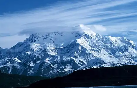 2. Mount Saint Elias is the second highest summit of both Canada and the United States.
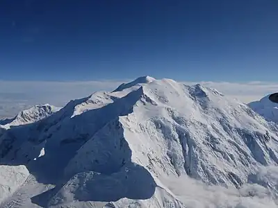 3. Mount Foraker is the second highest major summit of the Alaska Range.
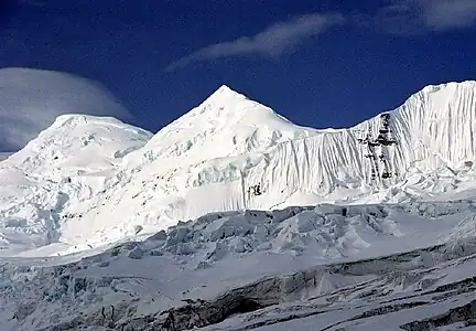 4. Mount Bona in Alaska is the highest volcano in the United States.
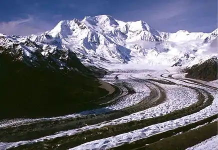 5. Mount Blackburn in Alaska is the highest summit of the Wrangell Mountains.
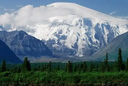 6. Mount Sanford in Alaska is the third highest volcano in the United States.
 7. Mount Fairweather lies on the Alaska-British Columbia international border.
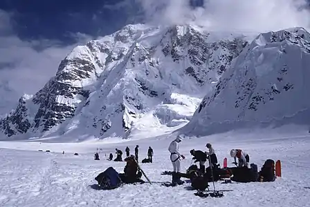 10. Mount Hunter is the third highest major summit of the Alaska Range.
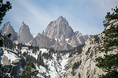 11. Mount Whitney highest summit of the Sierra Nevada and California.
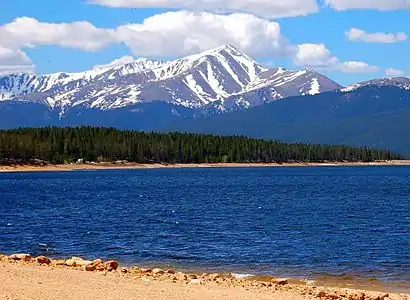 14. Mount Elbert is the highest summit of Colorado and the Rocky Mountains.
 15. Mount Massive is the second-highest summit of Colorado and the Rocky Mountains.
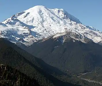 17. Mount Rainier is the highest summit of Washington and the Cascade Range.
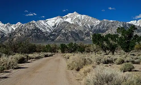 18. Mount Williamson is the second-highest summit of the Sierra Nevada and the state of California.
 19. Blanca Peak in Colorado is the highest summit of the Sangre de Cristo Mountains and is higher than any point in the United States east of its longitude.
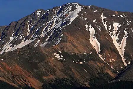 20. La Plata Peak is the fifth-highest summit of Colorado and the Rocky Mountains.
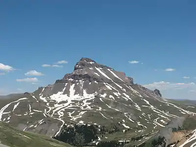 21. Uncompahgre Peak is the highest summit of the San Juan Mountains and the sixth-highest in Colorado.
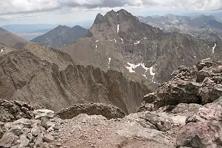 22. Crestone Peak
 23. Mount Lincoln is the highest summit of Colorado's Mosquito Range and of the entire Missouri River drainage basin.
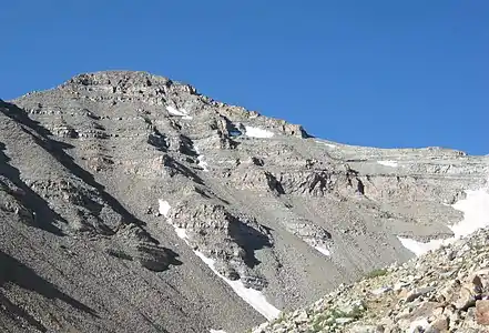 24. Castle Peak is the highest summit of Colorado's Elk Mountains.
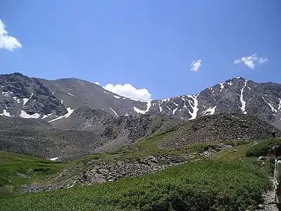 25. Grays Peak in Colorado is the highest point on the Continental Divide in North America.
 30. The summit of White Mountain Peak is the highest point in California's White Mountains and the third-highest point in the state of California.
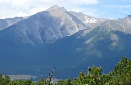 32. Mount Princeton in Colorado's Sawatch Range
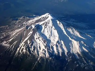 34. Mount Shasta in California is the highest summit of the southern Cascade Range.
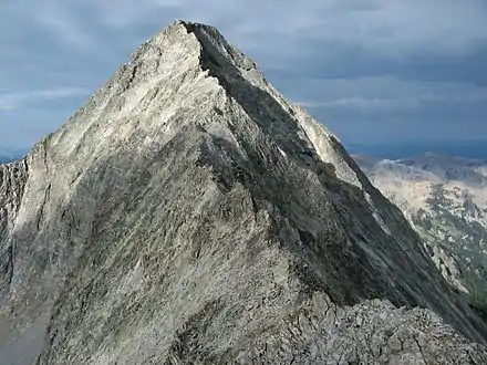 38. Capitol Peak in Colorado's Elk Mountains
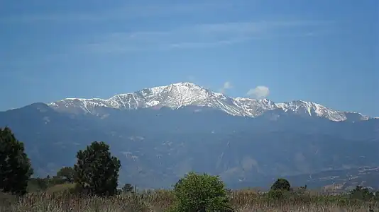 39. Pikes Peak in Colorado was the inspiration for America the Beautiful.
 44. The summit of San Luis Peak is the highest point in Colorado's La Garita Mountains.
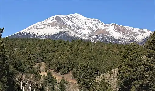 49. Mount Ouray
 50. Vermilion Peak
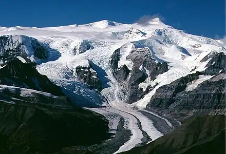 52. Regal Mountain is the 16th highest major summit in Alaska.
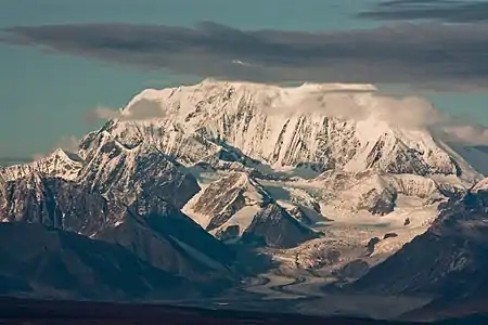 54. Mount Hayes is the highest summit of the eastern Alaska Range.
 57. Gannett Peak is the highest summit of the Wind River Range and Wyoming.
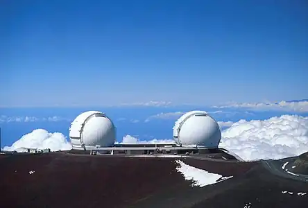 59. Mauna Kea on the Island of Hawaiʻi is the tallest mountain on Earth as measured from base to summit.
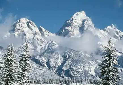 60. Grand Teton in Wyoming is the highest summit of the Teton Range.
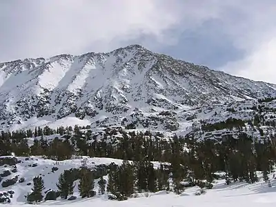 62. Mount Morgan
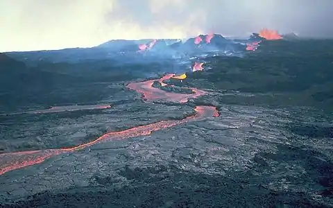 66. Mauna Loa on the Island of Hawaiʻi is the most voluminous mountain on Earth.
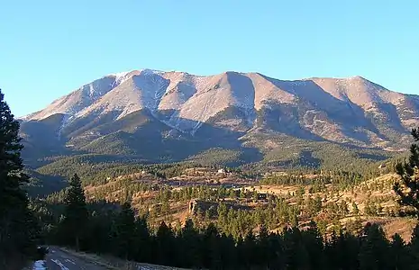 70. The summit of West Spanish Peak is the highest point in Las Animas County, Colorado.
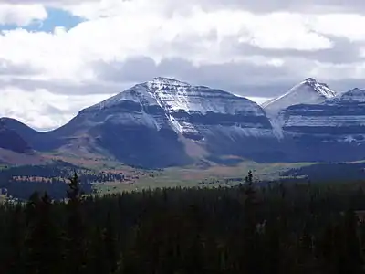 76. Kings Peak is the highest summit of the Uinta Range and Utah.
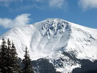 81. Parry Peak in Colorado's Front Range
 90. Henry Mountain in Gunnison County, Colorado
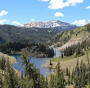 96. Conejos Peak is the highest summit of Conejos County in the state of Colorado.
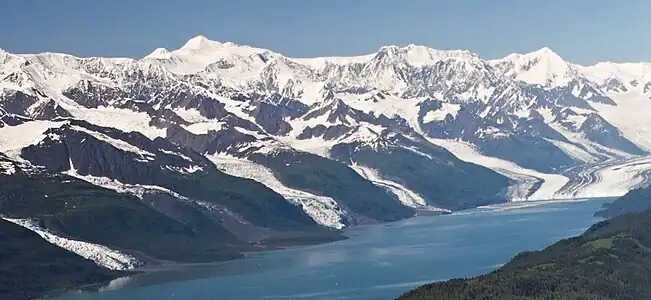 97. Mount Marcus Baker is the highest summit of Alaska's Chugach Mountains and the eighth most prominent summit in the United States.
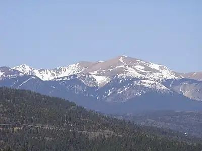 99. Wheeler Peak is the highest summit of New Mexico.
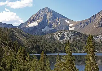 104. Red Slate Mountain in California's Sierra Nevada
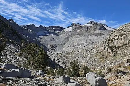 105. The summit of Mount Lyell is the highest point in Yosemite National Park.
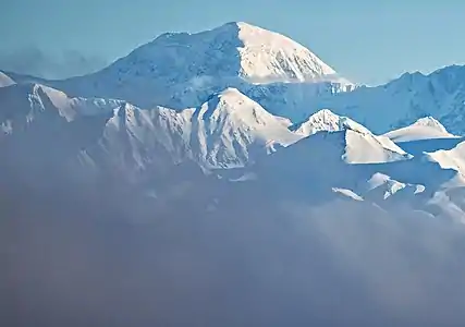 111. Mount Moffit in the Alaska Range
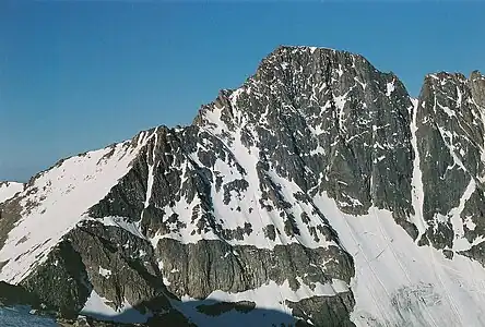 118. Granite Peak is the highest summit of the Beartooth Range and Montana.
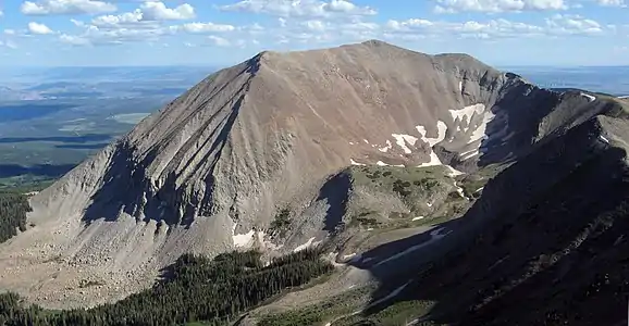 122. Mount Peale is the highest summit of Utah's La Sal Mountains.
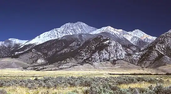 127. Borah Peak is the highest summit of the Lost River Range and Idaho.
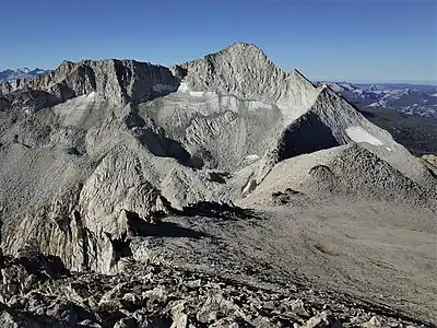 130. Mount Conness in California's Sierra Nevada
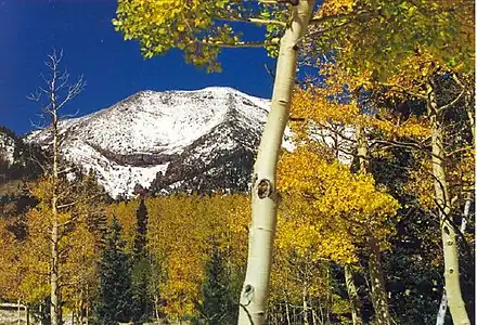 131. Humphreys Peak is the highest summit of the San Francisco Peaks and Arizona.
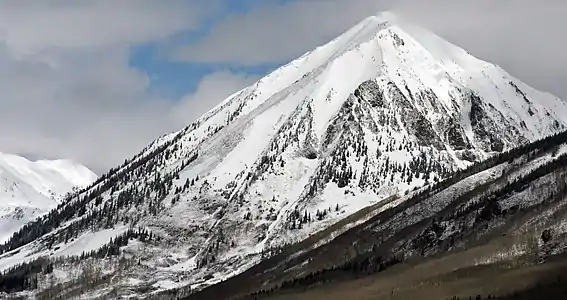 133. Gothic Mountain in Colorado's Elk Mountains
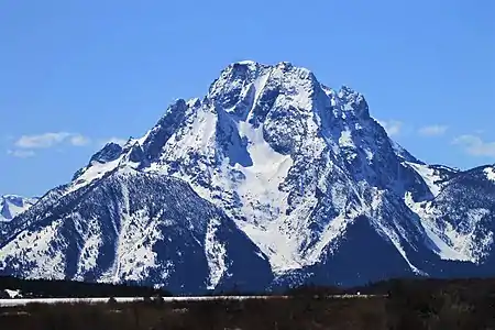 136. Mount Moran in Wyoming's Teton Range
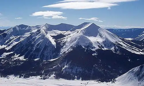 142. Whetstone Mountain in Colorado's West Elk Mountains
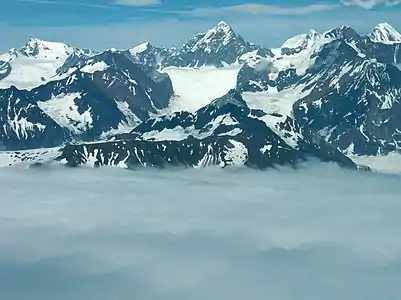 145. Mount Watson in the Fairweather Range of Alaska's Saint Elias Mountains
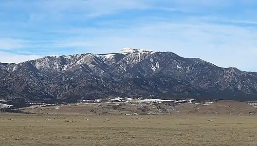 157. The summit of Greenhorn Mountain is the highest point in Colorado's Wet Mountains.
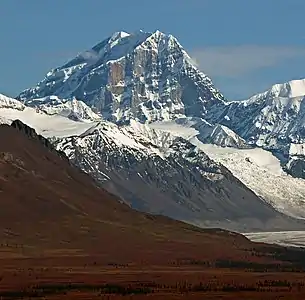 159. Mount Deborah in the eastern Alaska Range
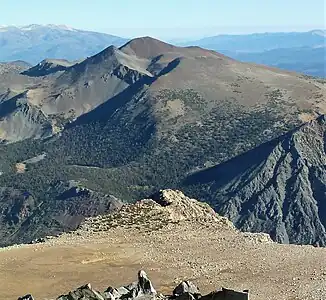 160. Mount Warren in Mono County, California
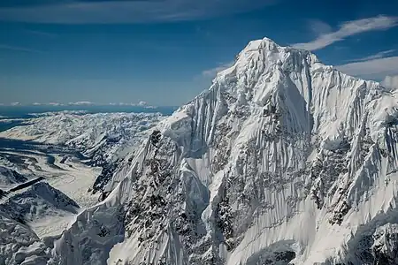 168. Mount Huntington in the central Alaska Range
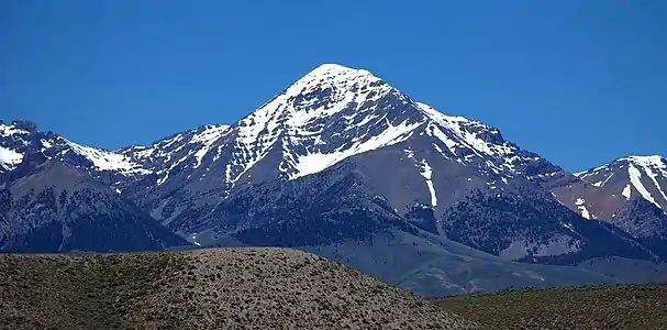 171. Diamond Peak is the highest summit of Idaho's Lemhi Range.
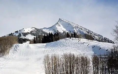 177. Crested Butte
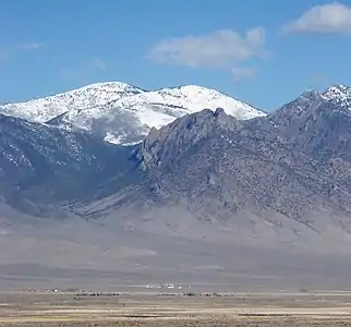 184. Ibapah Peak is the highest summit of Utah's Deep Creek Range.
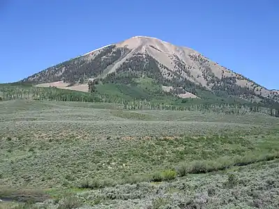 185. Carbon Peak in Gunnison County, Colorado
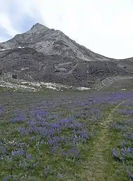 193. The summit of Hyndman Peak is the highest point in Idaho's Pioneer Mountains.
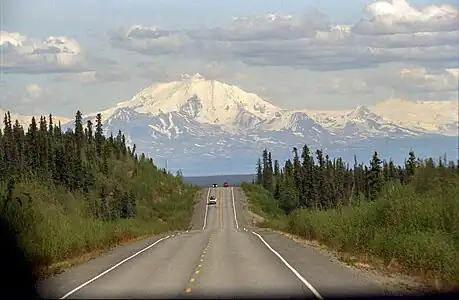 196. Mount Drum in Alaska's Wrangell Mountains
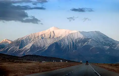 206. Mount Nebo is the highest summit of Utah's Wasatch Range.
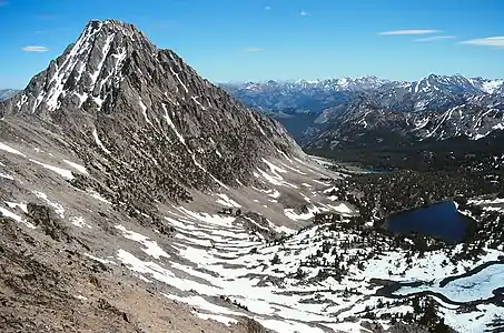 217. Castle Peak is the highest summit of Idaho's White Cloud Mountains.
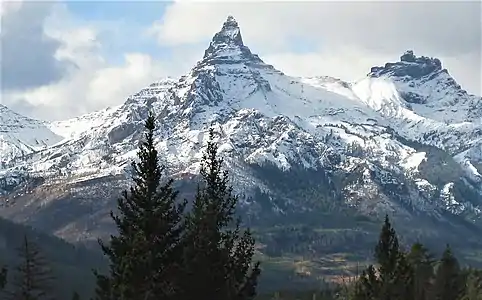 226. Pilot Peak is near the northeast corner of Yellowstone National Park in Wyoming.
 249. Tomichi Dome in Gunnison County, Colorado
 260. Ruby Dome is the highest summit of Nevada's Ruby Mountains.
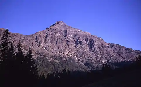 261. The summit of Eagle Peak is the highest point in Yellowstone National Park.
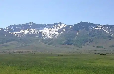 272. Hole in the Mountain Peak is the highest summit of Nevada's East Humboldt Range.
 284. Mount Hood is the highest summit of Oregon.
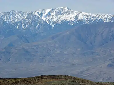 308. Telescope Peak is the highest summit of California's Panamint Range and Death Valley National Park.
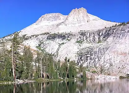 336. Mount Hoffmann in California's Yosemite National Park
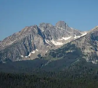 349. The summit of Thompson Peak is the highest point in Idaho's Sawtooth Range.
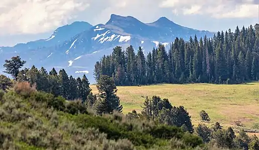 358. Saddle Mountain in Wyoming's Yellowstone National Park
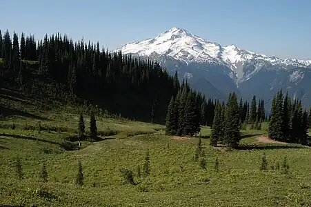 373. Glacier Peak is one of five major stratovolcanoes in the state of Washington.
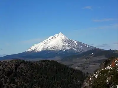 376. Mount Jefferson is the second-highest summit in Oregon.
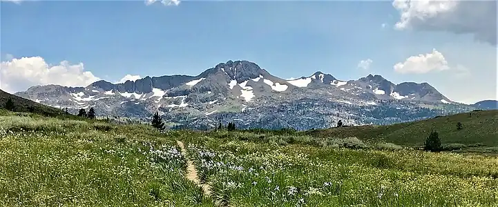 387. Round Top is the 16th most prominent summit in the state of California.
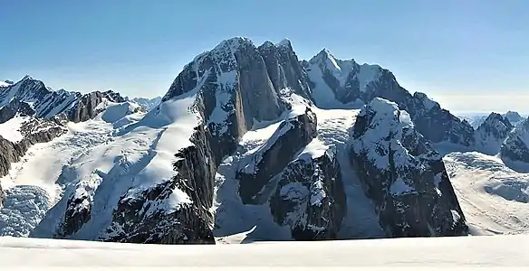 398. The Moose's Tooth in Alaska's Denali National Park
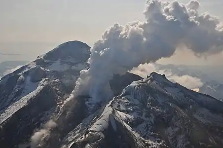 422. Redoubt Volcano is the highest summit of the Aleutian Range.
 424. Mount Regan in Idaho's Sawtooth Range
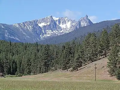 430. The summit of Trapper Peak is the highest point in Montana's Bitterroot Mountains.
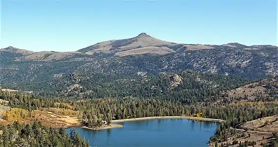 444. Hawkins Peak in Alpine County, California
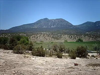 454. Ute Peak on the Ute Mountain Ute Tribe Reservation in southwest Colorado
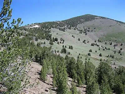 471. Eagle Peak is the highest summit of California's Warner Mountains and Modoc County.
See also
- List of mountain peaks of North America
- List of mountain peaks of Greenland
- List of mountain peaks of Canada
- List of mountain peaks of the Rocky Mountains
- List of mountain peaks of the United States
- List of the highest major summits of the United States
- List of the major 4000-meter summits of the United States
- List of the major 3000-meter summits of the United States
- List of United States fourteeners
- List of the most prominent summits of the United States
- List of the most isolated major summits of the United States
- List of the major 100-kilometer summits of the United States
- List of extreme summits of the United States
- List of mountain peaks of Alaska
- List of mountain peaks of California
- List of mountain peaks of Colorado
- List of mountain peaks of Hawaiʻi
- List of mountain peaks of Montana
- List of mountain peaks of Nevada
- List of mountain peaks of Utah
- List of mountain peaks of Washington (state)
- List of mountain peaks of Wyoming
- List of the highest major summits of the United States
- List of mountain peaks of México
- List of mountain peaks of Central America
- List of mountain peaks of the Caribbean
- United States of America
- Geography of the United States
- Geology of the United States
- Category:Mountains of the United States
- Physical geography
Notes
- The summit of Denali is the highest point of the Alaska Range, the State of Alaska, the United States of America, and greater North America. Denali is the third most topographically prominent and third most topographically isolated summit on Earth after Mount Everest and Aconcagua.
- Mount Saint Elias is the second-highest major summit of both Canada and the United States.
- Mount Foraker is the westernmost 5000-meter (16,404-foot) summit of Alaska, the United States, and greater North America.
- The summit of Mount Bona is the highest point of the northwest Saint Elias Mountains.
- The summit of Mount Blackburn is the highest point of the Wrangell Mountains.
- Mount Fairweather lies on the international border between Alaska and British Columbia. The peak is the highest point of the Canadian Province of British Columbia and the southernmost and easternmost summit of its elevation in both Canada and the United States.
- The summit of Mount Whitney is the highest point of the Sierra Nevada, the State of California, and the contiguous United States.
- Mount Whitney is the southernmost and easternmost summit of its elevation in the United States.
- The summit of Mount Elbert is the highest point of the U.S. State of Colorado, the Rocky Mountains of North America, and the entire Mississippi River drainage basin.
- Mount Massive is the second highest major summit of the Rocky Mountains.
- The elevation of Mount Massive includes an adjustment of +2.087 m (6.85 ft) from NGVD 29 to NAVD 88.
- The summit of Mount Harvard is the highest point of the Collegiate Peaks.
- Mount Harvard is the southernmost and easternmost summit of its elevation in the Rocky Mountains.
- The summit of Mount Rainier is the highest point of the Cascade Range and the U.S. State of Washington. Mount Rainier is the most prominent summit in the contiguous United States and the fourth most prominent in North America.
- The elevation of Mount Rainier includes an adjustment of +1.914 m (6.28 ft) from NGVD 29 to NAVD 88.
- The elevation of Mount Williamson includes an adjustment of +1.807 m (5.93 ft) from NGVD 29 to NAVD 88.
- The summit of Blanca Peak is the highest point of the Sangre de Cristo Mountains and the entire Rio Grande drainage basin.
- Blanca Peak is the southernmost ultra-prominent summit of the Rocky Mountains.
- The elevation of Blanca Peak includes an adjustment of +1.755 m (5.76 ft) from NGVD 29 to NAVD 88.
- The elevation of La Plata Peak includes an adjustment of +1.983 m (6.51 ft) from NGVD 29 to NAVD 88.
- The summit of Uncompahgre Peak is the highest point of the San Juan Mountains and the entire Gulf of California drainage basin.
- Uncompahgre Peak is the westernmost summit of its elevation in the Rocky Mountains.
- The summit of Crestone Peak is the highest point of the Crestones.
- The elevation of Crestone Peak includes an adjustment of +1.76 m (5.77 ft) from NGVD 29 to NAVD 88.
- The summit of Mount Lincoln is the highest point of the Mosquito Range and the entire Missouri River drainage basin.
- Mount Lincoln is the northernmost summit of its elevation in the Rocky Mountains.
- The summit of Castle Peak is the highest point of the Elk Mountains.
- The summit of Grays Peak is the highest point of the Front Range and the Continental Divide in North America.
- Grays Peak is the northernmost summit of its elevation in the Rocky Mountains.
- The summit of Mount Antero is the highest point of the southern Sawatch Range.
- The summit elevation of Mount Blue Sky includes a vertical offset of +1.798 m (5.9 ft) from the station benchmark.
- The summit of Longs Peak is the highest point of the northern Front Range.
- Longs Peak is the northernmost 14,000-foot (4267-meter) summit of the Rocky Mountains.
- The summit of Mount Wilson is the highest point of the San Miguel Mountains.
- Mount Wilson is the westernmost summit of its elevation in the Rocky Mountains.
- The elevation of Mount Wilson includes an adjustment of +1.899 m (6.23 ft) from NGVD 29 to NAVD 88.
- The summit of White Mountain Peak is the highest point of the White Mountains.
- The summit of North Palisade is the highest point of the Palisades.
- The elevation of North Palisade includes an adjustment of +1.867 m (6.13 ft) from NGVD 29 to NAVD 88.
- The summit of Mount Shasta is the highest point of the southern Cascade Range.
- The summit of Mount Sneffels is the highest point of the Sneffels Range.
- The elevation of Capitol Peak includes an adjustment of +1.991 m (6.53 ft) from NGVD 29 to NAVD 88.
- Pikes Peak is the easternmost 14,000-foot (4267-meter) summit and ultra-prominent summit of the Rocky Mountains. Pikes Peak was the inspiration for the lyrics of America the Beautiful.
- The summit of Windom Peak is the highest point of the Needle Mountains.
- Mount Eolus may be higher than Windom Peak.
- The elevation of Windom Peak includes an adjustment of +1.785 m (5.86 ft) from NGVD 29 to NAVD 88.
- The summit of Culebra Peak is the highest point of the Culebra Range.
- Culebra Peak is the southernmost 14,000-foot (4267-meter) summit of the Rocky Mountains.
- The elevation of Culebra Peak includes an adjustment of +1.74 m (5.71 ft) from NGVD 29 to NAVD 88.
- The summit of Mount of the Holy Cross is the highest point of the northern Sawatch Range.
- The summit elevation of Mount of the Holy Cross includes a vertical offset of +0.61 m (2 ft) from the station benchmark.
- The elevation of Mount Humphreys includes an adjustment of +1.842 m (6.04 ft) from NGVD 29 to NAVD 88.
- The elevation of Mount Keith includes an adjustment of +1.795 m (5.89 ft) from NGVD 29 to NAVD 88.
- The summit of Mount Ouray is the highest point of the far southern Sawatch Range.
- The elevation of Vermilion Peak includes an adjustment of +1.827 m (5.99 ft) from NGVD 29 to NAVD 88.
- The elevation of Mount Darwin includes an adjustment of +1.886 m (6.19 ft) from NGVD 29 to NAVD 88.
- The summit of Mount Hayes is the highest point of the Hayes Range.
- Mount Hayes is the northernmost 4000-meter (13,123-foot) summit of Alaska, the United States, and greater North America.
- The summit of Gannett Peak is the highest point of the Wind River Range, the U.S. State of Wyoming, and the central Rocky Mountains.
- Gannett Peak is the northernmost and westernmost summit of its elevation in the Rocky Mountains.
- The summit of Mount Kaweah is the highest point of the Great Western Divide.
- Mount Kaweah is the southernmost summit of its elevation in United States.
- The elevation of Mount Kaweah includes an adjustment of +1.652 m (5.42 ft) from NGVD 29 to NAVD 88.
- The summit of Mauna Kea is the highest point of the Island of Hawaiʻi, the U.S. State of Hawaiʻi, and all islands of the Pacific Ocean.
- Mauna Kea is the tallest mountain on Earth as measured from base to summit. The shield volcano sits on the ocean floor at a depth of 5998 meters (19,678 feet) for a total height of 10,205.3 meters (33,482 feet).
- The summit of Grand Teton is the highest point of the Teton Range.
- Grand Teton is the northernmost and westernmost 4000-meter (13,123-foot) summit of the Rocky Mountains.
- The elevation of Mount Gabb includes an adjustment of +1.958 m (6.42 ft) from NGVD 29 to NAVD 88.
- The elevation of Bald Mountain includes an adjustment of +1.922 m (6.31 ft) from NGVD 29 to NAVD 88.
- The elevation of Mount Oso includes an adjustment of +1.776 m (5.83 ft) from NGVD 29 to NAVD 88.
- Mauna Loa is the southernmost and westernmost 4000-meter (13,123-foot) summit of Hawaiʻi and the United States.
- The shield volcano Mauna Loa is the most voluminous mountain on Earth with an estimated volume of 74,000 km3 (17,800 cubic miles), or enough material to fill the Grand Canyon more than 18 times.
- The elevation of Mount Tom includes an adjustment of +1.379 m (4.52 ft) from NGVD 29 to NAVD 88.
- The elevation of Bard Peak includes an adjustment of +1.707 m (5.6 ft) from NGVD 29 to NAVD 88.
- West Spanish Peak is the easternmost 4000-meter (13,123-foot) summit of the Rocky Mountains and the United States.
- The elevation of West Spanish Peak includes an adjustment of +1.468 m (4.82 ft) from NGVD 29 to NAVD 88.
- The summit of Mount Powell is the highest point of the Gore Range.
- The elevation of Mount Powell includes an adjustment of +1.771 m (5.81 ft) from NGVD 29 to NAVD 88.
- The summit of Hagues Peak is the highest point of the Mummy Range.
- The elevation of Mount Dubois includes an adjustment of +1.879 m (6.16 ft) from NGVD 29 to NAVD 88.
- The elevation of Tower Mountain includes an adjustment of +1.796 m (5.89 ft) from NGVD 29 to NAVD 88.
- The elevation of Treasure Mountain includes an adjustment of +2.008 m (6.59 ft) from NGVD 29 to NAVD 88.
- The summit of Kings Peak is the highest point of the Uinta Mountains, the U.S. State of Utah, and the western Rocky Mountains.
- The elevation of Kings Peak includes an adjustment of +1.807 m (5.93 ft) from NGVD 29 to NAVD 88.
- The summit of North Arapaho Peak is the highest point of the Indian Peaks.
- The elevation of North Arapaho Peak includes an adjustment of +1.763 m (5.78 ft) from NGVD 29 to NAVD 88.
- The elevation of Mount Pinchot includes an adjustment of +1.81 m (5.94 ft) from NGVD 29 to NAVD 88.
- The elevation of Parry Peak includes an adjustment of +1.763 m (5.78 ft) from NGVD 29 to NAVD 88.
- The summit of Bill Williams Peak is the highest point of the Williams Mountains.
- The elevation of Bill Williams Peak includes an adjustment of +2.044 m (6.71 ft) from NGVD 29 to NAVD 88.
- The elevation of Sultan Mountain includes an adjustment of +1.649 m (5.41 ft) from NGVD 29 to NAVD 88.
- The elevation of Mount Herard includes an adjustment of +1.64 m (5.38 ft) from NGVD 29 to NAVD 88.
- The elevation of West Buffalo Peak includes an adjustment of +1.834 m (6.02 ft) from NGVD 29 to NAVD 88.
- The summit of Summit Peak is the highest point of the southern San Juan Mountains.
- Dolores Peak may be higher than Middle Peak.
- The elevation of Middle Peak includes an adjustment of +1.809 m (5.94 ft) from NGVD 29 to NAVD 88.
- The elevation of Antora Peak includes an adjustment of +1.883 m (6.18 ft) from NGVD 29 to NAVD 88.
- The elevation of Henry Mountain includes an adjustment of +2.037 m (6.68 ft) from NGVD 29 to NAVD 88.
- The summit of Hesperus Mountain is the highest point of the La Plata Mountains.
- The elevation of Hesperus Mountain includes an adjustment of +1.65 m (5.41 ft) from NGVD 29 to NAVD 88.
- The elevation of Jacque Peak includes an adjustment of +1.866 m (6.12 ft) from NGVD 29 to NAVD 88.
- The elevation of Bennett Peak includes an adjustment of +1.782 m (5.85 ft) from NGVD 29 to NAVD 88.
- The summit of Wind River Peak is the highest point of the southern Wind River Range.
- The summit of Mount Marcus Baker is the highest point of the Chugach Mountains.
- The summit of Cloud Peak is the highest point of the Bighorn Mountains.
- Cloud Peak is the northernmost 4000-meter (13,123-foot) summit of the Rocky Mountains.
- The summit of Wheeler Peak is the highest point of the Taos Mountains and the U.S. State of New Mexico.
- Wheeler Peak is the southernmost 4000-meter (13,123-foot) summit of the Rocky Mountains.
- The summit of Francs Peak is the highest point of the Absaroka Range.
- The summit of Twilight Peak is the highest point of the West Needle Mountains.
- The elevation of Twilight Peak includes an adjustment of +1.537 m (5.04 ft) from NGVD 29 to NAVD 88.
- The summit of Mount Ritter is the highest point of the Ritter Range.
- The elevation of Mount Ritter includes an adjustment of +1.786 m (5.86 ft) from NGVD 29 to NAVD 88.
- The elevation of Red Slate Mountain includes an adjustment of +1.893 m (6.21 ft) from NGVD 29 to NAVD 88.
- The summit of Truchas Peak is the highest point of the Santa Fe Mountains.
- Truchas Peak is the southernmost summit of its elevation in the Rocky Mountains.
- The summit of Wheeler Peak is the highest point of the Snake Range.
- The summit of West Elk Peak is the highest point of the West Elk Mountains.
- The elevation of Mount Centennial includes an adjustment of +1.814 m (5.95 ft) from NGVD 29 to NAVD 88.
- The summit of Clark Peak is the highest point of the Medicine Bow Mountains.
- The summit of Mount Richthofen is the highest point of the Never Summer Mountains.
- The elevation of Mount Richthofen includes an adjustment of +1.658 m (5.44 ft) from NGVD 29 to NAVD 88.
- The summit of Lizard Head Peak is the highest point of the Cirque of the Towers.
- The elevation of Lizard Head Peak includes an adjustment of +1.572 m (5.16 ft) from NGVD 29 to NAVD 88.
- The summit of Granite Peak is the highest point of the Beartooth Mountains and the U.S. State of Montana.
- The elevation of Venado Peak includes an adjustment of +1.65 m (5.41 ft) from NGVD 29 to NAVD 88.
- The summit of Mount Peale is the highest point of the La Sal Mountains and the Colorado Plateau.
- East Spanish Peak is the easternmost 3000-meter (9843-foot) summit of the Rocky Mountains and the entire United States.
- The elevation of East Spanish Peak includes an adjustment of +1.372 m (4.5 ft) from NGVD 29 to NAVD 88.
- The summit of Borah Peak is the highest point of the Lost River Range and the U.S. State of Idaho.
- The summit of Mount Wood is the highest point of the Granite Range.
- The elevation of Mount Wood includes an adjustment of +1.516 m (4.97 ft) from NGVD 29 to NAVD 88.
- The summit of Humphreys Peak is the highest point of the San Francisco Peaks and the U.S. State of Arizona.
- The elevation of Humphreys Peak includes an adjustment of +1.345 m (4.41 ft) from NGVD 29 to NAVD 88.
- Santa Fe Baldy is the southernmost 3000-meter (9843-foot) summit of the Rocky Mountains.
- The elevation of Gothic Mountain includes an adjustment of +1.936 m (6.35 ft) from NGVD 29 to NAVD 88.
- The elevation of Needham Mountain includes an adjustment of +1.602 m (5.26 ft) from NGVD 29 to NAVD 88.
- The elevation of Atlantic Peak includes an adjustment of +1.521 m (4.99 ft) from NGVD 29 to NAVD 88.
- The elevation of Specimen Mountain includes an adjustment of +1.614 m (5.3 ft) from NGVD 29 to NAVD 88.
- The summit of Baldy Mountain is the highest point of the Cimarron Range.
- The summit of Knobby Crest is the highest point of the Kenosha Mountains.
- The elevation of Knobby Crest includes an adjustment of +1.595 m (5.23 ft) from NGVD 29 to NAVD 88.
- The summit of Bison Peak is the highest point of the Tarryall Mountains.
- The elevation of Matchless Mountain includes an adjustment of +1.941 m (6.37 ft) from NGVD 29 to NAVD 88.
- The summit of Flat Top Mountain is the highest point of the Flat Tops.
- The summit of Greenhorn Mountain is the highest point of the Wet Mountains.
- The elevation of Elliott Mountain includes an adjustment of +1.709 m (5.61 ft) from NGVD 29 to NAVD 88.
- Mount Deborah is the northernmost summit of its elevation in Alaska, the United States, and greater North America.
- The elevation of Twin Peaks includes an adjustment of +1.717 m (5.63 ft) from NGVD 29 to NAVD 88.
- The summit of Parkview Mountain is the highest point of the Rabbit Ears Range.
- The elevation of Cornwall Mountain includes an adjustment of +1.715 m (5.63 ft) from NGVD 29 to NAVD 88.
- The summit of Trout Peak is the highest point of the central Absaroka Range.
- The elevation of Leatherman Peak includes an adjustment of +1.61 m (5.28 ft) from NGVD 29 to NAVD 88.
- The summit of Diamond Peak is the highest point of the Lemhi Range.
- The summit of Mount Zirkel is the highest point of the Park Range.
- The elevation of Mount Zirkel includes an adjustment of +1.632 m (5.35 ft) from NGVD 29 to NAVD 88.
- The summit of Delano Peak is the highest point of the Tushar Mountains.
- The elevation of Crested Butte includes an adjustment of +1.94 m (6.36 ft) from NGVD 29 to NAVD 88.
- The summit of Olancha Peak is the highest point of the southern Sierra Nevada.
- The elevation of Park Cone includes an adjustment of +1.873 m (6.15 ft) from NGVD 29 to NAVD 88.
- The summit of Ibapah Peak is the highest point of the Deep Creek Range.
- The elevation of Ibapah Peak includes an adjustment of +1.517 m (4.98 ft) from NGVD 29 to NAVD 88.
- The elevation of Glover Peak includes an adjustment of +1.609 m (5.28 ft) from NGVD 29 to NAVD 88.
- The summit of Medicine Bow Peak is the highest point of the Snowy Range.
- The summit of Hyndman Peak is the highest point of the Pioneer Mountains.
- The elevation of Mount Zwischen includes an adjustment of +1.481 m (4.86 ft) from NGVD 29 to NAVD 88.
- The summit of Sierra Blanca Peak is the highest point of the Sacramento Mountains.
- The elevation of Bald Mountain includes an adjustment of +1.59 m (5.22 ft) from NGVD 29 to NAVD 88.
- The summit of Mount Jefferson is the highest point of the Toquima Range.
- The elevation of Mount Jefferson includes an adjustment of +1.666 m (5.47 ft) from NGVD 29 to NAVD 88.
- Hess Mountain is the northernmost 3000-meter (9843-foot) summit of Alaska and the United States.
- The summit of Cerro Vista is the highest point of the southern Sangre de Cristo Range.
- The summit of Mount Nebo is the highest point of the Wasatch Range.
- The elevation of Mount Nebo includes an adjustment of +1.395 m (4.58 ft) from NGVD 29 to NAVD 88.
- The summit of Charleston Peak is the highest point of the Spring Mountains.
- The summit of North Schell Peak is the highest point of the Schell Creek Range.
- The elevation of Huntsman Ridge includes an adjustment of +1.711 m (5.61 ft) from NGVD 29 to NAVD 88.
- The elevation of South Mountain includes an adjustment of +1.437 m (4.71 ft) from NGVD 29 to NAVD 88.
- The summit of Castle Peak is the highest point of the White Cloud Mountains.
- The summit of Arc Dome is the highest point of the Toiyabe Range.
- The elevation of Arc Dome includes an adjustment of +1.665 m (5.46 ft) from NGVD 29 to NAVD 88.
- The summit of Mount Timpanogos is the highest point of the central Wasatch Range.
- The summit of Doubletop Peak is the highest point of the Gros Ventre Range.
- The elevation of Doubletop Peak includes an adjustment of +1.708 m (5.6 ft) from NGVD 29 to NAVD 88.
- The summit of Ryan Peak is the highest point of the Boulder Mountains.
- The summit of Waugh Mountain is the highest point of the South Park Hills.
- The elevation of Waugh Mountain includes an adjustment of +1.702 m (5.58 ft) from NGVD 29 to NAVD 88.
- The elevation of Coal Mountain includes an adjustment of +1.625 m (5.33 ft) from NGVD 29 to NAVD 88.
- The summit of Mount Patterson is the highest point of the Sweetwater Range.
- The elevation of Mount Patterson includes an adjustment of +1.734 m (5.69 ft) from NGVD 29 to NAVD 88.
- Mount Russell is the westernmost summit of its elevation in Alaska and greater North America.
- The elevation of Black Mountain includes an adjustment of +1.631 m (5.35 ft) from NGVD 29 to NAVD 88.
- The summit of Fish Lake Hightop is the highest point of the Fish Lake Plateau.
- The elevation of Glassford Peak includes an adjustment of +1.583 m (5.19 ft) from NGVD 29 to NAVD 88.
- The summit elevation of San Joaquin Mountain includes a vertical offset of +0.61 m (2 ft) from the station benchmark.
- The elevation of San Joaquin Mountain includes an adjustment of +1.7 m (5.58 ft) from NGVD 29 to NAVD 88.
- The elevation of Puma Peak includes an adjustment of +1.513 m (4.96 ft) from NGVD 29 to NAVD 88.
- The elevation of Mount Mestas includes an adjustment of +1.372 m (4.5 ft) from NGVD 29 to NAVD 88.
- The elevation of Leavitt Peak includes an adjustment of +1.6 m (5.25 ft) from NGVD 29 to NAVD 88.
- The summit of Chicoma Mountain is the highest point of the Jemez Mountains.
- The elevation of Thirtynine Mile Mountain includes an adjustment of +1.584 m (5.2 ft) from NGVD 29 to NAVD 88.
- The summit of Mount Ellen is the highest point of the Henry Mountains.
- The elevation of Mount Ellen includes an adjustment of +1.486 m (4.88 ft) from NGVD 29 to NAVD 88.
- The summit of Currant Mountain is the highest point of the White Pine Range.
- The summit of San Gorgonio Mountain is the highest point of the San Bernardino Mountains.
- The elevation of San Gorgonio Mountain includes an adjustment of +1.303 m (4.27 ft) from NGVD 29 to NAVD 88.
- The elevation of Twin Peaks includes an adjustment of +1.463 m (4.8 ft) from NGVD 29 to NAVD 88.
- The elevation of Tomichi Dome includes an adjustment of +1.693 m (5.55 ft) from NGVD 29 to NAVD 88.
- The elevation of Sonora Peak includes an adjustment of +1.62 m (5.31 ft) from NGVD 29 to NAVD 88.
- The summit of Blair Mountain is the highest point of the White River Plateau.
- The elevation of Blair Mountain includes an adjustment of +1.565 m (5.13 ft) from NGVD 29 to NAVD 88.
- The elevation of Twin Sisters Peaks includes an adjustment of +1.388 m (4.55 ft) from NGVD 29 to NAVD 88.
- The summit of Wyoming Peak is the highest point of the Wyoming Range.
- The elevation of Iron Mountain includes an adjustment of +1.436 m (4.71 ft) from NGVD 29 to NAVD 88.
- The summit of Mount Torbert is the highest point of the Tordrillo Mountains.
- Mount Torbert is the westernmost summit of its elevation in Alaska and greater North America.
- The summit of Mount Baldy is the highest point of the White Mountains.
- The summit of Scott Peak is the highest point of the Beaverhead Mountains.
- The summit of Ruby Dome is the highest point of the Ruby Mountains.
- The elevation of Ruby Dome includes an adjustment of +1.429 m (4.69 ft) from NGVD 29 to NAVD 88.
- The elevation of Eagle Peak includes an adjustment of +1.42 m (4.66 ft) from NGVD 29 to NAVD 88.
- The elevation of Toiyabe Dome includes an adjustment of +1.579 m (5.18 ft) from NGVD 29 to NAVD 88.
- The summit of Abajo Peak is the highest point of the Abajo Mountains.
- The elevation of Marcellina Mountain includes an adjustment of +1.658 m (5.44 ft) from NGVD 29 to NAVD 88.
- The elevation of Bluebell Knoll includes an adjustment of +1.708 m (5.6 ft) from NGVD 29 to NAVD 88.
- The summit of Crater Peak is the highest point of Grand Mesa.
- The summit of Tumble Mountain is the highest point of the Lake Plateau.
- The summit of Hilgard Peak is the highest point of the Madison Range.
- The elevation of Hilgard Peak includes an adjustment of +1.49 m (4.89 ft) from NGVD 29 to NAVD 88.
- The summit of Brian Head is the highest point of the Markagunt Plateau.
- The elevation of Brian Head includes an adjustment of +1.556 m (5.1 ft) from NGVD 29 to NAVD 88.
- The summit of Hole in the Mountain Peak is the highest point of the eastern Humboldt Range.
- The elevation of Hole in the Mountain Peak includes an adjustment of +1.457 m (4.78 ft) from NGVD 29 to NAVD 88.
- The summit of Mount Taylor is the highest point of the northern San Mateo Mountains.
- The elevation of Castle Peak includes an adjustment of +1.575 m (5.17 ft) from NGVD 29 to NAVD 88.
- The summit of Mount Grant is the highest point of the Wassuk Range.
- The elevation of Mount Grant includes an adjustment of +1.456 m (4.78 ft) from NGVD 29 to NAVD 88.
- The summit of Troy Peak is the highest point of the Grant Range.
- The summit of South Tent Mountain is the highest point of the Wasatch Plateau.
- The elevation of Mount Douglas includes an adjustment of +1.501 m (4.92 ft) from NGVD 29 to NAVD 88.
- The summit of Shelly Mountain is the highest point of the White Knob Mountains.
- The elevation of North Breccia Cliffs includes an adjustment of +1.529 m (5.02 ft) from NGVD 29 to NAVD 88.
- The summit of Mount Hood is the highest point of the Oregon Cascades and the U.S. State of Oregon.
- The summit of Monroe Peak is the highest point of the Sevier Plateau.
- The elevation of Mount Cowen includes an adjustment of +1.469 m (4.82 ft) from NGVD 29 to NAVD 88.
- The summit of Crazy Peak is the highest point of the Crazy Mountains.
- The elevation of Crazy Peak includes an adjustment of +1.421 m (4.66 ft) from NGVD 29 to NAVD 88.
- The elevation of Two Sisters includes an adjustment of +1.398 m (4.59 ft) from NGVD 29 to NAVD 88.
- The elevation of Hardscrabble Mountain includes an adjustment of +1.612 m (5.29 ft) from NGVD 29 to NAVD 88.
- The elevation of Lone Mountain includes an adjustment of +1.482 m (4.86 ft) from NGVD 29 to NAVD 88.
- The summit of Tweedy Mountain is the highest point of the Pioneer Mountains.
- The elevation of Tweedy Mountain includes an adjustment of +1.598 m (5.24 ft) from NGVD 29 to NAVD 88.
- The elevation of Cochetopa Dome includes an adjustment of +1.804 m (5.92 ft) from NGVD 29 to NAVD 88.
- The summit of Waucoba Mountain is the highest point of the Inyo Mountains.
- The summit of Glass Mountain is the highest point of the Glass Mountain Ridge.
- The elevation of Keynot Peak includes an adjustment of +1.347 m (4.42 ft) from NGVD 29 to NAVD 88.
- The elevation of Aiken Peak includes an adjustment of +1.483 m (4.87 ft) from NGVD 29 to NAVD 88.
- The elevation of South Lost River Range high point includes an adjustment of +1.466 m (4.81 ft) from NGVD 29 to NAVD 88.
- The elevation of Provo Peak includes an adjustment of +1.31 m (4.3 ft) from NGVD 29 to NAVD 88.
- The summit of Telescope Peak is the highest point of the Panamint Range.
- The elevation of Mammoth Mountain includes an adjustment of +1.766 m (5.79 ft) from NGVD 29 to NAVD 88.
- The summit of Deseret Peak is the highest point of the Stansbury Mountains.
- The elevation of Laramie Mountains high point includes an adjustment of +1.415 m (4.64 ft) from NGVD 29 to NAVD 88.
- The elevation of Gallatin Peak includes an adjustment of +1.52 m (4.99 ft) from NGVD 29 to NAVD 88.
- The summit of Electric Peak is the highest point of the Gallatin Range.
- The summit elevation of Highland Peak includes a vertical offset of +0.61 m (2 ft) from the station benchmark.
- The summit of Ward Mountain is the highest point of the Egan Range.
- The elevation of Rendezvous Peak includes an adjustment of +1.469 m (4.82 ft) from NGVD 29 to NAVD 88.
- The elevation of Shoshone Mountain includes an adjustment of +1.521 m (4.99 ft) from NGVD 29 to NAVD 88.
- The summit of Mount Fitzpatrick is the highest point of the Salt River Range.
- The elevation of Mount Fitzpatrick includes an adjustment of +1.483 m (4.87 ft) from NGVD 29 to NAVD 88.
- The summit of Whitewater Baldy is the highest point of the Mogollon Mountains.
- The elevation of Whitewater Baldy includes an adjustment of +1.273 m (4.18 ft) from NGVD 29 to NAVD 88.
- The summit of Table Mountain is the highest point of the Monitor Range.
- The summit of Freel Peak is the highest point of the Carson Range.
- The summit of Sand Mountain North is the highest point of the Elkhead Mountains.
- The elevation of Sand Mountain North includes an adjustment of +1.502 m (4.93 ft) from NGVD 29 to NAVD 88.
- The elevation of Sphinx Mountain includes an adjustment of +1.495 m (4.9 ft) from NGVD 29 to NAVD 88.
- The elevation of Black Mountain includes an adjustment of +1.537 m (5.04 ft) from NGVD 29 to NAVD 88.
- The elevation of Sleepy Cat Peak includes an adjustment of +1.471 m (4.83 ft) from NGVD 29 to NAVD 88.
- The summit of Matterhorn is the highest point of the Jarbidge Mountains.
- The elevation of Matterhorn includes an adjustment of +1.429 m (4.69 ft) from NGVD 29 to NAVD 88.
- The summit of San Jacinto Peak is the highest point of the San Jacinto Mountains.
- The summit of West Goat Peak is the highest point of the Anaconda Range.
- The elevation of West Goat Peak includes an adjustment of +1.52 m (4.99 ft) from NGVD 29 to NAVD 88.
- The summit of South Baldy is the highest point of the Magdalena Mountains.
- The summit of Mount Baker is the highest point of the northern Cascade Range.
- The elevation of Mount Baker includes an adjustment of +1.43 m (4.69 ft) from NGVD 29 to NAVD 88.
- The elevation of Mount McDougal includes an adjustment of +1.499 m (4.92 ft) from NGVD 29 to NAVD 88.
- The summit of Mount Rose is the highest point of the Carson Range.
- The summit of Thompson Peak is the highest point of the Sawtooth Range.
- The elevation of Rocky Peak includes an adjustment of +1.423 m (4.67 ft) from NGVD 29 to NAVD 88.
- The summit of Mount Miller is the highest point of Barkley Ridge.
- The elevation of Mount Hillers includes an adjustment of +1.364 m (4.48 ft) from NGVD 29 to NAVD 88.
- The summit of Mount Graham is the highest point of the Pinaleño Mountains.
- The summit of Pilot Peak is the highest point of the Pilot Range.
- The elevation of Cutoff Mountain includes an adjustment of +1.31 m (4.3 ft) from NGVD 29 to NAVD 88.
- The summit of Sandia Crest is the highest point of the Sandia Mountains.
- The elevation of Sandia Crest includes an adjustment of +1.101 m (3.61 ft) from NGVD 29 to NAVD 88.
- The elevation of Sage Peak includes an adjustment of +1.438 m (4.72 ft) from NGVD 29 to NAVD 88.
- The elevation of Mount Evans includes an adjustment of +1.543 m (5.06 ft) from NGVD 29 to NAVD 88.
- The summit of Diamond Peak is the highest point of the Diamond Mountains.
- The summit of Homer Youngs Peak is the highest point of the West Big Hole Mountains.
- The elevation of Homer Youngs Peak includes an adjustment of +1.483 m (4.87 ft) from NGVD 29 to NAVD 88.
- The summit of Flat Top Mountain is the highest point of the Oquirrh Mountains.
- The elevation of Flat Top Mountain includes an adjustment of +1.329 m (4.36 ft) from NGVD 29 to NAVD 88.
- The elevation of San Pedro Peaks high point includes an adjustment of +1.306 m (4.28 ft) from NGVD 29 to NAVD 88.
- The summit of South Sheep Mountain is the highest point of the Lionshead Mountains.
- The elevation of South Sheep Mountain includes an adjustment of +1.431 m (4.69 ft) from NGVD 29 to NAVD 88.
- The summit of Hollowtop Mountain is the highest point of the Tobacco Root Mountains.
- The elevation of Hollowtop Mountain includes an adjustment of +1.486 m (4.88 ft) from NGVD 29 to NAVD 88.
- The summit of Sunset Peak is the highest point of the Snowcrest Range.
- The elevation of Sunset Peak includes an adjustment of +1.553 m (5.1 ft) from NGVD 29 to NAVD 88.
- The elevation of Hogback Mountain includes an adjustment of +1.514 m (4.97 ft) from NGVD 29 to NAVD 88.
- The elevation of The Thunderer includes an adjustment of +1.26 m (4.13 ft) from NGVD 29 to NAVD 88.
- The summit of Black Butte is the highest point of the Gravelly Range.
- The summit elevation of Black Butte includes a vertical offset of +1 m (3.3 ft) from the station benchmark.
- The elevation of Glacier Peak includes an adjustment of +1.492 m (4.9 ft) from NGVD 29 to NAVD 88.
- The summit of Cherry Creek Benchmark is the highest point of the Cherry Creek Range.
- The summit of Mount Steller is the highest point of Waxell Ridge.
- The elevation of Mount Jefferson includes an adjustment of +1.388 m (4.55 ft) from NGVD 29 to NAVD 88.
- The summit of Mount Cleveland is the highest point of the Lewis Range.
- The summit of White Mountain West is the highest point of the Salmon River Mountains.
- The elevation of White Mountain West includes an adjustment of +1.567 m (5.14 ft) from NGVD 29 to NAVD 88.
- The elevation of Barronette Peak includes an adjustment of +1.274 m (4.18 ft) from NGVD 29 to NAVD 88.
- The summit of Bromaghin Peak South is the highest point of the Smoky Mountains.
- The elevation of Bromaghin Peak South includes an adjustment of +1.525 m (5 ft) from NGVD 29 to NAVD 88.
- The elevation of Sliderock Mountain includes an adjustment of +1.49 m (4.89 ft) from NGVD 29 to NAVD 88.
- The summit of McAfee Peak is the highest point of the Independence Mountains.
- The summit elevation of McAfee Peak includes a vertical offset of +0.03 m (0.1 ft) from the station benchmark.
- The summit of Round Top is the highest point of Eldorado National Forest and the Mokelumne Wilderness.
- The summit of Signal Peak is the highest point of the Pine Valley Mountains.
- The elevation of Signal Peak includes an adjustment of +1.249 m (4.1 ft) from NGVD 29 to NAVD 88.
- The summit of Mount Kimball is the highest point of the Delta Range.
- The summit of Cache Peak is the highest point of the Albion Range.
- The summit of Strawberry Peak is the highest point of the Roan Cliffs.
- The summit of West Blue Mountain is the highest point of the San Mateo Mountains.
- The elevation of West Blue Mountain includes an adjustment of +1.112 m (3.65 ft) from NGVD 29 to NAVD 88.
- The elevation of Mount Chisholm includes an adjustment of +1.532 m (5.03 ft) from NGVD 29 to NAVD 88.
- The summit of North Shoshone Peak is the highest point of the Shoshone Mountains.
- The summit of Mount Sheridan is the highest point of the Red Mountains.
- The elevation of Fan Mountain includes an adjustment of +1.42 m (4.66 ft) from NGVD 29 to NAVD 88.
- The summit of Spruce Mountain is the highest point of the Pequop Mountains.
- The elevation of Columbus Mountain includes an adjustment of +1.378 m (4.52 ft) from NGVD 29 to NAVD 88.
- The summit of Morey Peak is the highest point of the Hot Creek Range.
- The elevation of Alegres Mountain includes an adjustment of +1.078 m (3.54 ft) from NGVD 29 to NAVD 88.
- The summit of Potato Peak is the highest point of the Bodie Mountains.
- The summit elevation of Vienna Benchmark includes a vertical offset of +0.914 m (3 ft) from the station benchmark.
- The summit of Table Mountain is the highest point of the Highland Mountains.
- The elevation of Table Mountain includes an adjustment of +1.467 m (4.81 ft) from NGVD 29 to NAVD 88.
- The summit of Mine Camp Peak is the highest point of the Pavant Range.
- The elevation of Mine Camp Peak includes an adjustment of +1.418 m (4.65 ft) from NGVD 29 to NAVD 88.
- The summit of Mount Jefferson is the highest point of the Centennial Mountains.
- Mount Jefferson lies on the Continental Divide between Idaho and Montana.
- The elevation of Capitan Mountains high point includes an adjustment of +0.963 m (3.16 ft) from NGVD 29 to NAVD 88.
- The summit of Redoubt Volcano is the highest point of the Chigmit Mountains.
- Redoubt Volcano is the westernmost summit of its elevation in Alaska and greater North America.
- The elevation of Mount Regan includes an adjustment of +1.587 m (5.21 ft) from NGVD 29 to NAVD 88.
- The elevation of Quinn Canyon Range high point includes an adjustment of +1.292 m (4.24 ft) from NGVD 29 to NAVD 88.
- The summit of Mount Powell is the highest point of the Flint Creek Range.
- The summit of McKnight Mountain is the highest point of the Black Range.
- The elevation of McKnight Mountain includes an adjustment of +1.193 m (3.91 ft) from NGVD 29 to NAVD 88.
- The summit of Trapper Peak is the highest point of the central Bitterroot Range.
- The elevation of Trapper Peak includes an adjustment of +1.367 m (4.48 ft) from NGVD 29 to NAVD 88.
- The summit of Kintla Peak is the highest point of the Livingston Range.
- The elevation of Kintla Peak includes an adjustment of +1.413 m (4.64 ft) from NGVD 29 to NAVD 88.
- The summit of Manzano Peak is the highest point of the Manzano Mountains.
- The elevation of Ute Mountain includes an adjustment of +1.288 m (4.23 ft) from NGVD 29 to NAVD 88.
- The summit of Smoky Dome is the highest point of the Soldier Mountains.
- The summit of Mount McGuire is the highest point of the Bighorn Crags.
- The summit of Ferris Mountain is the highest point of the Ferris Mountains.
- The summit of Mount San Antonio is the highest point of the San Gabriel Mountains.
- The elevation of Mount San Antonio includes an adjustment of +1.214 m (3.98 ft) from NGVD 29 to NAVD 88.
- The elevation of Mount Jackson includes an adjustment of +1.425 m (4.68 ft) from NGVD 29 to NAVD 88.
- The elevation of Becky Peak includes an adjustment of +1.306 m (4.28 ft) from NGVD 29 to NAVD 88.
- The summit of Haleakalā is the highest point of the Island of Maui and the westernmost 3000 meter (9842.5-foot) summit of the United States.
- The elevation of Mount Siyeh includes an adjustment of +1.435 m (4.71 ft) from NGVD 29 to NAVD 88.
- Iliamna Volcano is the westernmost 3000-meter (9843-foot) summit of Alaska and greater North America.
- The elevation of Mount Merritt includes an adjustment of +1.372 m (4.5 ft) from NGVD 29 to NAVD 88.
- The summit of Salt Benchmark is the highest point of the San Pitch Mountains.
- The elevation of Shay Mountain includes an adjustment of +1.249 m (4.1 ft) from NGVD 29 to NAVD 88.
- The elevation of El Capitan includes an adjustment of +1.251 m (4.1 ft) from NGVD 29 to NAVD 88.
- The summit of Ute Peak is the highest point of Ute Mountain.
- The summit of Naomi Peak is the highest point of the Bear River Mountains.
- The elevation of Peak 9980 includes an adjustment of +1.369 m (4.49 ft) from NGVD 29 to NAVD 88.
- The summit of Desatoya Peak is the highest point of the Desatoya Mountains.
- The summit of Mount Augusta is the highest point of the Clan Alpine Mountains.
- The summit of Meade Peak is the highest point of the Preuss Range.
- The elevation of Horse Mountain includes an adjustment of +1.461 m (4.79 ft) from NGVD 29 to NAVD 88.
- The summit of Bull Mountain is the highest point of the Raft River Mountains.
- The elevation of Bull Mountain includes an adjustment of +1.343 m (4.41 ft) from NGVD 29 to NAVD 88.
- The summit of Hayford Peak is the highest point of the Sheep Range.
- The elevation of Baldy Mountain includes an adjustment of +1.436 m (4.71 ft) from NGVD 29 to NAVD 88.
- The elevation of Rainbow Peak includes an adjustment of +1.362 m (4.47 ft) from NGVD 29 to NAVD 88.
- The summit of Eagle Peak is the highest point of the Warner Mountains.
- The elevation of Dry Mountain includes an adjustment of +1.222 m (4.01 ft) from NGVD 29 to NAVD 88.
- Taylor Mountain lies on the Continental Divide between Idaho and Montana.
- The summit of Sacajawea Peak is the highest point of the Wallowa Mountains and the Columbia Plateau.
- The elevation of Sacajawea Peak includes an adjustment of +1.56 m (5.12 ft) from NGVD 29 to NAVD 88.
References
- This article defines a significant summit as a summit with at least 100 m (328.1 ft) of topographic prominence, and a major summit as a summit with at least 500 m (1,640 ft) of topographic prominence. All summits in this article have at least 500 meters of topographic prominence. An ultra-prominent summit is a summit with at least 1,500 m (4,921 ft) of topographic prominence.
- All elevations in the 48 states of the contiguous United States include an elevation adjustment from the National Geodetic Vertical Datum of 1929 (NGVD 29) to the North American Vertical Datum of 1988 (NAVD 88). For further information, please see this United States National Geodetic Survey note.
- If the elevation or prominence of a summit is calculated as a range of values, the arithmetic mean is shown.
- The topographic prominence of a summit is the topographic elevation difference between the summit and its highest or key col to a higher summit. The summit may be near its key col or quite far away. The key col for Denali in Alaska is the Isthmus of Rivas in Nicaragua, 7642 kilometers (4749 miles) away.
- The topographic isolation of a summit is the great-circle distance to its nearest point of equal elevation.
- "MT BLACKBURN". Datasheet for NGS Station UV4136. U.S. National Geodetic Survey. Retrieved 4 May 2016.
- "WHITNEY". Datasheet for NGS Station GT1811. U.S. National Geodetic Survey. Retrieved 4 May 2016.
- "BOUNDARY POINT 180". Datasheet for NGS Station UV3032. U.S. National Geodetic Survey. Retrieved 4 May 2016.
- "MOUNT ELBERT". Datasheet for NGS Station KL0637. U.S. National Geodetic Survey. Retrieved 4 May 2016.
- "MOUNT MASSIVE CAIRN". Datasheet for NGS Station KL0640. U.S. National Geodetic Survey. Retrieved 4 May 2016.
- "HARVARD". Datasheet for NGS Station JL0879. U.S. National Geodetic Survey. Retrieved 4 May 2016.
- "UNCOMPAHGRE". Datasheet for NGS Station JL0798. U.S. National Geodetic Survey. Retrieved 4 May 2016.
- "MT LINCOLN". Datasheet for NGS Station KL0627. U.S. National Geodetic Survey. Retrieved 4 May 2016.
- "CASTLE PK". Datasheet for NGS Station KL0659. U.S. National Geodetic Survey. Retrieved 4 May 2016.
- "GRAYS PEAK". Datasheet for NGS Station KK2036. U.S. National Geodetic Survey. Retrieved 4 May 2016.
- "MT ANTERO". Datasheet for NGS Station JL0883. U.S. National Geodetic Survey. Retrieved 4 May 2016.
- "EVANS". Datasheet for NGS Station KK2030. U.S. National Geodetic Survey. Retrieved 4 May 2016.
- "LONGS PEAK". Datasheet for NGS Station LL1346. U.S. National Geodetic Survey. Retrieved 4 May 2016.
- "WHITE MOUNTAIN PEAK". Datasheet for NGS Station HR2559. U.S. National Geodetic Survey. Retrieved 4 May 2016.
- "NORTH PALISADE". Datasheet for NGS Station HR2629. U.S. National Geodetic Survey. Retrieved 4 May 2016.
- "PRINCETON". Datasheet for NGS Station JL0886. U.S. National Geodetic Survey. Retrieved 4 May 2016.
- "YALE". Datasheet for NGS Station JL0889. U.S. National Geodetic Survey. Retrieved 4 May 2016.
- "MT SHASTA". Datasheet for NGS Station MX1016. U.S. National Geodetic Survey. Retrieved 4 May 2016.
- "MAROON PEAK". Datasheet for NGS Station KL0805. U.S. National Geodetic Survey. Retrieved 4 May 2016.
- "SNEFFLES". Datasheet for NGS Station JL0826. U.S. National Geodetic Survey. Retrieved 4 May 2016.
- "CAPITOL PK". Datasheet for NGS Station KL0688. U.S. National Geodetic Survey. Retrieved 4 May 2016.
- "PIKES PEAK". Datasheet for NGS Station JK1242. U.S. National Geodetic Survey. Retrieved 4 May 2016.
- "HANDIES". Datasheet for NGS Station HL0635. U.S. National Geodetic Survey. Retrieved 4 May 2016.
- "SAN LUIS PEAK CAIRN". Datasheet for NGS Station HL0570. U.S. National Geodetic Survey. Retrieved 4 May 2016.
- "MT HOLY CROSS ET". Datasheet for NGS Station KL0649. U.S. National Geodetic Survey. Retrieved 4 May 2016.
- "GRIZZLY". Datasheet for NGS Station KL0800. U.S. National Geodetic Survey. Retrieved 4 May 2016.
- "MT HUMPHREYS". Datasheet for NGS Station HR2626. U.S. National Geodetic Survey. Retrieved 4 May 2016.
- "MT KEITH". Datasheet for NGS Station GT1807. U.S. National Geodetic Survey. Retrieved 4 May 2016.
- "MOUNT OURAY RESET". Datasheet for NGS Station JL0672. U.S. National Geodetic Survey. Retrieved 4 May 2016.
- "REGAL MOUNTAIN". Datasheet for NGS Station UV4133. U.S. National Geodetic Survey. Retrieved 4 May 2016.
- "MT DARWIN". Datasheet for NGS Station HR2631. U.S. National Geodetic Survey. Retrieved 4 May 2016.
- "SILVERHEELS ET". Datasheet for NGS Station KL0629. U.S. National Geodetic Survey. Retrieved 4 May 2016.
- "PYRAMID". Datasheet for NGS Station HL0589. U.S. National Geodetic Survey. Retrieved 4 May 2016.
- "GANNETT PEAK CAIRN". Datasheet for NGS Station OW0356. U.S. National Geodetic Survey. Retrieved 4 May 2016.
- "SUMMIT". Datasheet for NGS Station TU2314. U.S. National Geodetic Survey. Retrieved 4 May 2016.
- "GRAND TETON". Datasheet for NGS Station OX0838. U.S. National Geodetic Survey. Retrieved 4 May 2016.
- "MORGAN". Datasheet for NGS Station HR2627. U.S. National Geodetic Survey. Retrieved 4 May 2016.
- "MT JACKSON ET". Datasheet for NGS Station KL0650. U.S. National Geodetic Survey. Retrieved 4 May 2016.
- "MT TOM LOOKOUT TOWER". Datasheet for NGS Station HR2770. U.S. National Geodetic Survey. Retrieved 4 May 2016.
- "HAGUE RM". Datasheet for NGS Station LL1350. U.S. National Geodetic Survey. Retrieved 4 May 2016.
- "NORTH ARAPAHOE PEAK CAIRN". Datasheet for NGS Station LL1357. U.S. National Geodetic Survey. Retrieved 4 May 2016.
- "BUFFALO WEST PEAK CAIRN". Datasheet for NGS Station JL0653. U.S. National Geodetic Survey. Retrieved 4 May 2016.
- "SUMMIT". Datasheet for NGS Station HL0503. U.S. National Geodetic Survey. Retrieved 4 May 2016.
- "WIND". Datasheet for NGS Station NS0274. U.S. National Geodetic Survey. Retrieved 4 May 2016.
- "CONEJOS". Datasheet for NGS Station HL0502. U.S. National Geodetic Survey. Retrieved 4 May 2016.
- "CLOUD PEAK". Datasheet for NGS Station PW0524. U.S. National Geodetic Survey. Retrieved 4 May 2016.
- "WHEELER". Datasheet for NGS Station GM0779. U.S. National Geodetic Survey. Retrieved 4 May 2016.
- "FRANCS PK 2". Datasheet for NGS Station OW0325. U.S. National Geodetic Survey. Retrieved 4 May 2016.
- "S RIVER". Datasheet for NGS Station HL0558. U.S. National Geodetic Survey. Retrieved 4 May 2016.
- "RED SLATE MOUNTAIN". Datasheet for NGS Station HR2690. U.S. National Geodetic Survey. Retrieved 4 May 2016.
- "LYELL 2". Datasheet for NGS Station HR2884. U.S. National Geodetic Survey. Retrieved 4 May 2016.
- "TWIN". Datasheet for NGS Station JK1305. U.S. National Geodetic Survey. Retrieved 4 May 2016.
- "TRUCHAS". Datasheet for NGS Station FN0666. U.S. National Geodetic Survey. Retrieved 4 May 2016.
- "WHEELER PEAK". Datasheet for NGS Station JP0339. U.S. National Geodetic Survey. Retrieved 4 May 2016.
- "MOUNT DANA". Datasheet for NGS Station HR2738. U.S. National Geodetic Survey. Retrieved 4 May 2016.
- "WEST ELK D". Datasheet for NGS Station JL0755. U.S. National Geodetic Survey. Retrieved 4 May 2016.
- "CLARK". Datasheet for NGS Station LL1388. U.S. National Geodetic Survey. Retrieved 4 May 2016.
- "GRANITE PEAK". Datasheet for NGS Station QW0616. U.S. National Geodetic Survey. Retrieved 4 May 2016.
- "CHAIR D". Datasheet for NGS Station KL0696. U.S. National Geodetic Survey. Retrieved 4 May 2016.
- "MOUNT PEALE". Datasheet for NGS Station JM0496. U.S. National Geodetic Survey. Retrieved 4 May 2016.
- "GUNNISON D". Datasheet for NGS Station JL0762. U.S. National Geodetic Survey. Retrieved 4 May 2016.
- "GOLD". Datasheet for NGS Station GM0854. U.S. National Geodetic Survey. Retrieved 3 September 2022.
- "Gold Hill". Geographic Names Information System. United States Geological Survey, United States Department of the Interior.
- "EAST SPANISH PEAK CAIRN". Datasheet for NGS Station HK0488. U.S. National Geodetic Survey. Retrieved 4 May 2016.
- "BEAUTY RESET". Datasheet for NGS Station PZ0770. U.S. National Geodetic Survey. Retrieved 4 May 2016.
- "MOUNT CONNESS". Datasheet for NGS Station HR2743. U.S. National Geodetic Survey. Retrieved 4 May 2016.
- "SANTA FE BALDY". Datasheet for NGS Station FN0726. U.S. National Geodetic Survey. Retrieved 4 May 2016.
- "PLATEAU". Datasheet for NGS Station QW0613. U.S. National Geodetic Survey. Retrieved 4 May 2016.
- "LONE CONE". Datasheet for NGS Station HM0489. U.S. National Geodetic Survey. Retrieved 4 May 2016.
- "MT MORAN ET". Datasheet for NGS Station OX0854. U.S. National Geodetic Survey. Retrieved 4 May 2016.
- "CUERVO". Datasheet for NGS Station GM0770. U.S. National Geodetic Survey. Retrieved 4 May 2016.
- "GRAHAM". Datasheet for NGS Station HL0620. U.S. National Geodetic Survey. Retrieved 4 May 2016.
- "WHETSTONE MTN CAIRN". Datasheet for NGS Station JL0732. U.S. National Geodetic Survey. Retrieved 4 May 2016.
- "BALDY MTN". Datasheet for NGS Station GM0775. U.S. National Geodetic Survey. Retrieved 4 May 2016.
- "EAST BECKWITH". Datasheet for NGS Station JL0741. U.S. National Geodetic Survey. Retrieved 4 May 2016.
- "BISON". Datasheet for NGS Station KK1966. U.S. National Geodetic Survey. Retrieved 4 May 2016.
- "ANTHRACITE". Datasheet for NGS Station JL0739. U.S. National Geodetic Survey. Retrieved 4 May 2016.
- "FLATTOP". Datasheet for NGS Station LM0694. U.S. National Geodetic Survey. Retrieved 4 May 2016.
- "MT NYSTROM". Datasheet for NGS Station NS0271. U.S. National Geodetic Survey. Retrieved 4 May 2016.
- "GREENHORN MTN". Datasheet for NGS Station HK0512. U.S. National Geodetic Survey. Retrieved 4 May 2016.
- "CARTER". Datasheet for NGS Station PX0432. U.S. National Geodetic Survey. Retrieved 4 May 2016.
- "MOUNT WAAS RESET". Datasheet for NGS Station JM0478. U.S. National Geodetic Survey. Retrieved 3 September 2022.
- "Mount Waas". Geographic Names Information System. United States Geological Survey, United States Department of the Interior.
- "PARKVIEW MOUNTAIN". Datasheet for NGS Station LM0574. U.S. National Geodetic Survey. Retrieved 4 May 2016.
- "MOUNT ADAMS". Datasheet for NGS Station SB1004. U.S. National Geodetic Survey. Retrieved 4 May 2016.
- "TROUT". Datasheet for NGS Station PX0457. U.S. National Geodetic Survey. Retrieved 4 May 2016.
- "Leatherman Peak". Geographic Names Information System. United States Geological Survey, United States Department of the Interior.
- "DIAMOND RESET". Datasheet for NGS Station PZ0750. U.S. National Geodetic Survey. Retrieved 4 May 2016.
- "DELANO PEAK M 5". Datasheet for NGS Station JO0502. U.S. National Geodetic Survey. Retrieved 4 May 2016.
- "YOUNTS". Datasheet for NGS Station OW0379. U.S. National Geodetic Survey. Retrieved 4 May 2016.
- "SAWTOOTH". Datasheet for NGS Station JL0697. U.S. National Geodetic Survey. Retrieved 4 May 2016.
- "OLANCHA". Datasheet for NGS Station GT1820. U.S. National Geodetic Survey. Retrieved 4 May 2016.
- "Fortress Mountain". Geographic Names Information System. United States Geological Survey, United States Department of the Interior.
- "CARBON". Datasheet for NGS Station JL0738. U.S. National Geodetic Survey. Retrieved 4 May 2016.
- "MT MORIAH". Datasheet for NGS Station KP0314. U.S. National Geodetic Survey. Retrieved 4 May 2016.
- "MT GUERO". Datasheet for NGS Station JL0894. U.S. National Geodetic Survey. Retrieved 4 May 2016.
- "RUEDI". Datasheet for NGS Station KL0811. U.S. National Geodetic Survey. Retrieved 4 May 2016.
- "CHALK". Datasheet for NGS Station HL0510. U.S. National Geodetic Survey. Retrieved 4 May 2016.
- "MEDICINE BOW". Datasheet for NGS Station MP0546. U.S. National Geodetic Survey. Retrieved 4 May 2016.
- "HYNDMAN". Datasheet for NGS Station OZ0915. U.S. National Geodetic Survey. Retrieved 3 September 2022.
- "Hyndman Peak". Geographic Names Information System. United States Geological Survey, United States Department of the Interior.
- "LITTLE CONE". Datasheet for NGS Station HM0486. U.S. National Geodetic Survey. Retrieved 4 May 2016.
- "MCCALEB". Datasheet for NGS Station PZ0768. U.S. National Geodetic Survey. Retrieved 3 September 2022.
- "SIERRA BLANCA". Datasheet for NGS Station DR1010. U.S. National Geodetic Survey. Retrieved 4 May 2016.
- "BALD MTN CAIRN". Datasheet for NGS Station LO1135. U.S. National Geodetic Survey. Retrieved 3 September 2022.
- "Bald Mountain". Geographic Names Information System. United States Geological Survey, United States Department of the Interior.
- "MT BROOKS". Datasheet for NGS Station TT6450. U.S. National Geodetic Survey. Retrieved 4 May 2016.
- "CERRO". Datasheet for NGS Station GM0798. U.S. National Geodetic Survey. Retrieved 4 May 2016.
- "CHARLESTON". Datasheet for NGS Station GR1965. U.S. National Geodetic Survey. Retrieved 4 May 2016.
- "NORTH SHELL". Datasheet for NGS Station KP0332. U.S. National Geodetic Survey. Retrieved 4 May 2016.
- "BUFFALO". Datasheet for NGS Station LM0590. U.S. National Geodetic Survey. Retrieved 4 May 2016.
- "South Mountain". Geographic Names Information System. United States Geological Survey, United States Department of the Interior.
- "CASTLE". Datasheet for NGS Station QA0732. U.S. National Geodetic Survey. Retrieved 4 May 2016.
- "TIMPANOGOS". Datasheet for NGS Station LO0769. U.S. National Geodetic Survey. Retrieved 4 May 2016.
- "Doubletop Peak". Geographic Names Information System. United States Geological Survey, United States Department of the Interior.
- "CLEAR". Datasheet for NGS Station GM0792. U.S. National Geodetic Survey. Retrieved 3 September 2022.
- "Mount Phillips". Geographic Names Information System. United States Geological Survey, United States Department of the Interior.
- "RYAN". Datasheet for NGS Station OZ0926. U.S. National Geodetic Survey. Retrieved 3 September 2022.
- "Ryan Peak". Geographic Names Information System. United States Geological Survey, United States Department of the Interior.
- "FISH LAKE". Datasheet for NGS Station JN0377. U.S. National Geodetic Survey. Retrieved 3 September 2022.
- "WILLIAMS". Datasheet for NGS Station KL0783. U.S. National Geodetic Survey. Retrieved 4 May 2016.
- "BELL MTN". Datasheet for NGS Station PZ0753. U.S. National Geodetic Survey. Retrieved 3 September 2022.
- "Bell Mountain". Geographic Names Information System. United States Geological Survey, United States Department of the Interior.
- "Glassford Peak". Geographic Names Information System. United States Geological Survey, United States Department of the Interior.
- "SAN JOAQUIN". Datasheet for NGS Station HR2890. U.S. National Geodetic Survey. Retrieved 1 September 2022.
- "San Joaquin Mountain". Geographic Names Information System. United States Geological Survey, United States Department of the Interior.
- "MOUNT MARVINE". Datasheet for NGS Station JN0380. U.S. National Geodetic Survey. Retrieved 3 September 2022.
- "Mount Marvine". Geographic Names Information System. United States Geological Survey, United States Department of the Interior.
- "LEAVITT". Datasheet for NGS Station JR1124. U.S. National Geodetic Survey. Retrieved 1 September 2022.
- "Leavitt Peak". Geographic Names Information System. United States Geological Survey, United States Department of the Interior.
- "LANGLEY". Datasheet for NGS Station GN0677. U.S. National Geodetic Survey. Retrieved 4 May 2016.
- "CURRANT MT". Datasheet for NGS Station JP0700. U.S. National Geodetic Survey. Retrieved 4 May 2016.
- "SMILEY RESET". Datasheet for NGS Station OY0991. U.S. National Geodetic Survey. Retrieved 3 September 2022.
- "Smiley Mountain". Geographic Names Information System. United States Geological Survey, United States Department of the Interior.
- "Twin Peaks". Geographic Names Information System. United States Geological Survey, United States Department of the Interior.
- "KERN". Datasheet for NGS Station GT1831. U.S. National Geodetic Survey. Retrieved 1 September 2022.
- "Kern Peak". Geographic Names Information System. United States Geological Survey, United States Department of the Interior.
- "BUNKER HILL". Datasheet for NGS Station KQ0445. U.S. National Geodetic Survey. Retrieved 2 September 2022.
- "Sonora Peak". Geographic Names Information System. United States Geological Survey, United States Department of the Interior.
- "ELK". Datasheet for NGS Station LM0582. U.S. National Geodetic Survey. Retrieved 4 May 2016.
- "WYOMING PEAK". Datasheet for NGS Station NT0655. U.S. National Geodetic Survey. Retrieved 4 May 2016.
- "PENNELL". Datasheet for NGS Station HN1004. U.S. National Geodetic Survey. Retrieved 3 September 2022.
- "BALDY". Datasheet for NGS Station DT0788. U.S. National Geodetic Survey. Retrieved 4 May 2016.
- "SCOTT PK". Datasheet for NGS Station PZ0705. U.S. National Geodetic Survey. Retrieved 3 September 2022.
- "RUBY DOME CAIRN". Datasheet for NGS Station LQ0693. U.S. National Geodetic Survey. Retrieved 4 May 2016.
- "Eagle Peak". Geographic Names Information System. United States Geological Survey, United States Department of the Interior.
- "Toiyabe Dome". Geographic Names Information System. United States Geological Survey, United States Department of the Interior.
- "ABAJO PEAK". Datasheet for NGS Station HM0536. U.S. National Geodetic Survey. Retrieved 4 May 2016.
- "BIG RESET". Datasheet for NGS Station PZ0764. U.S. National Geodetic Survey. Retrieved 3 September 2022.
- "CIRCLEVILLE". Datasheet for NGS Station JO0499. U.S. National Geodetic Survey. Retrieved 3 September 2022.
- "CRATER PK". Datasheet for NGS Station KL0706. U.S. National Geodetic Survey. Retrieved 4 May 2016.
- "TUMBLE". Datasheet for NGS Station QX0680. U.S. National Geodetic Survey. Retrieved 3 September 2022.
- "TAYLOR". Datasheet for NGS Station FO1614. U.S. National Geodetic Survey. Retrieved 4 May 2016.
- "Mount Grant". Geographic Names Information System. United States Geological Survey, United States Department of the Interior.
- "WHITE PINE RESET". Datasheet for NGS Station JP0387. U.S. National Geodetic Survey. Retrieved 4 May 2016.
- "THOUSAND LAKE MTN". Datasheet for NGS Station JN0361. U.S. National Geodetic Survey. Retrieved 3 September 2022.
- "SOUTH TENT". Datasheet for NGS Station KN0397. U.S. National Geodetic Survey. Retrieved 4 May 2016.
- "Mount Douglas". Geographic Names Information System. United States Geological Survey, United States Department of the Interior.
- "SHELLY RESET". Datasheet for NGS Station OY0978. U.S. National Geodetic Survey. Retrieved 3 September 2022.
- "11252 REDONDO". Datasheet for NGS Station FO1482. U.S. National Geodetic Survey. Retrieved 3 September 2022.
- "MOUNT HOOD HIGHEST POINT". Datasheet for NGS Station RC2244. U.S. National Geodetic Survey. Retrieved 4 May 2016.
- "Prospectors Mountain". Geographic Names Information System. United States Geological Survey, United States Department of the Interior.
- "MONROE PEAK 13". Datasheet for NGS Station JO0474. U.S. National Geodetic Survey. Retrieved 3 September 2022.
- "MONROE 2". Datasheet for NGS Station JO0472. U.S. National Geodetic Survey. Retrieved 3 September 2022.
- "Mount Cowen". Geographic Names Information System. United States Geological Survey, United States Department of the Interior.
- "Two Sisters". Geographic Names Information System. United States Geological Survey, United States Department of the Interior.
- "Lone Mountain". Geographic Names Information System. United States Geological Survey, United States Department of the Interior.
- "ELK MTN". Datasheet for NGS Station MP0585. U.S. National Geodetic Survey. Retrieved 2 September 2022.
- "TWEEDY MTN SOUTH PEAK". Datasheet for NGS Station QY0549. U.S. National Geodetic Survey. Retrieved 4 May 2016.
- "DICKEY". Datasheet for NGS Station PZ0776. U.S. National Geodetic Survey. Retrieved 3 September 2022.
- "WAUCOBA". Datasheet for NGS Station HR2612. U.S. National Geodetic Survey. Retrieved 4 May 2016.
- "GLASS MOUNTAIN". Datasheet for NGS Station HR2673. U.S. National Geodetic Survey. Retrieved 4 May 2016.
- "NORTH MAM". Datasheet for NGS Station KL0716. U.S. National Geodetic Survey. Retrieved 4 May 2016.
- "Provo Peak". Geographic Names Information System. United States Geological Survey, United States Department of the Interior.
- "MT DUTTON". Datasheet for NGS Station JO0491. U.S. National Geodetic Survey. Retrieved 3 September 2022.
- "TELESCOPE". Datasheet for NGS Station GS0799. U.S. National Geodetic Survey. Retrieved 4 May 2016.
- "Gallatin Peak". Geographic Names Information System. United States Geological Survey, United States Department of the Interior.
- "BRIDGER RESET". Datasheet for NGS Station AJ1667. U.S. National Geodetic Survey. Retrieved 2 September 2022.
- "ELECTRIC RM 2". Datasheet for NGS Station QX0707. U.S. National Geodetic Survey. Retrieved 3 September 2022.
- "MOUNT GRAFTON". Datasheet for NGS Station JP0380. U.S. National Geodetic Survey. Retrieved 3 September 2022.
- "LEM". Datasheet for NGS Station PZ0796. U.S. National Geodetic Survey. Retrieved 3 September 2022.
- "GARFIELD". Datasheet for NGS Station PZ0710. U.S. National Geodetic Survey. Retrieved 3 September 2022.
- "HIGHLAND PEAK CAIRN". Datasheet for NGS Station JR1318. U.S. National Geodetic Survey. Retrieved 1 September 2022.
- "WARD SMALL CAIRN 2". Datasheet for NGS Station KP0471. U.S. National Geodetic Survey. Retrieved 3 September 2022.
- "PAPOOSE". Datasheet for NGS Station PX0467. U.S. National Geodetic Survey. Retrieved 2 September 2022.
- "EMIGRANT". Datasheet for NGS Station QX0697. U.S. National Geodetic Survey. Retrieved 3 September 2022.
- "BALD MTN". Datasheet for NGS Station KN0447. U.S. National Geodetic Survey. Retrieved 3 September 2022.
- "SHEEP MTN". Datasheet for NGS Station QA0704. U.S. National Geodetic Survey. Retrieved 3 September 2022.
- "SAN ANTONE". Datasheet for NGS Station GN0422. U.S. National Geodetic Survey. Retrieved 3 September 2022.
- "Shoshone Mountain". Geographic Names Information System. United States Geological Survey, United States Department of the Interior.
- "Mount Fitzpatrick". Geographic Names Information System. United States Geological Survey, United States Department of the Interior.
- "Whitewater Baldy". Geographic Names Information System. United States Geological Survey, United States Department of the Interior.
- "DANVILLE". Datasheet for NGS Station JQ0582. U.S. National Geodetic Survey. Retrieved 2 September 2022.
- "FREEL PEAK". Datasheet for NGS Station JR1221. U.S. National Geodetic Survey. Retrieved 4 May 2016.
- "ESCUDILLA". Datasheet for NGS Station DT0715. U.S. National Geodetic Survey. Retrieved 3 September 2022.
- "Sphinx Mountain". Geographic Names Information System. United States Geological Survey, United States Department of the Interior.
- "HOBACK PEAK RESET". Datasheet for NGS Station OX0799. U.S. National Geodetic Survey. Retrieved 2 September 2022.
- "MT HOFFMANN". Datasheet for NGS Station HR2847. U.S. National Geodetic Survey. Retrieved 1 September 2022.
- "Mount Hoffmann". Geographic Names Information System. United States Geological Survey, United States Department of the Interior.
- "PEARL PEAK". Datasheet for NGS Station LQ0715. U.S. National Geodetic Survey. Retrieved 2 September 2022.
- "SPRUCE MTN". Datasheet for NGS Station KL0703. U.S. National Geodetic Survey. Retrieved 4 May 2016.
- "SAN JACINTO". Datasheet for NGS Station DX5119. U.S. National Geodetic Survey. Retrieved 4 May 2016.
- "SADDLE". Datasheet for NGS Station OY0924. U.S. National Geodetic Survey. Retrieved 3 September 2022.
- "PICURIS". Datasheet for NGS Station GM0819. U.S. National Geodetic Survey. Retrieved 3 September 2022.
- "SOUTH". Datasheet for NGS Station DS1463. U.S. National Geodetic Survey. Retrieved 4 May 2016.
- "Mount McDougal". Geographic Names Information System. United States Geological Survey, United States Department of the Interior.
- "MOUNT ROSE RESET". Datasheet for NGS Station KR1728. U.S. National Geodetic Survey. Retrieved 2 September 2022.
- "GOAT". Datasheet for NGS Station QA0805. U.S. National Geodetic Survey. Retrieved 4 May 2016.
- "Rocky Peak". Geographic Names Information System. United States Geological Survey, United States Department of the Interior.
- "Mount Hillers". Geographic Names Information System. United States Geological Survey, United States Department of the Interior.
- "GRAHAM". Datasheet for NGS Station CY1235. U.S. National Geodetic Survey. Retrieved 4 May 2016.
- "PILOT PEAK". Datasheet for NGS Station MT0738. U.S. National Geodetic Survey. Retrieved 4 May 2016.
- "Cutoff Mountain". Geographic Names Information System. United States Geological Survey, United States Department of the Interior.
- "LOAFER". Datasheet for NGS Station KN0422. U.S. National Geodetic Survey. Retrieved 3 September 2022.
- "SADDLE". Datasheet for NGS Station PX0465. U.S. National Geodetic Survey. Retrieved 2 September 2022.
- "Sage Peak". Geographic Names Information System. United States Geological Survey, United States Department of the Interior.
- "Mount Evans". Geographic Names Information System. United States Geological Survey, United States Department of the Interior.
- "DIAMOND PEAK". Datasheet for NGS Station KP0435. U.S. National Geodetic Survey. Retrieved 3 September 2022.
- "Hogback Mountain". Geographic Names Information System. United States Geological Survey, United States Department of the Interior.
- "The Thunderer". Geographic Names Information System. United States Geological Survey, United States Department of the Interior.
- "BLACK BUTTE RESET". Datasheet for NGS Station PY1200. U.S. National Geodetic Survey. Retrieved 3 September 2022.
- "SHEEP MTN". Datasheet for NGS Station QX0701. U.S. National Geodetic Survey. Retrieved 3 September 2022.
- "GLACIER PEAK". Datasheet for NGS Station TQ0506. U.S. National Geodetic Survey. Retrieved 4 May 2016.
- "CHERRY CREEK". Datasheet for NGS Station KP0369. U.S. National Geodetic Survey. Retrieved 2 September 2022.
- "MOUNT JEFFERSON". Datasheet for NGS Station QD1739. U.S. National Geodetic Survey. Retrieved 4 May 2016.
- "CLEVELAND". Datasheet for NGS Station TM1009. U.S. National Geodetic Survey. Retrieved 4 May 2016.
- "BROKEN BACK 2". Datasheet for NGS Station KQ0513. U.S. National Geodetic Survey. Retrieved 3 September 2022.
- "LASSEN". Datasheet for NGS Station LT0688. U.S. National Geodetic Survey. Retrieved 4 May 2016.
- "Barronette Peak". Geographic Names Information System. United States Geological Survey, United States Department of the Interior.
- "Bromaghin Peak South". Geographic Names Information System. United States Geological Survey, United States Department of the Interior.
- "Sliderock Mountain". Geographic Names Information System. United States Geological Survey, United States Department of the Interior.
- "JACKS". Datasheet for NGS Station MT0876. U.S. National Geodetic Survey. Retrieved 3 September 2022.
- "GREEN". Datasheet for NGS Station KK1978. U.S. National Geodetic Survey. Retrieved 4 May 2016.
- "KENDRICK". Datasheet for NGS Station FQ0560. U.S. National Geodetic Survey. Retrieved 3 September 2022.
- "ROUND TOP RESET". Datasheet for NGS Station JS3905. U.S. National Geodetic Survey. Retrieved 1 September 2022.
- "Signal Peak". Geographic Names Information System. United States Geological Survey, United States Department of the Interior.
- "SOUTH SISTER". Datasheet for NGS Station QD1872. U.S. National Geodetic Survey. Retrieved 4 May 2016.
- "CACHE". Datasheet for NGS Station NU1721. U.S. National Geodetic Survey. Retrieved 4 May 2016.
- "STRAWBERRY WEST". Datasheet for NGS Station LO1097. U.S. National Geodetic Survey. Retrieved 3 September 2022.
- "West Blue Mountain". Geographic Names Information System. United States Geological Survey, United States Department of the Interior.
- "Mount Chisholm". Geographic Names Information System. United States Geological Survey, United States Department of the Interior.
- "THE GENERAL RESET". Datasheet for NGS Station QA0744. U.S. National Geodetic Survey. Retrieved 3 September 2022.
- "Mount Leidy". Geographic Names Information System. United States Geological Survey, United States Department of the Interior.
- "10319". Datasheet for NGS Station LQ0716. U.S. National Geodetic Survey. Retrieved 3 September 2022.
- "NORTH SHOSHONE". Datasheet for NGS Station KQ0454. U.S. National Geodetic Survey. Retrieved 3 September 2022.
- "North Shoshone Peak". Geographic Names Information System. United States Geological Survey, United States Department of the Interior.
- "RAM RESET". Datasheet for NGS Station QA0717. U.S. National Geodetic Survey. Retrieved 3 September 2022.
- "SHERIDAN". Datasheet for NGS Station PY1238. U.S. National Geodetic Survey. Retrieved 2 September 2022.
- "Fan Mountain". Geographic Names Information System. United States Geological Survey, United States Department of the Interior.
- "LARAMIE PEAK". Datasheet for NGS Station NQ0621. U.S. National Geodetic Survey. Retrieved 4 May 2016.
- "WINDY". Datasheet for NGS Station PX0455. U.S. National Geodetic Survey. Retrieved 2 September 2022.
- "SPRUCE MTN". Datasheet for NGS Station LQ0670. U.S. National Geodetic Survey. Retrieved 3 September 2022.
- "MOREY". Datasheet for NGS Station JQ0561. U.S. National Geodetic Survey. Retrieved 3 September 2022.
- "WASHBURN". Datasheet for NGS Station PY1215. U.S. National Geodetic Survey. Retrieved 2 September 2022.
- "Mount Washburn". Geographic Names Information System. United States Geological Survey, United States Department of the Interior.
- "Alegres Mountain". Geographic Names Information System. United States Geological Survey, United States Department of the Interior.
- "VIENNA". Datasheet for NGS Station OZ0978. U.S. National Geodetic Survey. Retrieved 3 September 2022.
- "TABLE MTN". Datasheet for NGS Station QY0501. U.S. National Geodetic Survey. Retrieved 4 May 2016.
- "Mine Camp Peak". Geographic Names Information System. United States Geological Survey, United States Department of the Interior.
- "TWO OCEAN". Datasheet for NGS Station PY1224. U.S. National Geodetic Survey. Retrieved 2 September 2022.
- "Two Ocean Mountain". Geographic Names Information System. United States Geological Survey, United States Department of the Interior.
- "HANCOCK". Datasheet for NGS Station PY1231. U.S. National Geodetic Survey. Retrieved 2 September 2022.
- "SAWTELLE". Datasheet for NGS Station PY1196. U.S. National Geodetic Survey. Retrieved 3 September 2022.
- "SPANISH FORK PEAK". Datasheet for NGS Station LO0779. U.S. National Geodetic Survey. Retrieved 3 September 2022.
- "MOUNT CALLAHAN". Datasheet for NGS Station KQ0544. U.S. National Geodetic Survey. Retrieved 3 September 2022.
- "BRUIN". Datasheet for NGS Station KN0464. U.S. National Geodetic Survey. Retrieved 3 September 2022.
- "POWELL ET". Datasheet for NGS Station RX1032. U.S. National Geodetic Survey. Retrieved 3 September 2022.
- "McKnight Mountain". Geographic Names Information System. United States Geological Survey, United States Department of the Interior.
- "STIMSON". Datasheet for NGS Station TM0942. U.S. National Geodetic Survey. Retrieved 4 May 2016.
- "ROBERTS CREEK". Datasheet for NGS Station AH8054. U.S. National Geodetic Survey. Retrieved 3 September 2022.
- "MT WITHINGTON". Datasheet for NGS Station DS1373. U.S. National Geodetic Survey. Retrieved 3 September 2022.
- "MANZANO". Datasheet for NGS Station EQ0698. U.S. National Geodetic Survey. Retrieved 3 September 2022.
- "Manzano Peak". Geographic Names Information System. United States Geological Survey, United States Department of the Interior.
- "Ute Mountain". Geographic Names Information System. United States Geological Survey, United States Department of the Interior.
- "SMOKY". Datasheet for NGS Station OZ0878. U.S. National Geodetic Survey. Retrieved 3 September 2022.
- "Smoky Dome". Geographic Names Information System. United States Geological Survey, United States Department of the Interior.
- "MOUNT MCGUIRE". Datasheet for NGS Station QZ0600. U.S. National Geodetic Survey. Retrieved 3 September 2022.
- "FERRIS". Datasheet for NGS Station NR0432. U.S. National Geodetic Survey. Retrieved 4 May 2016.
- "Mount Jackson". Geographic Names Information System. United States Geological Survey, United States Department of the Interior.
- "Becky Peak". Geographic Names Information System. United States Geological Survey, United States Department of the Interior.
- "Mount Siyeh". Geographic Names Information System. United States Geological Survey, United States Department of the Interior.
- "Mount Merritt". Geographic Names Information System. United States Geological Survey, United States Department of the Interior.
- "SALT". Datasheet for NGS Station KN0432. U.S. National Geodetic Survey. Retrieved 3 September 2022.
- "Shay Mountain". Geographic Names Information System. United States Geological Survey, United States Department of the Interior.
- "El Capitan". Geographic Names Information System. United States Geological Survey, United States Department of the Interior.
- "PYRAMID". Datasheet for NGS Station JS3933. U.S. National Geodetic Survey. Retrieved 1 September 2022.
- "Pyramid Peak". Geographic Names Information System. United States Geological Survey, United States Department of the Interior.
- "UTE". Datasheet for NGS Station HM0511. U.S. National Geodetic Survey. Retrieved 4 May 2016.
- "NAOMI". Datasheet for NGS Station MR0721. U.S. National Geodetic Survey. Retrieved 4 May 2016.
- "TWIN". Datasheet for NGS Station KQ0479. U.S. National Geodetic Survey. Retrieved 3 September 2022.
- "Desatoya Peak". Geographic Names Information System. United States Geological Survey, United States Department of the Interior.
- "INDIAN". Datasheet for NGS Station OX0812. U.S. National Geodetic Survey. Retrieved 2 September 2022.
- "GRANT". Datasheet for NGS Station KQ0486. U.S. National Geodetic Survey. Retrieved 3 September 2022.
- "PREUSS". Datasheet for NGS Station NT0536. U.S. National Geodetic Survey. Retrieved 3 September 2022.
- "LOAF". Datasheet for NGS Station EV4031. U.S. National Geodetic Survey. Retrieved 1 September 2022.
- "GOAT MOUNTAIN". Datasheet for NGS Station PZ0737. U.S. National Geodetic Survey. Retrieved 3 September 2022.
- "PINYON". Datasheet for NGS Station QA0767. U.S. National Geodetic Survey. Retrieved 3 September 2022.
- "DUNN". Datasheet for NGS Station MS0765. U.S. National Geodetic Survey. Retrieved 3 September 2022.
- "HAYFORD". Datasheet for NGS Station GR1917. U.S. National Geodetic Survey. Retrieved 4 May 2016.
- "Baldy Mountain". Geographic Names Information System. United States Geological Survey, United States Department of the Interior.
- "Rainbow Peak". Geographic Names Information System. United States Geological Survey, United States Department of the Interior.
- "EAGLE PEAK CAIRN 1931". Datasheet for NGS Station MW0748. U.S. National Geodetic Survey. Retrieved 4 May 2016.
- "SLEEPING DEER". Datasheet for NGS Station QA0754. U.S. National Geodetic Survey. Retrieved 3 September 2022.
- "Dry Mountain". Geographic Names Information System. United States Geological Survey, United States Department of the Interior.
- "GLO POST 10". Datasheet for NGS Station PY1198. U.S. National Geodetic Survey. Retrieved 3 September 2022.