Woodland, Georgia
Woodland is a city in Talbot County, Georgia, United States. The population was 305 in 2020.
Woodland, Georgia | |
|---|---|
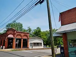 Woodland in 2012. | |
 Location in Talbot County and the state of Georgia | |
| Coordinates: 32°47′15″N 84°33′40″W | |
| Country | United States |
| State | Georgia |
| County | Talbot |
| Area | |
| • Total | 0.79 sq mi (2.05 km2) |
| • Land | 0.79 sq mi (2.03 km2) |
| • Water | 0.01 sq mi (0.01 km2) |
| Elevation | 791 ft (241 m) |
| Population (2020) | |
| • Total | 305 |
| • Density | 388.54/sq mi (149.98/km2) |
| Time zone | UTC-5 (Eastern (EST)) |
| • Summer (DST) | UTC-4 (EDT) |
| ZIP code | 31836 |
| Area code | 706 |
| FIPS code | 13-83952[2] |
| GNIS feature ID | 0356649[3] |
History
The community was named after C.S. Woods, original owner of the town site.[4] The Georgia General Assembly incorporated Woodland as a town in 1908.[5]
Geography
Woodland is located at 32°47′15″N 84°33′40″W (32.787594, -84.561018).[6] According to the United States Census Bureau, the city has a total area of 0.8 square miles (2.1 km2), all land.
Demographics
| Census | Pop. | Note | %± |
|---|---|---|---|
| 1910 | 189 | — | |
| 1920 | 356 | 88.4% | |
| 1930 | 463 | 30.1% | |
| 1940 | 489 | 5.6% | |
| 1950 | 621 | 27.0% | |
| 1960 | 720 | 15.9% | |
| 1970 | 689 | −4.3% | |
| 1980 | 664 | −3.6% | |
| 1990 | 552 | −16.9% | |
| 2000 | 432 | −21.7% | |
| 2010 | 408 | −5.6% | |
| 2020 | 305 | −25.2% | |
| U.S. Decennial Census[7] 1850-1870[8] 1870-1880[9] 1890-1910[10] 1920-1930[11] 1940[12] 1950[13] 1960[14] 1970[15] 1980[16] 1990[17] 2000[18] 2010[19] 2020[20] | |||
| Race / Ethnicity (NH = Non-Hispanic) | Pop 2000[21] | Pop 2010[19] | Pop 2020[20] | % 2000 | % 2010 | % 2020 |
|---|---|---|---|---|---|---|
| White alone (NH) | 90 | 95 | 55 | 20.83% | 23.28% | 18.03% |
| Black or African American alone (NH) | 336 | 307 | 236 | 77.78% | 75.25% | 77.38% |
| Native American or Alaska Native alone (NH) | 1 | 3 | 1 | 0.23% | 0.74% | 0.33% |
| Asian alone (NH) | 0 | 0 | 1 | 0.00% | 0.00% | 0.33% |
| Pacific Islander alone (NH) | 0 | 0 | 0 | 0.00% | 0.00% | 0.00% |
| Some Other Race alone (NH) | 1 | 0 | 1 | 0.23% | 0.00% | 0.33% |
| Mixed Race or Multi-Racial (NH) | 3 | 3 | 5 | 0.69% | 0.74% | 1.64% |
| Hispanic or Latino (any race) | 1 | 0 | 6 | 0.23% | 0.00% | 1.97% |
| Total | 432 | 408 | 305 | 100.00% | 100.00% | 100.00% |
As of the census[2] of 2000, there were 432 people, 181 households, and 131 families residing in the city. In 2020, its population declined to 305.
Gallery
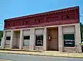 Woodland City Hall and Police Department
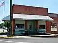 Woodland Post Office (ZIP code: 31836)
 Woodland Volunteer Fire Department
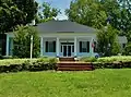 Located three miles east of Woodland, The Elms was built in 1838 and placed on the National Register of Historic Places. Robert H. Dixon, a Georgia State Senator and State Representative (1843) from Talbot County, owned this land from 1827 to 1857.
References
- "2020 U.S. Gazetteer Files". United States Census Bureau. Retrieved December 18, 2021.
- "U.S. Census website". United States Census Bureau. Retrieved January 31, 2008.
- "US Board on Geographic Names". United States Geological Survey. October 25, 2007. Retrieved January 31, 2008.
- Krakow, Kenneth K. (1975). Georgia Place-Names: Their History and Origins (PDF). Macon, GA: Winship Press. p. 256. ISBN 0-915430-00-2.
- Acts Passed by the General Assembly of Georgia. J. Johnston. 1908. p. 988.
- "US Gazetteer files: 2010, 2000, and 1990". United States Census Bureau. February 12, 2011. Retrieved April 23, 2011.
- "Decennial Census of Population and Housing by Decade". US Census Bureau.
- "1870 Census of Population - Georgia - Population of Civil Divisions less than Counties" (PDF). US Census Bureau. 1870.
- "1880 Census of Population - Georgia - Population of Civil Divisions less than Counties" (PDF). US Census Bureau. 1880.
- "1910 Census of Population - Georgia" (PDF). US Census Bureau. 1930.
- "1930 Census of Population - Georgia" (PDF). US Census Bureau. 1930. p. 251-256.
- "1940 Census of Population - Georgia" (PDF). US Census Bureau. 1940.
- "1950 Census of Population - Georgia" (PDF). US Census Bureau. 1980.
- "1960 Census of Population - Population of County Subdivisions - Georgia" (PDF). US Census Bureau. 1960.
- "1970 Census of Population - Population of County Subdivisions - Georgia" (PDF). US Census Bureau. 1970.
- "1980 Census of Population - Number of Inhabitants - Georgia" (PDF). US Census Bureau. 1980.
- "1990 Census of Population - Summary Social, Economic, and Housing Characteristics - Georgia" (PDF). US Census Bureau. 1990.
- "2000 Census of Population - General Population Characteristics - Georgia" (PDF). US Census Bureau. 2000.
- "P2 Hispanic or Latino, and Not Hispanic or Latino by Race – 2010: DEC Redistricting Data (PL 94-171) – Woodland city, Georgia". United States Census Bureau.
- "P2 Hispanic or Latino, and Not Hispanic or Latino by Race – 2010: DEC Redistricting Data (PL 94-171) – Woodland city, Georgia". United States Census Bureau.
- "P004 Hispanic or Latino, and Not Hispanic or Latino by Race – 2000: DEC Summary File 1 – Woodland city, Georgia, Georgia". United States Census Bureau.
Municipalities and communities of Talbot County, Georgia, United States | ||
|---|---|---|
| Cities | 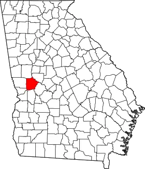 Map of Georgia highlighting Talbot County | |
| Towns | ||
| CDP |
| |
| Other unincorporated communities |
| |
| Footnotes | ‡This populated place also has portions in an adjacent county or counties | |
| ||
This article is issued from Wikipedia. The text is licensed under Creative Commons - Attribution - Sharealike. Additional terms may apply for the media files.